 Alfred Wainwright said that every walk should have a goal. He also said: “This is a place only for men with hair on their chests”, so that proves nothing.
Well, how about a walk with not one, but seven goals. And not easy ones at that. We’re not talking about grade-three scrambles or anything too taxing in terms of distance. This one relies more on brain power than staying power and is a refreshing change to the usual race up and down the highest hill.
Above, little green monsters are not the only thing you'll find in Upper Wharfedale's hidden treasure chests
We’re talking about geocaching: the slightly whacky world of treasure hunting. But it’s the thrill of the chase that’s important, not the value of the finds. grough decided to dip its booted toe into the water following the story about the Yorkshire Dales National Park’s idea of hiding walk-enhancing information in geocaches throughout upper Wharfedale.
So, what’s a geocache? It’s a waterproof box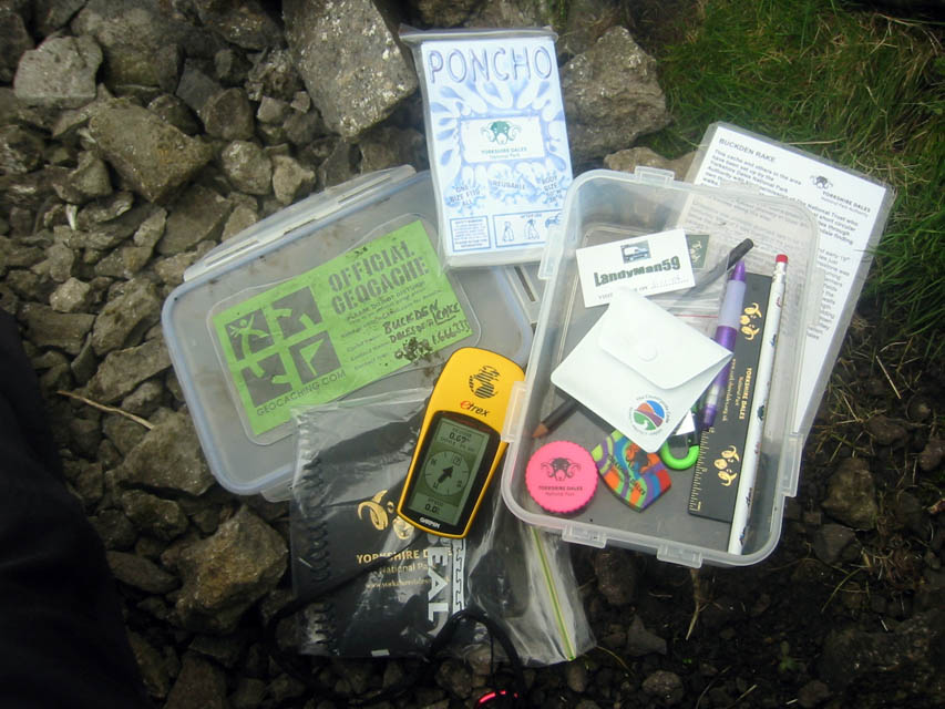 containing all sorts of things, but nearly always a log book in which you can record the fact you’ve been there and, depending on the site, a selection of small treasure pieces. There’s one important rule. Don’t take anything out of it without adding something in return.
Right, the Buckden Rake geocache box, plus the little yellow gizmo grough used to find it
How does geocaching work? First step is to register on the geocaching website. Until you’ve done that, you can’t do much, because it’s only after registration that you can get the locations of the caches. grough’s goal was the seven boxes hidden on National Trust land in upper Wharfedale in North Yorkshire. Dales Diva was responsible for secreting the objects.
There is something slightly odd about the way geocaching is conducted. It’s aimed at owners of GPS receivers and, as with virtually everything technology based, there’s a certain geekiness to the hobby. Hence the soubriquets and odd abbreviations, such as TNLNSL and FTF. One of which grough heartily approves is CITO: cache in, trash out, encouraging geocachers to take a rubbish bag with them and pick up any litter they find on their outing.
So, having ascertained the whereabouts of the seven Wharfedale caches, grough set out in search. It’s possible to download files and feed the data into your GPS unit. It’s also possible to get clues and even photos of where the boxes are hidden. grough decided to stay true to the spirit and eschew all of these additional aids. We also thought we might test our navigational prowess and see if it was possible to find any of the sites without using the little electronic gadget.
Armed with seven sets of ten-figure grid co-ordinates, we parked in the car park at Buckden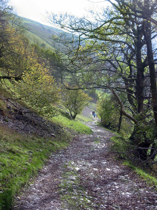 and set off in search of our first treasure trove. After about ten minutes gentle climbing out of the picturesque village, we figured we were approaching the location of the first cache, called Buckden Rake on the fairly logical grounds that it was close to the said rake. A ten-figure grid reference equates to a one-metre square on the ground. By dint of some careful micro-navigation, we reckoned we were close. The problem was, we weren’t sure exactly what we were looking for, how well it would be hidden and, well, the type of thing it would be hidden in or under.
Left, the footpath up Buckden Rake
With mounting frustration and some odd looks from walkers on the nearby path, we searched around what we thought was the right area. We looked under rocks, it rabbit holes; you name it, we looked under it. No luck! It was time to resort to technology. Out came the little yellow Garmin and in went the co-ordinates. Now, anyone who uses a GPS will know that they are only accurate, at best, to about five to ten metres. Add to that the fact that our Diva who placed the cache would also have been working with a limited accuracy, then it becomes quickly evident that this is not going to be the doddle the overconfident grough thought it would be.
With five minutes spent searching without electronic aid and another five with, grough was becoming a trifle flumoxed and, in the back of the mind is that nagging doubt: has someone found the blasted thing and taken it away?
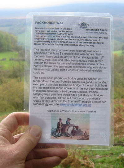 Then, Eureka! We don’t want to give anything away so as to spoil anyone’s fun, but after a little judicious movement of certain objects, grough’s eye caught the glint of the corner of the little plastic box which was the object of our increasingly fevered search. If it weren’t for the fact there were quizzical ramblers within a hundred metres, grough would have been tempted to dance and whoop. After all, this craze has American origins.
Right, one of the park authority's information cards to be found in the geocaches
The cache is a lunch-box sized affair. Inside are the logbook, lots of Yorkshire Dales National Park trinkets such as a badge, ruler, rubber, pencil sharpener, toy compass, gum pouch and – we kid you not – a poncho! It was now that we wished we’d brought something to put in. Next time we won’t be empty handed. We sign the log book and stash the box back where we found it. Fifty metres away, there’s a busy footpath, with oblivious walkers whose only thought is: what’s that idiot doing sitting up there on the hill? It occurs to us that we must walk past geocaches virtually every time we’re out on the hills. In future, we’ll check out our route for any hidden treasure.
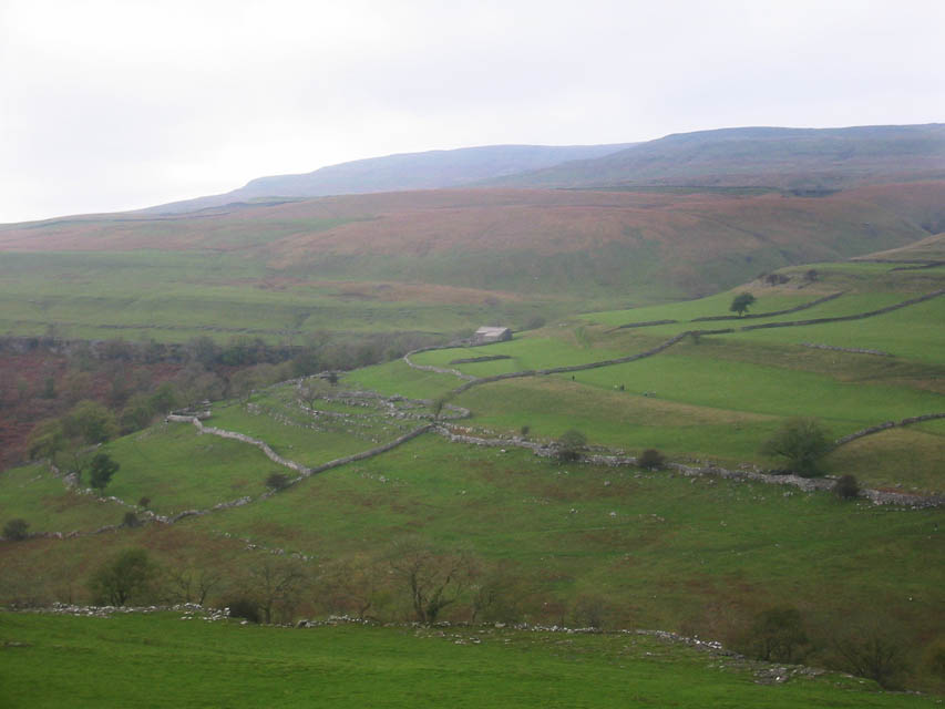 So now we know what we’re looking for, we have a spring in our step as we join the path to cache number two. The route is an elevated one over the top end of Wharfedale. There are no tops involved; we have to skip the temptation to nip up to Buckden Pike’s trig as the call of the next geocache draws us through Cray, and down to the next target.
Above, Middle Tongue and Cray Gill
Packhorse Way geocache involves leaving the usual route above the valley and dropping down the side of Cray Gill. We use the map again and some careful micro-navigation: pacing to where we think the next stash may be. This time, there’s no GPS: within two minutes or so, we spot the now familiar lunch box and, being reserved British types, allow ourselves a little smug smile.
There’s a familiar assortment of little gadgetry, along with a detailed card from the national park authority telling us about the packhorse route we’re on and its history. With the box safely hidden again, we climb back up to our original path and set off for target number three. On the way, we clamber up to a cairn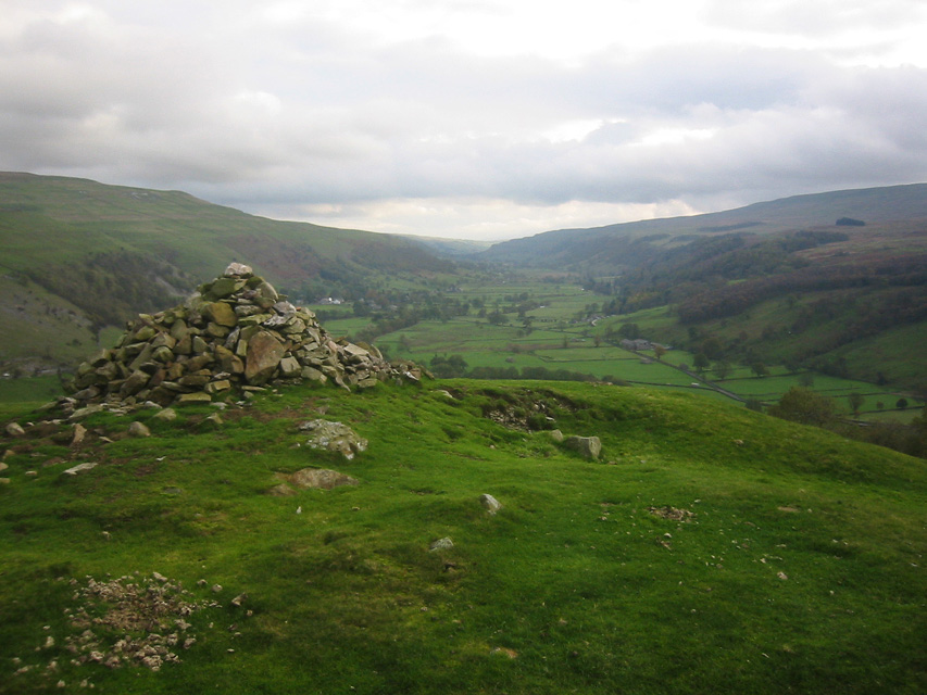 which, as our information card told us, is on the site of a large burial barrow. And that’s the point of these caches. If you take time to read the information in them you’ll have a much enhanced walk. And the beauty is, as Michael Caine possibly said, not a lot of people know that. We feel to be the recipients of privileged information. Once again, the hordes (for this is a popular, middling walking route with no great difficulties) are traversing below us, oblivious to the archaeological significance of the mound we’re standing on.
Above left, the barrow overlooking Wharfedale, surmounted by a cairn
Two down, five to go. It’s hard to gauge the timing of this route, since it’s largely dependent on how successful we’re going to be in finding our hidden gems, and it’s November, the day’s not too long, so there’s a little pressure on us now.
Which is a bit of a bugger, because cache number three eludes us for half an hour. Yes, we try without the GPS for ten minutes but, then even with it on, the signal is a bit dodgy and we end up back and forth, over a stream, back again, up and down, to and fro. In the back of grough’s mind is the thought that it would be worth a look at a certain feature in the area (again, we won’t say what, so as not to spoil your fun)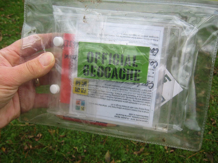 but it’s only after 30 minutes of increasingly frustrated scrabbling in walls, under boulders and in every nook and cranny within 50 metres that the micro-cache (a plastic wallet), see picture right, is found exactly where we should have looked in the first place. Still, it’s a relief to eventually find our treasure and we mark the book and replace it. Now, if we’d taken the trouble to check out the various geocaching websites before we’d set out, we’d have been informed that stashing the caches in dry-stone walls is a no-no. That said, it was obvious that we weren’t the first to have explored the crannies of the limestone walls.
At Scar House, we get to within 20 metres of our quarry (that’s not a hint, by the way) before resorting to Uncle Sam’s space technology and locate the box fairly quickly after that. We discover there’s an art to using the GPS, with a few passes back and forth, in each direction, giving the most reliable results. It’s amazing, though, how close you can be to these things and still not discover them. Still, there’s a 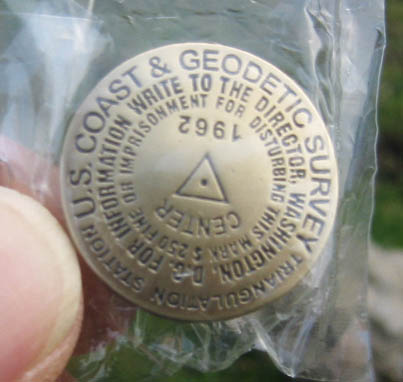 US Coastal and Geodesic Survey (see picture left) replica badge in this one, for a change. We’re chasing Landyman59 at each of these, according to the logbook, who was out the day before. There aren’t many entries in the logbooks we find, denoting, we suppose, that these are relatively recent caches.
We’re on a roll now and continue the traverse above the Wharfe towards Langstrothdale Chase, a cool November breeze aiding our concentration. At Little House barn, some careful pacing leads us straight to the cache, without the need to turn on the receiver. The Sykes family, Charlie and Garry, are a FTF (first to find – we told you it was a bit geeky). We feel we’re getting inside the psyche of the Dales Diva now, and we quickly make our mark and move on.
Time’s now a bit tight, so the GPS is brought into play for the Yockenthwaite cache but, apart from some erroneous scrabbling on a small scar, we’re reasonably quickly on to the box, which this time contains Cypriot coins and a little model plane kit.
The route descends from here into the valley bottom and the long return leg of the route starts alongside the uppermost reaches of the River Wharfe. The final stash of hidden treasure is another micro-cache and there’s some trepidation since the previous one was a sod to find. We needn’t have worried. We’re rapidly on to the location, again using just micro-navigation techniques and within less than a minute, we discover a small box this time, within which is a New Jersey Appalachian Geocaching badge. It’s getting very cosmopolitan in North Yorkshire!
Our final scribble into the logbook complete, we’re on our way down the valley in the gathering gloaming. It’s been an interesting diversion to the usual outing. There’s a definite childish glee to finding these caches, which have no real worth, but the thrill of winning the mental challenge is reward enough.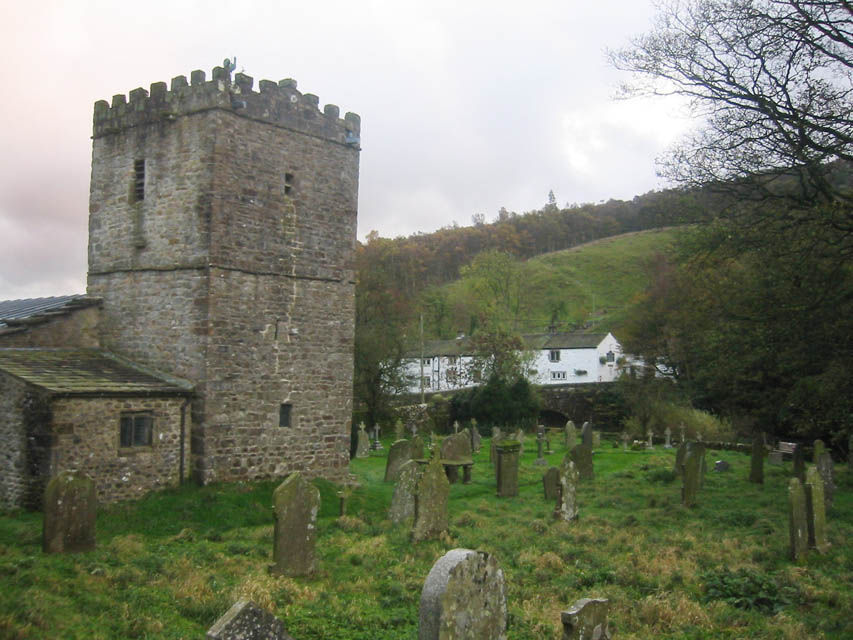
Would we recommend geocaching? Undoubtedly! It’s harmless, it’s a bit of fun and it gets you out into the great British countryside. OK, you really need a GPS, but they can be had for around £100 these days, and some of the geekiness can be a bit off-putting, but make of the hobby what you want. And if more organisations such as the Yorkshire Dales National Park Authority use it as an innovative way of letting us know a few interesting facts along the way, then it’s definitely an enriching experience.
Above, Hubberholme, on the return leg of the geocaching route
Thanks to the Dales Diva, whoever she may be (grough has a mental picture, but that’s another story). And all we can say is: TNLNSL – took nothing, left nothing, signed logbook. Actually, that’s not strictly speaking true; we did leave the grough calling card in each box, so if you find it, let us know. The address is on the cards. Happy hunting!
- A few facts: there are 329,290 caches on the go worldwide according to the Geocaching.com website. In the week grough visited, 182,614 logs had been written.
- There are two additional UK websites for enthusiasts: GeocacheUK and the Geocaching Association of Great Britain. Car parking at Buckden costs £3 for the day (at November 2006) and the Dales Bus service serves the village.
Matt
23 July 2007Saw the card in these caches today, what a great report you've written.
grough editor
24 July 2007Thanks for the vote of confidence, Matt. We haven't been out geocaching for a while. Must do it again soon