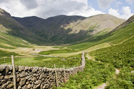
Pillar, at the head of Mosedale
Some Lakeland mountains draw you to them. They evoke a distant history and attendant mystery and whisper ‘climb me’: Helvellyn, Blencathra, Skiddaw for example. Others, even though they may have much intrinsically to appeal, have second-division names. Pity poor Slight Side and Border End.
Pillar belongs with the former, and has held a special place for me ever since, a couple of years ago, it was my companion for most of the morning as I set off from Low Gillerthwaite on the second day of my Coast to Coast Walk. Its name, coupled with the impressive-looking bulk of its northern crags, ensured that one day I would return and make the ascent.
Distance: 11.5km (7¼ miles)
Ascent: 935m (3,068ft)
Time: allow 5½ hours
Note: grough routes should be used in conjunction with maps, a compass and other navigational aids. Routes often use access land and involve finding your route off footpaths. Knowledge of and competence in using a map and compass are essential when using the routes. Carry the correct equipment for the conditions and be aware of hazards in the outdoor and upland environment. One option on this route involves some scrambling and exposure. Only undertake that section if it is within your capabilities.
The mountain, eighth in the Lake District hierarchy if one discounts Helvellyn Lower Man which is barely a 25m hummock on the summit massif, can be approached from various starting points, including the delightful valley of Ennerdale, where an ecological ‘rewilding’ project is underway as the artificial pine plantations are cleared and the area is allowed to return to its wilderness state.
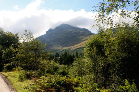
Pillar, with Pillar Rock prominent, seen from Ennerdale
The cantankerous chronicler of the fells, Alfred Wainwright, hated the Forestry Commission’s efforts in the valley. He wrote, in his seventh volume of Pictorial Guides to the Lakeland Fells: “We condemn vandalism and sanction this mess! Far better the old desolation of boulder and bog where a man could see the sky, than this new desolation of regimented timber shutting out the light of the day.”
He would probably have approved of the aims of the Wild Ennerdale project , a collaboration between the National Trust, Forestry Commission and United Utilities.
Those who appreciate solitude and grandeur will take immediately to Ennerdale, which has no metalled road for much of its length and contains England’s most majestically situated youth hostel at Black Sail.
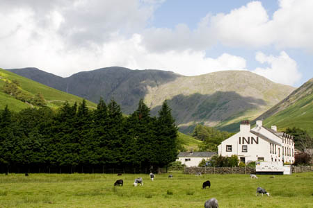
Pillar towers above the Wasdale Head Inn
But our route starts in Wasdale, another valley of superlatives. It has, according to ITV’s 2007 public vote, Britain’s Favourite View, with Wastwater, England’s deepest lake, Scafell Pike, the country’s highest mountain, and the world’s biggest liar, successor to 19th century Wasdale Head Inn landlord Will Ritson, the title of which is decided each November at a pub in Santon Bridge.
Wasdale Head is a grand place to start any walk. Surrounded by towering peaks – Yewbarrow, Kirk Fell, Great Gable, Lingmell and, mostly out of sight, Scafell and Scafell Pike – the tiny settlement, dominated by the pub, is a favourite for walkers.
There is usually space on the village green to park, though on summer weekends and bank holidays the sheer number of visitors to this isolated collection of buildings is overwhelming. Further parking (for a fee) can be had a kilometre back down the road at Brackenclose. In early mornings in the height of summer, the narrow road to Wasdale Head becomes choked with cars, minibuses and coaches disgorging confused competitors in numerous Three Peaks Challenges, many of whom end up customers of the busy Wasdale Mountain Rescue Team as they wander aimlessly in the night, trying to find their destination, Scafell Pike’s 978m (3,209ft) summit.
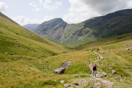
On the Black Sail Pass, with Yewbarrow prominent in the distance
But our route will strike out in the opposite direction, to the short valley of Mosedale and the huge bulk of the fell at its head: Pillar.
The walk starts at the Wasdale Head Inn. Head for the right-hand (northern) end of the pub, going between Ritson’s Bar and the shop. There are public toilets behind the inn.
A low finger post points the way up the Black Sail Pass bridleway, along the eastern bank of Mosedale Beck. The rising pyramid of Kirk Fell dominates to the right, and Pillar is soon in view at the blind head of the dale. Don’t cross the old packhorse bridge, once carrier of the main route out of the dale, but continue forward keeping the beck on your left.
Ignore the path diverging off to the right towards Great Gable at the confluence of Fogmire Beck and Mosedale Beck. Two gates in succession give access to the open fellside and there then follows an easy 2km (1¼ miles) of walking along the bridleway, with time to admire the towering fells of the Mosedale horseshoe: Kirk Fell, Pillar, Red Pike and Yewbarrow. The former pony track gradually gains height and then crosses Gatherstone Beck at a ford, which is easy enough but may present a little more difficulty if in spate. The climb towards Black Sail col is steady and slow, and presents plenty of opportunities to pause for breath, while pretending to admire the rearwards views which, in truth, really are worth halting for, with the expanse of Mosedale below and the Scafell range gradually coming into sight at height is gained.
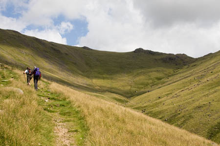
Nearing the top of the Black Sail Pass
The beck, now not much more than a trickle, is crossed and recrossed before the hause is reached and Ennerdale comes into view. Its redundant gate has certainly seen better times. It stands forlorn and distorted, a reminder of a time when man tried to tame this wild pass. Much of the fell is now in the ownership of the National Trust.
Turn left up the path towards Pillar. Two small tarns adorn the fell between the col and Looking Stead, one of which was being used for a spot of wild camping on the day of grough’s visit. The trust’s policy in the Lake District is that wild camping should be above 450m, out of sight of the public highway, entail only one-night stopovers and leave no trace of their presence. The owners of the Hilleberg tent seemed to have ticked all the boxes.
Looking Stead, the top of a spur bounding Green Cove, is worth the diversion for its views. The mound is well named, with Black Sail youth hostel distant in the valley, Great Gable and Brandreth to the East, and the Buttermere fells (or are they Ennerdale’s?) ascending from Haystacks, with High Crag, High Stile and Red Pike forming the northern wall of the valley.
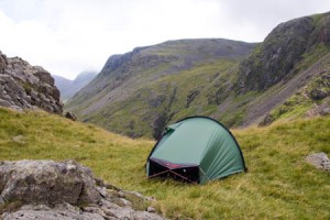
Wild camping near the Black Sail Pass
Looking Stead also affords a view, 1½km (1 mile) distant, of Pillar Rock, which gave the whole mountain its name. Those with a head for heights can follow the High Level Route for a close view of the crag; for less adventurous summiteers following the main path to the fell’s trig pillar, this is probably the best view they will have of the rock, which was the scene of some of the Lake District’s pioneering climbing.
The prominent buttress jutting from the main bulk of the mountain into Ennerdale was climbed in 1826, by John Atkinson of Crowfoot, Ennerdale, who made the first recorded ascent, it is believed by the Old West Route. The Slab and Notch route was added in 1863, and in 1891 Walter Parry Haskett-Smith posted the ascent of the North Climb, a Severe route on the north face. Haskett-Smith was also the first to climb Napes Needle on nearby Great Gable.
Pillar Rock is, as Wainwright admits, rockclimbers’ terrain. He says: “To walkers whose experience is limited to easy scrambling on rough ground, Pillar Rock is definitely out of bounds. Don’t even try to get a foothold on it. The climbing guides mention easy routes (the Old West and the Slab and Notch) but these are NOT easy for a walker who is not a climber and lead into danger situations. Remember the stretcher box.”
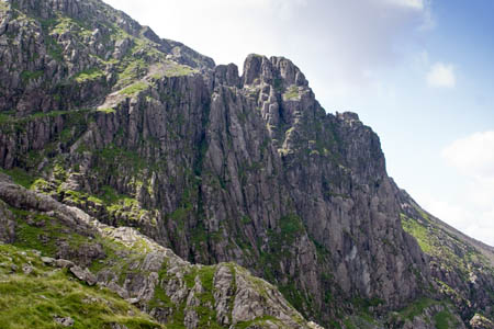
Pillar Rock, with, from left, Shamrock, Pisgah, High Man and Low Man
There are now many routes on the rock, ranging from Easy to E4. The fact that a full climbing rack has to be carried on a long walk-in deters many would-be climbers these days and more or less guarantees a quiet day on the routes for those determined to slog up to its base.
Rejoin the main path from Looking Stead and continue upwards. 300m later, an important decision is to be made. If you have any qualms about heights, exposure and scrambling, your route is straight up: the main path up to the broad plateau. This can be accomplished with no more than a bout of huffing and puffing and a little less than 1½km (1 mile) later arrive at the trig point and tumbledown shelter on its peak.
However, for those who enjoy a frisson of excitement on their ascents, there is the High Level Route. Be warned: the route involves some scrambling, a little exposure and one very short section that, shall we say, concentrates the mind.
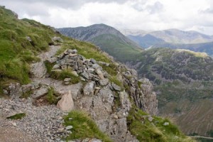
The start of the High Level Route, where it leaves the main path ascending Pillar
Wainwright, no great lover of precipices and exposure declares: “There are no difficulties or dangers on this route provided the path is kept underfoot.” The route is a mixture grassy track and rock, with extensive views over Ennerdale. If you want to admire the view, stop. The High Level Route demands care, and a trip at some points could have dire consequences.
Robinson’s Cairn is reached after a kilometre’s walking. Set on the mound of a spur, its situation gives a panoramic view of the imposing presence of Pillar Rock. The cairn has a plaque which says: “For remembrance of John Wilson Robinson of Whinfell Hall in Lorton, who died 1907 at Brigham. One hundred of his comrades and friends raised this. He knew and loved as none other these his native crags and fells whence he drew simplicity, strength and charm. ‘We climb the hills from end to end, of all the landscape underneath. We find no place that does not breathe some gracious memory of our friend.’”
Continue from the cairn, contouring into Pillar Cove, before tackling the short zigzag path up the scree to start the rake along the top of Shamrock.
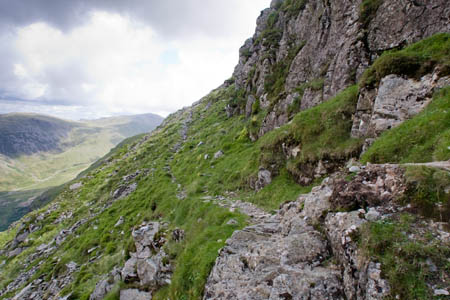
On the High Level Route
The Shamrock Traverse provides that little test of concentration. Part way along is a slippery, sloping slab, often with a trickle of water passing over it. The attendant drop to the right, over the crag of Shamrock, will set the pulse going a little faster. There are some handholds on the rising rockface to the left; and there is always the option of all-fours if the grip of the stone seems just a little less than reassuring. grough has spoken to mountain-rescue members who confirmed falls have taken place here. So the message is clear: take care at this point.
Once along the rake, the reward is a fabulous view of the rock. Biblical references abound: Pisgah, nearest the path and to the north of the Jordan Gap, takes its name from the Hebrew meaning, appropriately, cleft, and is, according to Deuteronomy, the mountain from which Moses was given a view of the Promised Land. Another Pisgah, interestingly, lords it over Deep Gill on Scafell and is again accompanied by a cleft separating it from Scafell Pinnacle.
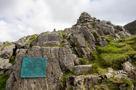
Robinson's Cairn and its plaque
On our visit, there was a party of four undertaking routes on Pisgah and High Man. We also encountered four Manxmen who were seasoned fellrunners and climbers. One of their party soloed to the top of Pisgah in a matter of seconds. Despite having Wainwright’s guide in their hands, they clearly considered it not ‘out of bounds’.
The Manx walkers were strong men, having started out from Buttermere and intended taking in Steeple before crossing Red Stile (the Buttermere fell, not its Mosedale namesake) before nightfall.
A final rocky scramble, including the option of a little demanding chimney which can be bypassed on the right, lead the breathless walker on to the summit plateau.
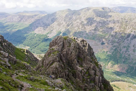
Pillar Rock, with Ennerdale, High Stile and Red Pike behind
The broad, grassy bulk is surprising for a mountain possessing so many fine rocky crags. A triangulation pillar is accompanied by a rough stone shelter. Walkers who choose to take the direct route from Looking Stead will have reached the summit some time before their panting colleagues who braved the High Level Route.
Wind Gap (not to be confused with Windy Gap below Great Gable) is the next objective. Take a bearing from the summit trig if visibility is bad or there is any doubt in which direction the col lies.
There are a few small cairns at the plateau’s edge, marking where a stony, steep path starts its descent. On reaching the col, where the path from Gillerthwaite joins from the right, the torture begins.
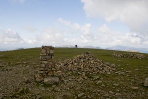
Pillar's summit
The route, back down into Mosedale on the left, is a scree chute. It’s tough going, the top ⅔ of the path being alternatively rock-sized scree or pebbly, smaller talus. The descent will test your balance, footwear and fortitude. By the bottom of the scree, your brow will be wet and your knees will ache. If you’re with a group, make sure you don’t unleash any rocks on those below; try to stagger your route, so there isn’t anyone directly below.
The rock finally peters out and the path follows a narrow green tongue. Stop for a while; curse, give your knees and feet a rest and enjoy the views of Scafell Pike and Scafell towering above Wasdale, with the green of Mosedale leading the eye in their direction, its beck meandering towards Wastwater.
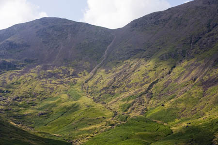
The col of Wind Gap can be seen on the centre skyline, with the scree-chute descent path
An easy path follows, through bracken and across two becks to a sheepfold, before rejoining the Black Sail path near a small stream.
Enjoy the views again of Red Pike, Yewbarrow and Kirk Fell as the path gradually descends, handily, to the beer garden of Ritson’s Bar where fibbing can be practised for the competition down the road at the Bridge Inn.
Mapping for this route will soon be available through this website on grough route, the online route-sharing community with access to the whole of Britain’s Ordnance Survey maps at 1:25,000 and 1:50,000.
harrison.david8
23 March 2010I myself did the pillar high level route as part of the mosedale horseshoe, a truly exhilerating walk, my favourite lake district walk to date.
Jack Eldon
13 June 2017my favourite walk too. And I've climbed all over Pillar Rock and am still here to tell the tale!
John Matthews
06 August 2018Climbed Pillar yesterday via the Shamrock Traverse with my fearless other half. The greasy slab we both found alarming , I'd worry about anyone who thought it nothing. Far more scary than, say, Sharp edge. Clearly we lived to tell the tale. If you're going right round to Red Pike , don't be tempted to descend to mosedale via Dorehead Screes, truly horrendous.