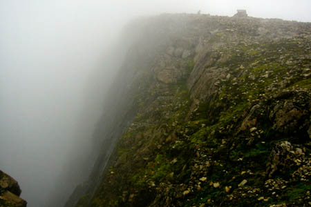
Gardyloo Gully, with the summit shelter visible on the right
Walkers on the summit of Britain’s highest mountain can now follow a line of cairns to lead them safely to and from its peak.
The Nevis Partnership, which manages Ben Nevis, has rebuilt a line of stone cairns so they mark the recommended compass bearing to be followed to safely navigate off the summit plateau, which has 600m (1,970ft) drops on its north face. In winter, cornices build up on the plateau edges, adding to the hazard for walkers in bad visibility.

The Nevis cairns should be used to find a safe route when snow covers ths summit
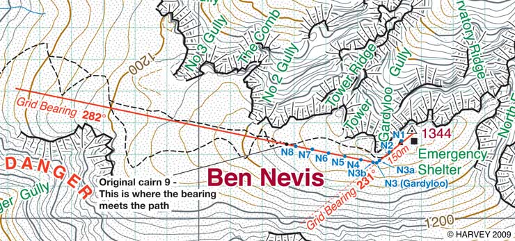
The cairns are at 50m intervals and are almost 1.8m (6ft) high, leading from the summit trig safely off the mountain top, avoiding both the northern gullies and Five Finger Gully on the peak’s south-western side.
When the summit is free of snow, the recommendation is still to use the visible path. However, when snow covers the path, the cairned route should be followed. This heads on a grid bearing of 231 degrees for 150m before turning to the right on a bearing of 282 degrees, which will lead walkers and climbers safely to the zigzag tourist path to Lochan Meall an t-Suidhe. It is important not to set off from the summit trig pillar immediately on 282 degrees, as this would lead straight over the edge of Gardyloo Gully.
When using a compass on the summit, this needs to be corrected to a magnetic bearing from the grid values.
But the Mountaineering Council of Scotland warns that walkers and climbers still need to equip themselves properly before venturing on to the 1,344m (4,409ft) ben, especially in winter conditions.
The MCofS said: “Walkers and climbers must also be aware that at times the cairns may be completely covered and it is therefore essential, at all times, to carry a map and compass and to know how to safely navigate off the summit plateau.”

roworth
15 October 2009"This heads on a grid bearing of 231 degrees for 150m before turning to the right on a bearing of 282 degrees, which will lead walkers and climbers safely to the zigzag tourist path to Lochan Meall an t-Suidhe. It is important not to set off from the summit trig pillar immediately on 231 degrees, as this would lead straight over the edge of Gardyloo Gully."
Shouldn't that last 231 really read 282?
Colin
15 October 2009"It is important not to set off from the summit trig pillar immediately on 231 degrees". I suspect you meant to say something like, "it is important to set off from the summit trig pillar on a bearing of 231 degrees to avoid Gardyloo Gully."
And that line about correcting grid bearings to magnetic made me groan a bit - I think the MCofS made the point rather more thoroughly: "know how to safely navigate".
Bob
15 October 2009Absolutley right, Colin and Roworth. We should have said: 'It's important not to set off on a bearing of 282 degrees', which will take you very rapidly off the summit.
We'll amend the story.
On the subject of magnetic variation, we thought it safer to point out that the bearings are grid bearings, which won't change, whereas the magnetic bearings will, with time.
But you're spot on: the best advice is, learn how to navigate.
Bob Smith, editor