From Horton in Ribblesdale via Hull Pot, Plover Hill
Distance: 9.5km (6 miles)
Ascent: 510m (1,673ft)
Navigation: careful navigation needed in poor visibility
Strenuousness: fairly hard, gentle at first, but tough ascent to Plover Hill and final sting in the tail to Pen-y-ghent summit. Boggy sections hard work
Trickiness: no scrambling, but care needed on steep steps up to Plover Hill
Time: allow 4½ to 5 hours.
Horton is a long, straggling village built along the B6474. There is a national park car park with good toilets near the bridge by the Crown Inn (still marked on OS maps as the New Inn even though it has been the Crown for more than 40 years), but there are also places to park either on the streets or the large layby at the southern end of the village.
Take the track leading up the side of the village shop, formerly the post office and take the left-hand route where it forks, signposted Horton Scar Lane.
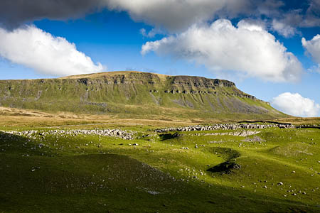
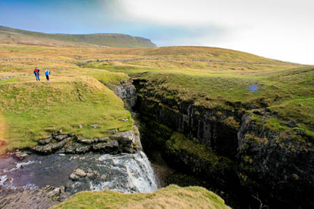
The track climbs gradually, with good views of Pen-y-ghent to the right. After the gate at Tarn Bar, the main Pennine Way path to the summit turns sharp right, but our route continues straight on along a sometimes wet green path leading to Hull Pot, a huge gash in the moorland, 90m long, 20m wide and almost as deep, reputedly the largest natural hole in England.
Walkers in a huge rush to get to the top of the hill can bypass Hull Pot by taking a feint track just to the right of the path to the pothole, which leads diagonally up to meet the wall at a gate.
From Hull Pot, take a path south-eastwards to the wall and gate mentioned above, and pass through the gate to take a rough track round to the left, which gradually ascends the hill to cross a well-used path at a wall corner. It’s well used because it’s the main route used by walkers and runners attempting the Three Peaks. Don’t be tempted to turn left along it, or you’ll be taking the long route to Whernside.
Head roughly straight on, keeping the ascending wall to your right. This is the main old road to Foxup at the head of Littondale and alternates between bogginess underfoot and well-drained limestone walking.
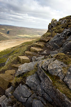
After Swarth Gill Gate, look out for a finger post pointing right, up the steep flanks of Plover Hill’s northern escarpments. Follow a path, boggy at first then cross the broken wall to gain the steepest section which has now been furnished with rough stone steps.
The steps lead through the limestone outcrops before the gradient eases and a single wooden post marks the route across the moorland to a wall corner with a stile.
Cross the stile and prepare for some bog-hopping. The ridge wall is your constant handrail for the rest of the route, providing a safe guide right to the top of Pen-y-ghent. Keep the wall to your left and negotiate some very wet and peaty sections as the path makes its way along the broad ridge linking Plover Hill and Pen-y-ghent.
A final 70m slope ascent leads to the summit of Pen-y-ghent, with its trig point and wall shelters.
Descent (not included in route length description) can be made by the Pennine Way to Tarn Bar via Pen-y-ghent Side, or by the Brackenbottom path via an easy scramble down the southern nab of the hill.
This route features on grough route, available with Ordnance Survey mapping for just £2 per month. Key in ‘Plover Hill’ to the route search.


