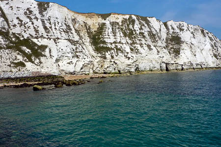
Planned sections of the coastal path include the White Cliffs of Dover. Photo: Pam Fray CC-BY-SA-2.0
The White Cliffs of Dover and the less attractive prospect of the new Hinkley Point nuclear power station are included in plans for the latest extension of the England Coast Path.
The coalition Government has been criticised for dragging its feet on implementation of the round-England coastal route, the legislation for which was passed by the last Labour Government.
Natural England has published proposals for 90km (56 miles) of path in Somerset, from Brean Down to Minehead.
It has also put out to consultation the route along a 59km (37-mile) stretch of Kentish coast between Folkestone and Ramsgate.
Interested parties have eight weeks in which to make representations. Landowners along the proposed routes can raise objections.
Natural England, the Government’s advisory body on the outdoors, said the Somerset plans are the first issued under the revised Coastal Access Scheme, approved by the Government in July, and which it said streamlines the process followed on each stretch of coast, significantly speeding up the time taken.
The proposed 90km stretch skirts the Quantock Hills, designated as England’s first area of outstanding natural beauty in 1956.
It includes sea views over the Bristol Channel, and the landscape is a haven for overwintering birds and contains a number of sites of historical interest including Daw’s Castle near Watchet.
NE said the route has been designed to take account of proposals for a new nuclear power station at Hinkley Point. Existing pathways of the West Somerset Coast Path and the northern extent of the River Parrett Trail are incorporated into the proposals where possible.

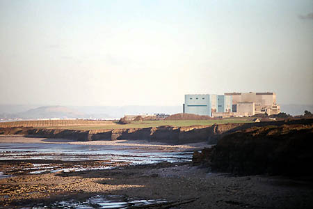
Hinkley Point nuclear power station on the Somerset section of the coast path. Photo: Richard Baker CC-BY-SA-2.0
Councillor Harvey Siggs, Somerset County Council cabinet member with responsibility for rights of way, said: “We expect the route to bring additional trade to local businesses throughout the year and along the whole route.”
Councillor Mike Hill, Kent County Council’s portfolio holder for community services, echoed his Somerset colleague’s views, saying: “We are delighted in the progress being made and hope that everyone will support these proposals.
“They can bring real social and health benefits to local communities, as well as contributing to the local economy and helping to attract visitors to Kent and its iconic white cliffs.”
The Kent route will traverse a section of the county’s undulating coastline which goes from sea level at the Sandwich peninsula up to 110m (350ft) on top of Shakespeare Cliff and includes the White Cliffs of Dover.
It is also designed to integrate with other major projects in the area, such as the new flood banks along the River Stour near Sandwich.
Existing pathways, such as the Saxon Shore Way, Stour Valley Walk, Thanet Coastal Path and the North Downs Way National Trail, are incorporated into the proposals where possible, with the aim of clarifying access rights to the less well-known areas of the Stour Estuary and Sandwich peninsula, Natural England said.
Details, including closing dates for representations, are on the Natural England website.