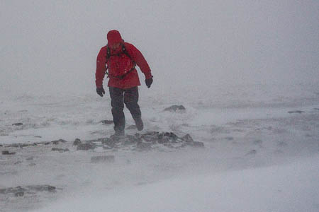
Tomorrow looks like a day to avoid walking the mountain tops as forecasters predict hurricane-speed winds for the western Highlands and violent storms affecting much of the North of England.
The winds are forecast to continue into Thursday when they will slowly abate.
An amber warning has been issued by the Met Office for parts of Northern Ireland, the West and North-West of Scotland, including the Hebrides and Northern Isles.
An amber warning means be prepared, as there is likelihood of bad weather affecting travel, power supplies and the potential risk to life and property.
The warning covers the period from 3am on Wednesday to 6pm the same day.
The Mountain Weather Information Service, which prepares forecasts specifically for hillgoers, said westerly winds will reach 70 to 80mph at 500m, with gusts touching 100mph.
The temperature on the hills will be –5C but windchill will make it feel more like –20C and snow and hail showers are also likely.
Thunderstorms could also affect mountains in the North and West and the MWIS said any movement on the higher reaches of hills will be torturous.
The Met Office said: “Very strong winds are likely to affect northern and central parts of the UK from early Wednesday and last through until early Thursday as a very deep low pressure system moves slowly eastwards between Scotland and Iceland.
“There remains some uncertainty in the precise depth of this low and therefore in the exact wind strengths and timings.
“However a period of severe gales is likely over northern and central Britain, as well as the potential for storm force winds over the amber area.
“Very large swell generated over the Atlantic to the South of the very deep depression will lead to exceptionally large waves affecting west coasts.”
The official weather forecasters also said wintry showers are expected to give some significant snow accumulations over ground above 200m, with 2 to 5cm possible over parts of northern England and Northern Ireland and 5 to 10cm over parts of Scotland. Greater amounts are likely over the mountains.
