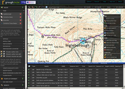
grough route: all-Britain mapping for £1.50 a month
You may have had your fill of the January sales, but here’s a bargain we don’t think you can refuse.
We’re offering mapping of the whole of Britain for just £1.50 a month, the cheapest digital outdoor leisure maps on sale. grough route prices have been reduced in anticipation of major changes to Ordnance Survey charges likely to come in later this year.
In addition to top-class OS 1:25,000 and 1:50,000 scale maps, subscribers to grough route can plan their walks or bike rides, print out map with routes, upload them to a GPS unit and print a route card.
grough route offers all the features outdoor enthusiasts are likely to need. Maps from the Isles of Scilly to Shetland are included, all for less than the price of a single paper map.
grough took the decision to offer its readers OS mapping at cost price as the Government started a major consultation on mapping data in Britain. If, as seems likely, OS leisure mapping is made entirely free in April, grough will switch to a completely free system, offering one of the best route planning systems for no charge. Maps can be printed at high resolution either with or without routes.
The £1.50 monthly charge will run until April.
Already, grough route compares favourably with other digital mapping providers’ charges – typically at least £1.95 for a 10×10km tile.
To sign up for the grough route service, simply follow this link.
Full details of our grough route system can be seen on this page.