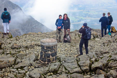
What drives a walker to gird his or her loins and huff and puff up the mountains and hills of Great Britain?
For many it is the thrill of the ascent, with all the difficulties it presents.
Others may revel in the feeling of achievement on topping out, or the fantastic view which the valley-bound public will never know. Some simply follow George Mallory’s tenet of climbing a mountain ‘because it’s there’.
But a great many hillwalkers are intent on bagging summits for a different reason. Munro completers are the best known, but there are scores of other categories of British hill, and for some, the fact a peak belongs to a certain list becomes the reason for the climb.
Many others simply want to log the hills they have walked, to preserve their own list of achievements.
The Database of British Hills is the definitive bagger’s source. More than 5,000 summits appear on the list, the result of collaboration between enthusiastic hillwalkers and number crunchers.
Graham Jackson, one of the men behind the database, explains why today is a special day for the hill statisticians:
- Many visitors to grough will be familiar with the Database of British Hills, but few will know that it celebrates its 10th birthday today.
In 2001 the first version was launched by Chris Crocker and Graham Jackson as a tool to aid hillwalkers to record their ascents. At that time many lists of hills were available on the web, but nowhere were these combined into a single downloadable database.
The advantage of such a database is that it requires the ascent of a hill to be recorded just once, no matter how many separate hill lists it appears on.
Version one, a Microsoft Access database, was launched on 13 September 2001 and received an enthusiastic response, much more so than we had dared hope.
Suggestions for improvements quickly followed from users, so that version two appeared just a few weeks later.
Since then, DoBH has grown considerably – there are currently over 5,600 listed hills in about 30 lists – and its emphasis has shifted from being a simple recording tool to aspiring to provide the most accurate hill-data available.
This has been achieved through meticulous cross-checking of maps, the recording of 10-figure grid references by GPS – more than 60 people contribute to this activity – and by the formation of our own survey team equipped with the most up-to-date technology.
Six editors now form the core team that manages the database: George Gradwell, an expert of Lake District hills; Simon Edwardes who runs the hill-bagging website and looks after IT; Mark Jackson, author of many new hill lists; John Barnard who develops our surveying expertise; as well as Chris Crocker and Graham Jackson.
How will DoBH evolve? We are led by demand and two user surveys in the last four years have helped mould the database’s development. The addition of new lists is planned for version 12, to be released before Christmas, and this will include some lists of Irish hills for the first time.
If you have not found our websites yet, then pay us a visit. A downloadable version of the database, for Access, Excel and in CSV format, is available on the Database of British Hills site, where the visitor can also browse extensive notes, or a web-based version is to be found on Hill-bagging. We look forward to hearing from you.
Ordnance Survey mapping and a route-planning system for all of Great Britain is available on grough route for just £2 per month, with 1:25,000, 1:50,000 and 1:250,000 coverage, ideal for all outdoors enthusiasts.


The Piglit
15 September 2011I'd like to nominate this for the National Boring Awards. This outstanding example of the clipboard mentality and the trainspotters mindset represents an outstanding contribution to the image of hillwalking.
Phil Newby
16 September 2011Oh that's a bit harsh.
Many people climb many hills for many different reasons, and often for more than one reason at a time.
Personally i find reference to a hill-bagging list gives me some inspiration to go to new places i might not have otherwise thought of.
Occasionally it also provides some additional motivation when the weather would otherwise keep me in a nice warm tea-shop.
phil
GPS Mountain Waypoints
http://www.haroldstreet.org.uk/
(which also uses the HDB data source)
Jon
16 September 2011Just because the Piglit doesn't appreciate hill pedantry doesn't mean it's not interesting to a lot of other people. I'm not a trainspotter, but I've never understood why trainspotters are looked down on by so many people, some of whom display behaviour at least as strange. For example, loads of people seem to think that they have had a good night out if they can't remember anything about it.
Personally, I'm not very concerned about the "image" of hillwalking. People who don't appreciate the hills or understand what we get out of them have plenty of other options, like wearing their bright new duvet jackets on city streets.