OS surveying has come a long way since the days of second-hand 'carriages on springs'
The pace of mapping developments is hard to keep pace with these days, with every day seemingly offering a new electronic means of viewing maps, exporting routes to GPS units and downloading applications for the latest smart phones.
But what underpins all of these is the ability of surveyors and cartographers to measure, detail and describe the world around us, so walkers, runners, cyclists and mountaineers can navigate our countryside and hills. The source of most of that information in Britain has been, and continues to be Ordnance Survey, the country’s official mapping agency.
Now, aficionados of the detailed topographical works produced by OS can read the history of the organisation online. OS has made available in a Flipbook style two works on the survey’s history, one published in the 1980 and the second 12 years later.
As outdoor enthusiasts look forward to the possibility of free online mapping from OS in April, the two publications provide an insight into how the country’s mapping agency evolved.

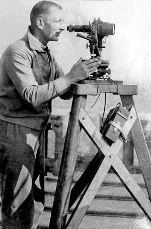
Surveying for Ordnance Survey in earlier times
A History of the Ordnance Survey, edited by WA Seymour, covers the time from its inception to 1978, while Ordnance Survey: Map Makers to Britain since 1791 by Tim Owen and Elaine Pilbeam was originally published in 1992 and covers the history up to1991.
Both are fairly scholarly tomes, but give insights into the development of mapping and cartography, and methods of surveying. The original estimate for the setting up of a national triangulation service to map the locations of the features across the country was an overoptimistic £350, including ‘A carriage on Springs (Secondhand or otherwise) for transporting the Instruments during the operation’, at a cost of £25, plus pay for six men for 60 days at 2s 6d [13p] each.
The organisation that now produces millions of mapping products and is used by walkers, bikers and mountaineers every day of the week was the creation of the Duke of Richmond in 1791.
From its original military origins, the OS quickly expanded and further mapping so tithes – the land taxes payable in parishes – could be collected based on accurate drawings of the countryside was developed. The infamous Enclosure Acts, when common land was appropriated by wealthy landowners, also demanded accurate cartography.

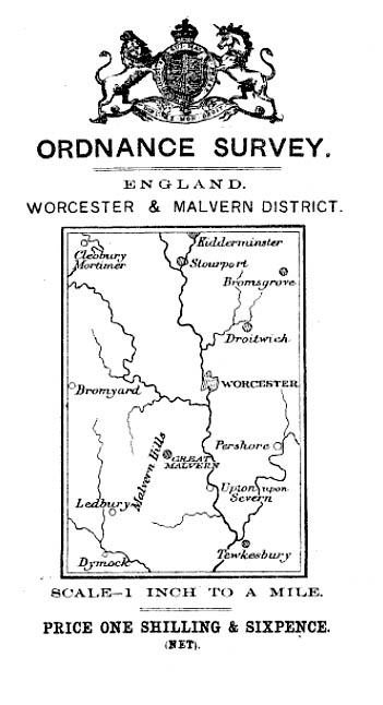
A one-inch map of Worcester and Malvern costing 8p
The familiar contour lines were almost abandoned at one point, as being ‘of no real practical use’ and Britain’s mountains were initially going to be depicted by artistic hachuring, but eventually the familiar lines won out.
The Owen and Pilbeam book also has a description of how the network of triangulation pillars – trig points – so familiar to those of us who love to summit hills, came to be placed and built. At the time, in the 1930s, there was much public speculation regarding the purpose of these mysterious new additions to Britain’s landscape. Among theories were: oilwells; anti-aircraft gun placements; aeroplane guidance systems; sundials, and jubilee markers.
Full metrication of OS mapping began in the 1960s, and computers began to do much of the more tedious mathematical work into the 1970s and 1980s, though the first computer had been bought by the OS in the 1950s.
The first Outdoor Leisure map, aimed at hillwalkers and climbers, was produced of the Dark Peak in 1972. By the 1970s the first digital map went on sale, on magnetic tape, and the move towards complete digitisation that allows system such as our own grough route service, began in earnest.
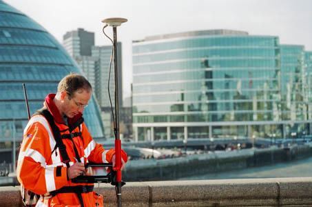
Satellite systems now provide a quicker and more accurate means of surveying Britain and have become familiar to many outdoor enthusiasts in the form of handheld GPS units.
For lovers of the carefully crafted maps produced by OS, the two online books provide a fascinating insight into the evolution of Britain’s mapping agency. The books can be read on the OS website.
Fred Pembridge
03 September 2013I'm after some information. I was a chartered civil engineer.
Prior to 1978 and in part doing my training in the 1960 i worked with an O S Surveyor. These surveyor's walked around with a board on straps and recorded details by Graphic Survey. To what degree was this infilling of trig data?
How accurate was this information at 1/2500 scale and 1/1250.