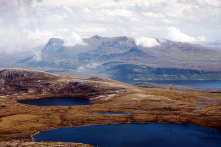
Scotland’s wild land has been mapped in a pioneering project aimed at protecting some of the nation’s most spectacular landscapes.
Scottish Natural Heritage, the Government’s advisory organisation on the outdoors, worked with a team from the University of Leeds to produce the maps.
The maps will help local authorities and other planning bodies make decisions about development and land use change to safeguard wild land. SNH said the maps can also help the tourism industry promote Scotland’s wild landscapes to visitors and walkers.
SNH said: “The Scottish public views wild land as an important priority. A recent SNH study found that 91 per cent of respondents agree that Scotland’s areas of wild land are important and should be protected.
“Another study found wild land provides even more economic and employment benefit than agriculture and forestry combined.”
The maps use a method developed by the university’s Wildland Research Institute based on work already carried out for the Cairngorms national park. Dr Stephen Carver, a senior lecturer in the department of geography at Leeds, has also worked with the Loch Lomond and the Trossachs national park on a similar project.
But the SNH maps detail the whole of Scotland’s wild country – a first in Europe. A geographical information system was used to detail four aspects of wild land: perceived naturalness – presence of natural and semi-natural vegetation; absence of man-made features, remoteness from public roads, and ruggedness of the terrain.
Simon Brooks, SNH policy and advice manager, said: “These new maps will give valuable, detailed information to local authorities to inform decisions.
“Scotland is famous for its wild landscapes – these maps tell us where the wildest areas are and will help everyone when considering changes in these places. The maps don’t mean changes or development can’t take place in these areas, but they do give local authorities more and better information to base planning decisions on.
“Using the maps and information published today, future work will identify areas of particular high wildness value. This work will build on our earlier work to identify wild land, and will support the Scottish Government’s policy of safeguarding areas of wild land character.”
Dr Carver added: “It’s great to see the methodologies that we developed here at the University of Leeds and with our partners in the Wildland Research Institute being used across the whole of the country.
“Scotland has taken the lead here, and is the first country in Europe to produce a national wildness map at this level of detail, so it’s very exciting to see these maps.
“Although we’re not surprised by the broad patterns shown, as we already have a good feeling for where the wild areas of Scotland are, the key thing with these maps is the fine detail and how they were created using the latest data and mapping tools.
“This makes them robust and repeatable. Hopefully, England and Wales will follow suit and produce their own maps in due course.”
The maps can be seen on the Scottish Natural Heritage website.
