
Get a 7 day trial for grough route. You’ll need to log in or register on this website first.

-
Ordnance Survey mapping for all of Great Britain with all subscriptions
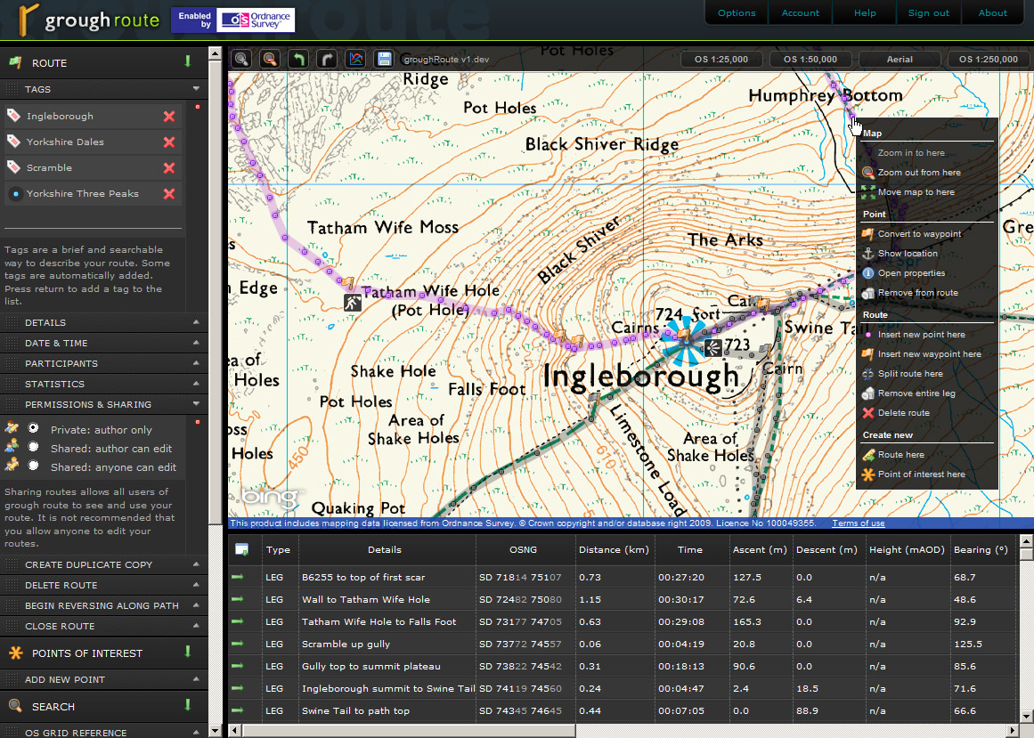
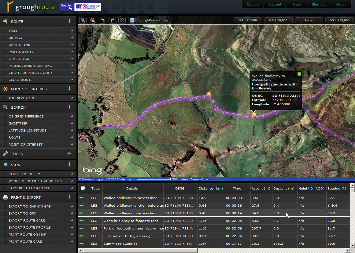
View and plot routes and points of interest with familiar Ordnance Survey mapping at 1:25,000 (Explorer), 1:50,000 (Landranger) and 1:250,000 scales. With a subscription we provide Great Britain in its entirity, you can go where you like.
-
Import and export routes
Connect directly to Garmin GPS devices or work with the standard GPX file format
-
Share, mix and match routes
A simple option allows you to share your route with the grough community. Shared routes can be used by others, or mixed with other routes in whole or part. It’s completely flexible
-
Print maps
Print only the maps you need for your route on A4 paper at 1:25,000 or 1:50,000 scale, with your route clearly highlighted. Take a new print for each route with up-to-date digital mapping.
-
Search
Search our database of routes and points of interest. Jump to a specific grid reference or latitude/longitude. Search for items in the Ordnance Survey 1:50,000 Gazetteer.
-
Online mapping software always up-to-date
grough route’s OS mapping is updated as soon as a new revision is received from Ordnance Survey. The application is in constant development, with small and frequent updates pushed out on a regular basis
View more detailsStart a free 7-day trialBuy a subscriptionExtend your subscriptionTerms and conditionsBrowser compatibilityDiscussion forumSupport forumFrequently asked questionsView screenshots
-
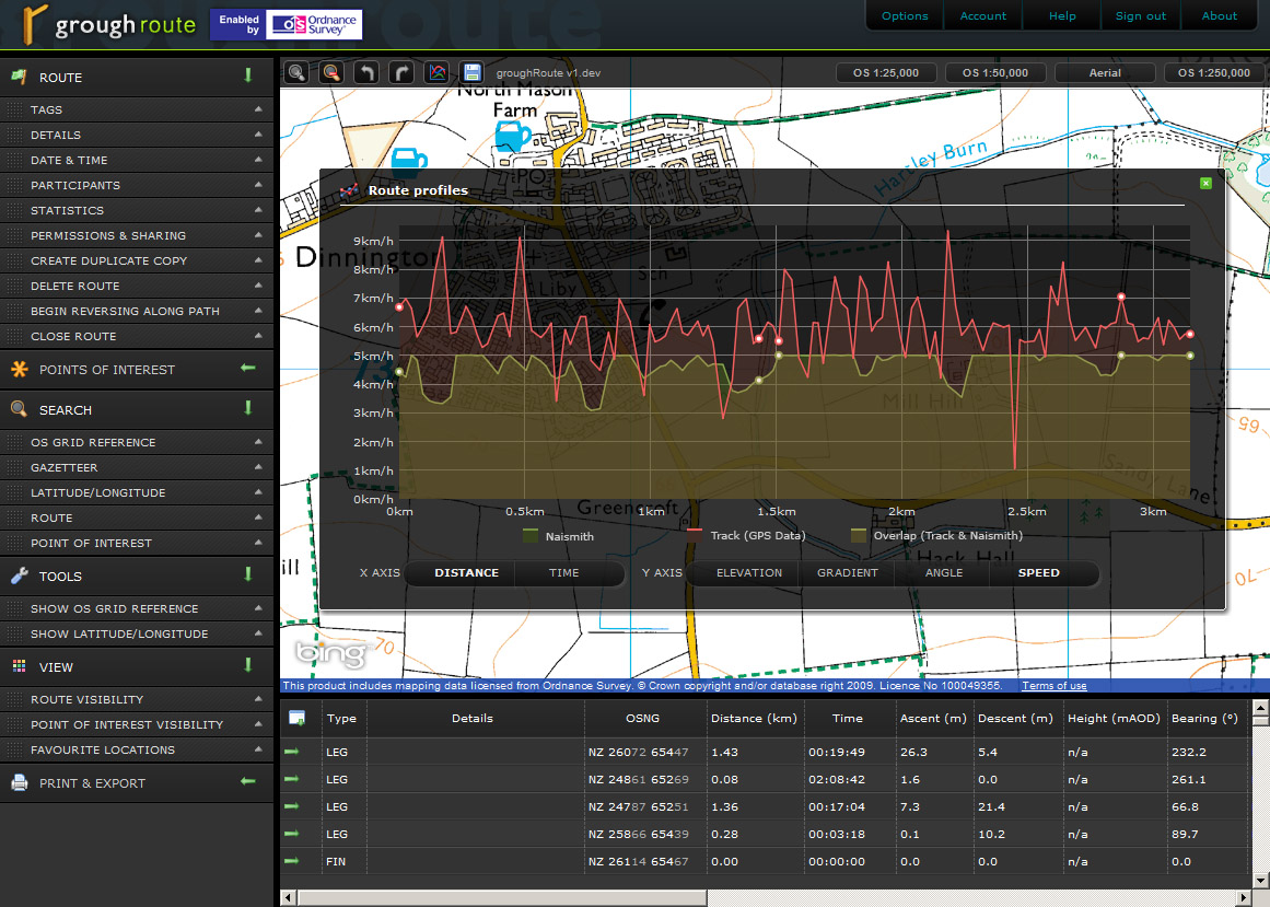
Analyse routes
View profiles of elevation, speed, gradient and angle along your route. Estimate timings using custom Naismith adjustments and terrain underfoot. Print a summary route card of the core information you need
-
Customise
Change individual units, timings and adjustments that are applied accross every route you plan. Add favourite locations to jump to with a single click. Automatically create waypoints and legs at changes in direction. Change the view to hide clutter from the map.
If you’d like to know more about any specific functions in grough route, we’d be happy to explain it and send screenshots if you get in touch.
 This product includes mapping data licensed from Ordnance Survey with the permission of the controller of Her Majesty's Stationery Office. © Crown copyright and/or database right 2026. All rights reserved. Licence number 100049355.