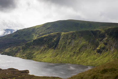
White Coomb and Loch Skeen
Mention hillwalking and Scotland in the same sentence and most people automatically think of the Highlands: munros, romantic-sounding Gaelic names, precipitous edges.
But there is another Scotland: high hills, grand views, remote, beautiful. And for people travelling from the South, there is another advantage: less time spent getting there.
The Southern Uplands stretch from the Ayrshire coast to East Lothian, from the Galloway Hills to the Cheviots, and cross some of the least populated land in the country, so if it’s solitude and wilderness you crave, this is for you. Thousands of motorists speed through the Borders every day en route for the delights north of Glasgow. It’s worth turning off the A74(M) for an exploration of the shapely hills of the Borders.
Distance: 11.7km (7¼ miles)
Ascent: 770m (2,526ft)
Time: allow five hours
Map: Ordnance Survey Explorer 330, Moffat & St Mary’s Loch
Note: grough routes should be used in conjunction with maps, a compass and other navigational aids. Routes often use access land and involve finding your route off footpaths. Knowledge of and competence in using a map and compass is essential when using the routes. Carry the correct equipment for the conditions and be aware of hazards in the outdoor and upland environment.
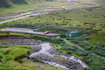
The car park and the 'visitor centre'
A few miles north-east of the former spa town of Moffat lies White Coomb, the highest point in the county of Dumfriesshire. Moffat was Scotland’s first Walkers Are Welcome town and is surrounded by good routes. This year, its walking festival runs over the weekend of 3-5 October. Details are on the town’s website.
The ascent of White Coomb can be incorporated into a moderate one-day horseshoe, and has plenty of distractions. The walk starts at the car park of the Grey Mare’s Tail (NT 186 144) at Tailburn Bridge on the twisty A708 from Moffat to Selkirk, about 16km (10miles) north-east of Moffat.
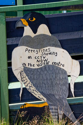
A sign advertising the visitor centre's peregrine falcon camera
Parking at the National Trust for Scotland car park costs £2 per day (free for NTS and National Trust members) – in September 2008. The ‘visitor centre’ run by the NTS puts one in mind of a larger version of Mr Benson’s hut at the bleak picnic spot at the centre of Father Ted’s Old Grey Whistle Theft. It’s a shed, let’s not mince words. However, at certain times (not during our visit) it is possible to view CCTV images of the area’s nesting peregrine falcons. Details are on the NTS website.
The Grey Mare’s Tail is, reputedly, the fifth highest waterfall in Britain. It carries the waters of the Tail Burn 60m (200ft) down into Moffat Dale. On the (nowadays rare) occasions when it freezes completely in winter, it rapidly draws winter climbers for a crack at its ice climbing challenge.
The area is also a nature reserve and observant walkers may sight, as well as the falcons, ring ouzel, black grouse, mountain hares, buzzards, dippers and wrens.
After pausing to admire the view from the viewpoint near the Giant’s Grave, take the rapidly rising path on the north-east side of the burn. The path on the opposite bank leads only to another viewpoint 400m up the gorge and entails retracing your steps to the car park.
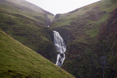
The Grey Mare's Tail
The route is a hill walk straight out of the box and leg muscles and lungs are quickly stretched as the path rapidly gains height under the craigs of Deacon Snout, on the slopes of Bran Law. The waters cascading down the waterfall are a constant draw. Look out, too, for feral goats grazing on the edges of the gorge.
There are good views back, also, down Moffat Dale eastwards towards the town, with the silvery thread of Moffat Water picked out against the browns and greens of the imposing valley, twisting just a little more than the road leading back westwards.
The relentless gradient eases near the top of the cascades and the route then follows the calmer waters of the burn up towards Loch Skeen (or Skene) the expanse of which appears abruptly as the walker rounds a small promontory.
The loch is in a classic glacial hanging valley and is surrounded by high ground. South-west lies our goal, the 821m White Coomb. At the head of the loch, the dark rocks of Loch Craig stand sentinel while the peat wilderness of Winterhope Moss forms the eastern boundary of the water.
Loch Skeen is now home to one of Britain’s rarest species of fish, the vendace, introduced to these waters from Bassenthwaite Lake in the English Lake District, and thriving in these more northern climes.
Be aware that the return route entails crossing the Tail Burn at some point. When we visited, the area had had a fair amount of water, so it’s worth noting potential crossing points on the way up the burn. Even in times of spate, it’s probable you will get across the water at the loch exit.
The maintained path peters out not long after meeting the loch. The wiggly contour lines of the map give a hint of the boggy nature of the terrain between the lochshore and Lochcraig Head. The aim is to hit the drystane dyke (wall) which will be our trusty handrail for virtually the whole of the rest of the walk.
It is possible to follow a wet and, in parts, muddy path across the dips around the shore. Sphagnum abounds, a sure sign of wet ground, before the land starts to rise under the craigs at the north-western head of the loch.
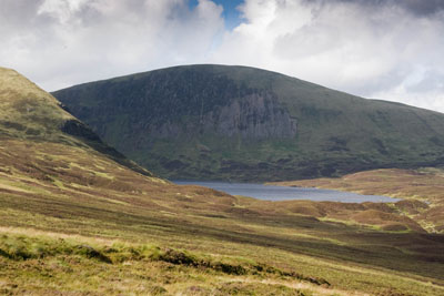
Loch Craig: head to the right of the rocks
Keep to the right of the rocks of the craig and get the legs and lungs working for the second big climb of the day, up to the 801m Lochcraig Head.
The 300m (1,000ft) slog is steep and unrelenting, so frequent pauses to look back across the splendour of the loch are welcome. The expanse of the Southern Uplands slowly unfolds as you rise to the head of the climb.
The wall bends round eventually taking a more westerly route. A small cairn marks the top of Lochcraig Head, though its true highest point is about 200m to the north. It’s from the tops that fine weather is most appreciated. The Moffat Hills are not overtopped by any close neighbours, and views are extensive. Unless, of course, the cloud is down.
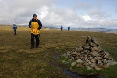
The cairn on top of Lochcraig Head
The wall along the top is broken in parts and is accompanied by a fence for much of the way. From Lochcraig Head, a steepish walk down to the col at Talla Nick means 100m (330ft) height is lost which has to be regained on the pull up to Firthybrig Head, but that represents the last big climb of the day.
Even in bad visibility, the drystane dyke provides a fairly foolproof navigation handrail but, of course, the great appeal of this walk is the views from the summits.
From Firthybrig Head, there’s just a gentle rise up to Donald’s Cleuch Head. A cleuch is the local name for a gill or gorge. Donald’s leads down to the waters of Games Hope Burn and then into Talla Reservoir to the North.
The tops on the route are broad and grassy and present no problems of exposure. For those intimidated by the Highlands’ ridges and edges, the Moffat Hills are a safer alternative. Be aware, however, that the drops over the craigs overlooking Loch Skeen are big enough to do you serious damage if you were to slip over them.
At Firthhope Rig, the fence turns 90 degrees to the left and the final rise starts to the summit of White Coomb. Just before the summit, leave the fence and take a feint path diagonally up to a small cairn marking the highest point of the county.
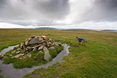
The summit of White Coomb, complete with bamboo cane embedded in the cairn. Border terrier Merlin surveys his home territory
Take a few moments to savour the views (this presupposes you’re not enveloped in clag). There a 360-degree panorama, stretching from the west coast to the east.
North, the Firth of Forth can be glanced between peaks, while to the South-West, the Solway Firth glistens. The hills of the Cheviot range extend to the south while all around stretch the upland wilderness of the Borders.
You could walk for weeks here and see very few people on the tops.
Regain the wall by walking 100m to the North, then start the descent back down towards the loch. On the map, the terrain of Rough Craigs looks intimidating, but the wall route picks a way through an easy grassier area and the rocks are nowhere near as precipitous as the cartographer might have you believe. The path leaves the wall briefly as it reaches the craigs, passing diagonally to the left with just a few slippery steps on a muddy section being all to slow the descent.
We met the only other walker here; a Northern Ireland man who had settled in Edinburgh. He told us he’d completed the munros and was just doing a quick ascent and descent of White Coomb. Incredibly, with no map and compass, he had taken the dead-end waterfall viewpoint path then ascended by the 45-degree braes of Nether Tarnberry’s steep gorge.
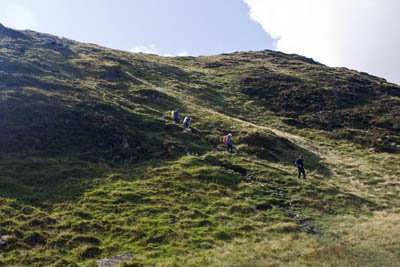
The path through Rough Craigs presents no major problems
The dyke leads all the way down to the Tail Burn and it’s then a matter of finding a crossing point. Heading slightly upstream is probably a good bet. If the burn has looked in spate on your route up, it might be best to cut away from the wall sooner and head towards the loch’s end, where the water is fairly shallow.
The rest of the route will be familiar, as you retrace the path along the steep slopes overlooking the Grey Mare’s Tail and back to the car park.
There are great views down Moffat Dale and the grand country of Scotland’s Border wilderness. You can now get out your bagger’s book and tick off White Coomb which, at 2,526ft, qualifies as a Corbett.
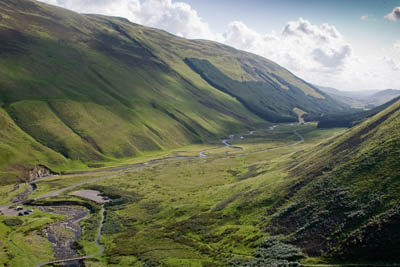
Moffat Dale
Further satisfaction can be gained for those of a numerical persuasion in the knowledge that you will also have bagged a Donald: Lochcraig Head. Confusingly for those not au fait with the intricacies of hill classification, White Coomb is also a Donald.
While we’re on the subject of bagging Donalds, a 1½km (1 mile) diversion from Firthybrig Head would also allow you to tick off the 785m Molls Cleuch Dodd.
Ruth
17 March 2009We climbed Grey Mares Tail on 14th March and had intended to go right up around Loch Skene and back down. We set off in the anticlockwise direction through the boggy bits and began to climb up by the drystane wall.....but there was a 40 mph gale blowing and we thought it was likely we'd be blown right off Lochcraig Head as we got blown into the fence quite often!
This is one of the most marvellous walks I've ever been on and I'm very grateful for sites such as yours because it really helped with the planning.
Keep up the great work and enjoy your walking.
Tinto63
29 March 2009This is a great walk.
But my preferred route to White Coomb starts near the bridge on the minor road between Talla and Megget reservoirs, this is easier accessed from the north than the Grey Mare's Tail carpark and this means less driving and more walking. (and also starts at 420m!) From the path by the bridge head SE and then S up the ridge between Molls Cleuch and Talla Water, Molls Cleuch Dod is soon reached and from here there is an excellent walk above 750m on a broad grassy ridge all the way to Firthhope Rig and then SE to White Coomb. On the way back turn NE at Firthybrig Head and onto Lochcraig Head, another high level ridge walk ensues over Talla East Side and Nickies Knowe and down to the starting point. Total distance is 15-16Km. Very exhilarating on a clear, breezy day with great views and plenty of skylarks and meadow pipits to serenade you. If you were really keen and fit you could do this in the morning, have lunch in the car and then go north in the afternoon over Broad Law, Cramalt Craig, Dun Law, Fifescar Knowe to Dollar Law, which would add another 20Km or so of excellent walking!
benthedog
02 June 2009did this walk in march, apparently i didn't need any gear as we kept meeting people who were not equipped to be on the hills.we left the loch just before a thunderstorm and despite telling these people to turn back thry kept going. what a bunch of idiots.the fact that we had all our gear with us should have given them a clue.these are the kind of fools that get us a bad name.great walk though.
James
10 November 20092 attempts to get to White Coombe but heavy cloud and horrible weather thwatred the adventure.The cloud hanging on peak Loch Craig Head was almost at the same level both times.
Boggy is the word on these hills.