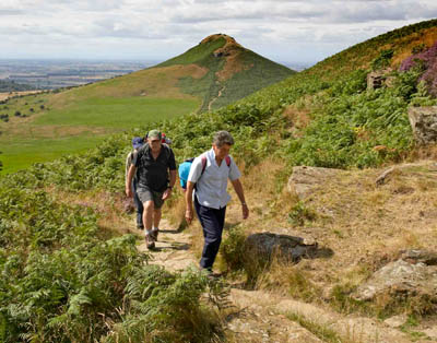
Walkers on the Cleveland Way, with Roseberry Topping in the background. Photo: Mike Kipling
Forty years ago, the great and the good gathered in the ruins of a north Yorkshire castle to celebrate the culmination of a successful campaign going back decades.
In the early 20th century, the Middlesbrough Rambling Club had proposed a long-distance ‘holiday walk’ across the moors and coastline south of the heavily industrialised town from which its members regularly escaped in search of clean air and exercise.
Just as the Manchester Ramblers and their counterparts in Sheffield fought long and hard for the right to walk in the Peak District, so their north-eastern comrades looked to the escarpment rising above the flat plain to the enticing moors and shapely hills of the uplands that overlooked their homes and workplaces. Why not, they argued, set up a series of youth hostels in the area and link them with a right of way to enable the workers of Teesside to spend a week walking the route?
It would be another four decades before MPs passed the 1949 National Parks and Access to the Countryside Act, and a further 20 years would pass before the idea of the Middlesbrough pioneers would come to fruition.
So on 24 May 1969, with speeches over, the gathering moved from Helmsley Castle on the southern edge of the North York Moors to the town’s youth hostel for light refreshments. The Cleveland Way had been born – only the second official long-distance path in England.
From Helmsley to the trail’s end at Filey is only 60km (37 miles) and can be accomplished comfortably in less than an hour by car. But the Cleveland Way takes a massive horseshoe-shaped detour around the hills and coast of the North York Moors national park, and most walkers take about nine days to cover the 176km (109 miles) of the national trail.
An early public-information film for the Cleveland Way.
The modern-day realisation of the ‘holiday walk’ of the Middlesbrough Ramblers is completed by about 2,300 people every year. It is estimated that, since its inception, 92,000 walkers have pounded the route, with 300,000 more taking in part of the route each year, a number boosted by those tackling Wainwright’s Coast-to-Coast Walk and the Lyke Wake Walk, both of which take follow part of the Cleveland Way along its northern section.
Early walkers along the route would have had to rely on self-sufficiency and good navigation, but over the years, the way has become much easier to follow, with extensive waymarking and signposting, and a small industry has grown to provide accommodation and backup for long-distance walkers along the trail.
The authorities looking after the route have tried to make the going a little easier, with a programme of replacing stiles with gates. In 1994, the Cleveland Way had 128 stiles; now there are 46 and the plan is to work with landowners and farmers to try to reduce this further.

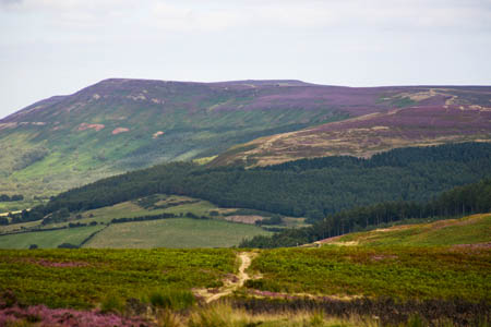
The Cleveland Hills, with Live Moor in the middle right distance and Carlton Bank and Cringle Moor in the distance
This may have helped Martin Dietrich, who holds the record for the fastest completion of the way, in 24hrs 19mins, set last September as part of the first Hardmoors 110 Ultrarun.
The route is a combination of moorland and coastal walking and, although not as arduous as routes through mountain areas such as the Highlands, the Lake District and north Wales, is still a challenge for walkers who will need to be able to cope with anything the northern English climate may throw at them.
Highest point is Round Hill on Urra Moor at 454m (1,489 ft) and nearly half of the route follows the North Yorkshire and Cleveland Heritage Coast, which is itself part of the Nave-Nortrail, a collaboration of countries bordering the North Sea, including Norway, Sweden, Denmark, Germany and the Netherlands.
Cyclists and horse riders can use about a fifth of the Cleveland Way, and the more adventurous can make the route into a loop by adding on the section through the Tabular Hills linking Scarborough with Helmsley, which adds a further 77km (48 miles) to the trail. 80 per cent of the Cleveland Way is within the boundaries of the North York Moors National Park, which has the largest expanse of heather moorland in England and Wales – about 44,000ha (108,726 acres) – around one third of the National Park.
While on the route, walkers will enjoy the extensive views – English weather permitting – westwards to the Dales and northern Pennines, then across the plains as far as the Penshaw Monument near Sunderland and finally the fine coastal scenery along the cliffs of North Yorkshire.
There are oddities to be encountered, too, including the White Horse of Kilburn, cut into the hillside in 1857 but which, unlike its southern chalk counterparts, has limestone underlying it and needed whitewash to make if visible.
Then there’s the toll house erected between Sandsend and Whitby by Maharajah Duleep Singh, the Indian ruler and possessor of the Koh-i-Noor diamond, whose lands and property were usurped by the East India Company and who lived for a time on the North Yorkshire estate.

Both the Coast-to-Coast Walk and the Cleveland Way follow the old trackbed of the Rosedale Ironstone Railway
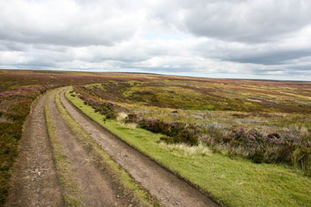
Soon after Urra Moor, the Cleveland Way follows the trackbed of the old Rosedale Ironstone Railway, which meanders round the contours of some of the highest land on the route and which was originally built to ferry the iron-ore-bearing rock to Teesside for use in its steel and ironworks.
Deep underground nearby at Boulby potash mine, British scientists are looking for the meaning of life, the universe and everything. Actually, they are more than 1km under the surface, sheltered from cosmic radiation and researching Wimps: weakly interacting massive particles – thought by some to be the dark matter that fills most of the universe.
Another object with a strange mass is The Creteblock: the wreck of a concrete boat near Whitby. It was constructed during the First World War from reinforced concrete, when steel was in short supply. It now sits, covered in barnacles and seaweed, visible at low tide below Whitby Abbey.

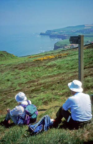
Walkers on the coastal section of the Cleveland Way
So although the Cleveland Way may not have the mighty splendour of the West Highland Way’s Glencoe, or the remote beauty of Wainwright’s Ennerdale, it does have plenty to tempt the walker, as those Middlesbrough Ramblers realised a century or so ago.
The anniversary will be celebrated with a series of linked walks organised by local Ramblers groups during which the whole of the route will be covered on the same day. Staff from the North York Moors National Park Authority and Redcar and Cleveland Borough Council will also be taking part and the public can join in some of the walks, or just turn up and walk which ever section they like. Details are available by ringing 01439 770657.
The official starting point of the Cleveland Way is the cross in Market Square, Helmsley and the route ends at Filey Brigg, 11km (7 miles) south of Scarborough.
Funding for the Cleveland Way comes from Natural England, the North York Moors National Park Authority, Redcar & Cleveland Borough Council and Scarborough Borough Council.
More information about the trail can be found on its official website.