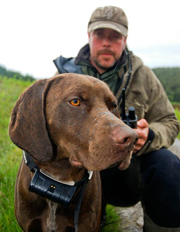
Ally Macaskill with one of his pointers, wearing the GPS collar
A ranger working in the Scottish Highlands is combining animal instinct and the latest technology to help preserve wildlife.
Ally Macaskill, wild ranger for Schiehallion and Glen Nevis, has equipped his two dogs with Global Positioning System collars to help him track birds on the two sites, many of which are rare or threatened species. Both estates are owned by conservation charity the John Muir Trust.
Mr Macaskill’s German short-haired pointers Max and Gus have been fitted with the Garmin collars which enable the ranger to pinpoint their movements on the mountainsides using a handheld GPS device. The dogs stop and stand still – on point – when they come across a bird. Their handler can then get up close and flush out the birds, meaning they can be identified at close quarters.

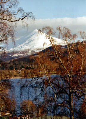
Schiehallion, much of which is owned and adminstered by the John Muir Trust
Species include red and black grouse, ptarmigan, merlin and hen harriers.
Mr Macaskill said: “I’ve been very impressed with these GPS collars, which I saw used during trips to Scandinavia.
“They indicate whether the dogs are on the move or on point. When they get on point the collars mean I can get there quickly, with more chance of seeing what the dogs have found.”
“As well as the mapping function on these GPS collars I can download their movements later onto a computer to work out if we’ve missed any large pockets of ground.
“I know of a couple of other people using these devices in Scotland – they really are a boon for this type of work.”
Black grouse are particularly threatened, with numbers declining rapidly in Scotland and elsewhere in northern Britain. The John Muir Trust ranger estimates there are 25 males on the Schiehallion site.
About 300ha (740 acres) of east Schiehallion make up part of the Schiehallion site of special scientific interest on the 1,083m (3,554ft) munro, west of Pitlochry. The SSSI is protected for its botanical interest and has limestone pavement habitats, flush vegetation and limestone outcrops. It also contains a number of plant species that are of restricted distribution in Britain.
The GPS system uses a constellation of orbiting US-owned satellites to give accurate locations to receivers in much of the world.