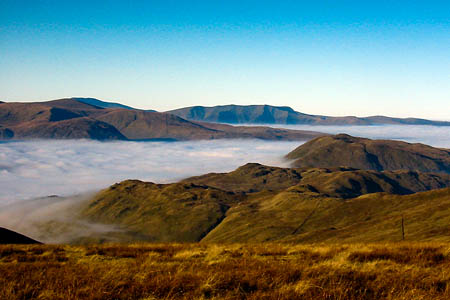
Get the cameras out; temperature inversions, and with them the opportunity for some stunning pictures, are likely later this weekend and into next week as the weather cools.
The recent general thaw across Britain has consolidated snow on the country’s mountains, but some areas remain prone to avalanche.
The risk in Lochaber, including the Ben Nevis northern routes and Aonach Mòr, has dropped to low at all levels as the snowpack gradually thaws. Yesterday, sportscotland Avalanche Information Service observers were reporting localised instabilities on many steep slopes above 1,000m but with a stable pack elsewhere.
In the northern Cairngorms, SAIS boss Mark Diggins blogged yesterday that there was hard walking getting to the corrie, with snow thigh deep in places and wet snow at lower levels. He said it was likely to get colder which will improve the conditions both for climbing and snowpack stability. There was some cornice collapse evidence at base of crags.
The forecast for tomorrow on the northern Cairngorms was for moderate risk of avalanche above 700m on all aspects, with low risk below that altitude.
The Lake District national park Weatherline felltop assessor recorded a temperature of 2C on Helvellyn’s summit on Friday, but warned that, with the thaw, the cornices on east- and west-facing slopes have become unstable and walkers and climbers are advised to stay well back, remembering that fracture lines can be several metres back from where you might expect them.
Verglas is also covering some hand- and footholds on Striding Edge and Swirral Edge and the Red Tarn ice covering is definitely not safe to walk on.
Exits from the edges are covered in heavy, wet snow, the assessor said.
The Northumberland National Park also issued a warning that avalanches have occurred in the Cheviots and deep snow is prevalent still in many areas from Hadrian’s Wall to the Cheviots.
The authority said: “If you are planning to be out and about please take suitable safety precautions as Northumberland National Park Mountain Rescue and National Park Rangers are presently helping the emergency medical services. There are deep drifts in the Cheviots and several avalanches have occurred. These are likely to increase with the present thaw and visitors are advised to avoid the upper valleys.”
Temperature inversions – where cloud and cool temperatures in valleys are topped with warmer and sunnier weather on the tops – are likely to develop into next week, according to the Mountain Weather Information Service, as a mass of cold air moves south to edge out the current warmer air.
Later next week there is potential for further substantial snowfall on northern and eastern mountains.
