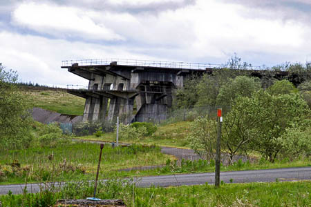
Test beds at Spadeadam which was once home to Britain's Blue Streak rocket project. Photo: Phil Thirkell CC-BY-SA-2.0
A military exercise currently underway which jams GPS signals will be repeated next year.
Ofcom announced another week of when navigational signals could be affected around an RAF base in the north Pennines.
The operation at RAF Spadeadam on the Cumbria-Northumberland boundary is due to end on Friday.
But Ofcom warned another exercise around the UK’s Electronic Warfare Tactics Range will take place next March.
Walkers and other outdoor enthusiasts are warned navigation signals from the Global Positioning System may be affected between 8am and 6pm from 5 March until 9 March.
Ofcom, the Government’s radio-communications body, said an area within 5km (3 miles) of the military base could be affected. Walkers will need to resort to traditional map-and-compass navigation while the jamming is taking place.
The jamming is likely to affect any GPS units up to 5km from Berry Hill in the Spadeadam Forest. The Hadrian’s Wall national trail lies 2km further south and there are few public rights of way in the jamming area, though there are tracts of Countryside and Rights of Way Act open access land within the stated radius, including Side Fell to the West and White Side and Deer Hill in the Kielder Forest Park to the East.
RAF Spadeadam covers the biggest area of any of the air force’s bases in the UK. It was also the test and launch site for Britain’s aborted Blue Streak missile project.