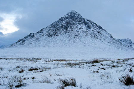
Hillgoers in Glencoe are warned avalanche risk will be high tomorrow. Photo: Carol Walker CC-BY-SA-2.0
Two Highland areas are at high risk of avalanche tomorrow as a temporary thaw sets in leading to unstable conditions.
Glencoe will see avalanche risk rated as high on slope aspects from the North through to the South-East, with similar conditions from North-East to South-East in Lochaber.
Slopes above 750m in Glencoe and 900m in Lochaber will be prone to both natural and human-triggered avalanches.
Creag Meagaidh, the northern Cairngorms and southern Cairngorms will have considerable avalanche risk on slopes on the eastern half of the compass.
The sportscotland Avalanche Information Service has reports of four avalanches within the last two days, three on Aonach Mòr and one on Meall a’Bhùiridh.
So far this winter there have been 64 avalanches reported to the service in the Scottish Highlands.
Tomorrow’s high avalanche rating, only one below the top category, is the most severe commonly seen in Britain.
The Mountain Weather Information Service said gusts of up to 100mph are possible tomorrow on Highland summits, with severe windchill likely in average 60mph southerly winds.
Wednesday’s rain is expected to turn back to snow on Thursday and Friday as summits refreeze, though thundery showers are possible.
A large cold airmass currently over continental Europe may move westwards over the UK early next week, bringing the possibility of cold, dry conditions.