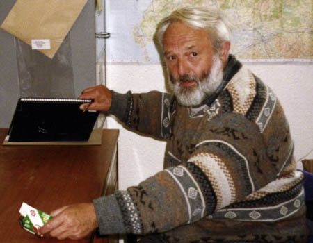
Amateur surveyor and hillwalking fanatic John Barnard has nailed the height of several contentious mountains as one of the trio of ‘hill sleuths’ who lug their expensive GPS equipment to summits around Britain.
But finding the true top of one of the Highlands’s most uninspiring munro tops proved a confusing exercise.
Munrobaggers who are climbing all the munro tops in addition to the main hills will remember the munro top Tom Dubh (grid reference NN 921 952, OS 1:50,000 map 36 or 43) in the southern Cairngorms.
Unfortunately the memories may not be very complimentary to the hill but would probably be unforgettable.
I have now climbed this hill on three separate occasions and I think it is time now to call a halt.
The first time I ascended, I approached from the West from the southern end of Glen Feshie. An excellent and recently reconstructed footpath leads in an easterly direction to just south of the munro top Carn Bàn Mòr (1,052m).
A little further on there is an excellent view of the high south-western Cairngorms: Sgòr Gaoith (1,118m) to the North; Braeriach (1,296m) to the North-East: Cairn Toul (1,291m) to the East and Monadh Mòr (1,113m) to the South-East to name but a few.
But where is Tom Dubh? It’s marked on the map and should be just in front of Monadh Mòr but I cannot see it.
Thoughts such as: “Am I in the right place?” or “Is the map wrong?” start to come to mind.
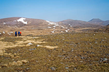
However, when one appreciates that the height of Tom Dubh is only 918m, just creeping into the 3,000ft-plus category, this is a hill that you have to go down to!
In fact apart from an approach from the south via the glen carrying the River Eidail, Tom Dubh is a hill you have to go down to from all directions and is probably unique in this respect.
If you think I am being a little unfair to Tom Dubh then I quote from the late Irvine Butterfield in his excellent book The High Mountains of Britain and Ireland. Irvine makes the following statements: “Braeriach boasts a pointless and distant top – Stob Lochan nan Cnapan (Tom Dubh).

The late Irvine Butterfield: 'meaningless top'
“This is one for the real enthusiast; the most meaningless 3,000ft ‘top’ in all Britain, for here lies the ultimate in desolate wilderness, a landscape so featureless that it defies man’s ability to use map and compass.
“Devoid of landmarks, in mist, only the oozy drains of the plateau’s few streams offer guides of any consequence.
“When frozen in winter blizzards even these fail to assist, and dead reckoning by compass is the only sure guide to the safety of the glens below.”
So what is the hill really like when you get to it? It does not take a great deal of effort to climb it. 50m or so of ascent over broken ground brings one up to the summit plateau.
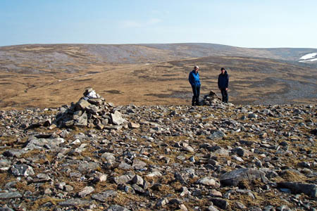
But where is the summit? One is presented with an array of cairns and stone shelters, any one of which or none could be at the highest point.
So without any further knowledge one is obliged to wander around visiting all the appropriate points until one is satisfied at summiting the hill before moving off to higher things.
Recently Graham Jackson and I were spending a few days in the Cairngorms walking with a group of friends. The surveying equipment had not been left at home and we took the opportunity to visit Tom Dubh so that we could put the ‘aimless wanderers’’ minds to rest by properly identifying the summit of this hill.
The highest point was not in fact at any one of the existing cairns but the top of a large embedded boulder to the east of the summit area. In case anyone feels there are not enough cairns there, we built another on to mark this point.
However, if you feed in NN 92144 95270 to your GPS then the point should easily be found.
So if Irvine Butterfield has called Tom Dubh ‘meaningless’, we hope that we have put a little more meaning into it.
The summit is also marked by a point of interest on grough route, our OS mapping and route-plannning system.


Gerald Davison
26 April 2012Climbed this in rather poor conditions about ten years ago, near to the end of my round of Tops. I recall it being an interesting navigation challenge in bad weather.
Came in from Carn Ban Mor in the west (another Top).
Don't think I'll be going back any time soon...... :-)
Neil Reid
27 April 2012No such thing as a meaningless top (unless, of course, you accept that they all are), but some of the activities that have centred on this one could be regarded as fairly meaningless. :)
Ian King
27 April 2012The comment above about 'a landscape so featureless that it defies man’s ability to use map and compass' brought back a memory from the 1970s while on a Glenmore Lodge Winter ML assessment.
Roger O'Donovan had us navigate around the area of Tom Dubh and various other vague ring contours, lochans etc while full winter conditions prevailed.
Before moving us on toward Braeriach, he demanded a high level of accurancy from us as we navigated, using only a map and compass, around that part of the plateau.
Craig W
27 April 2012Irvine Butterfield was not especially complimentary towards several east Grampian hills. I wonder what he made of the likes of Rogan's Seat in the Pennines.
I get out so rarely these days Tom Dubh looks like a fine objective.
R Webb
30 April 2012Ski tour heaven!
The Moine Mhòr is a wonderful place.