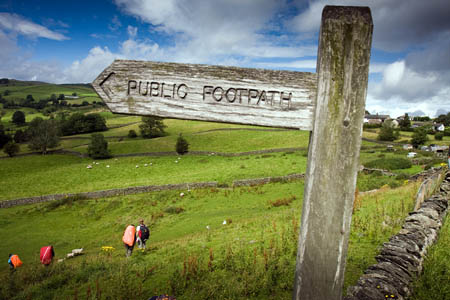
Access campaigners welcomed coalition Government moves to speed up the process of registering ‘lost’ footpaths and other rights of way.
The Open Spaces Society said Department for the Environment, Food and Rural Affairs proposals would make it easier to bring England’s official maps up to date.
The society, Britain’s oldest national conservation body, said the state of the country’s present definitive maps is lamentable.
Many are incomplete which means some public footpaths, bridleways and byways which are highways in law are not shown on the map remain hidden and secret. The process for putting them on the map can be long and tortuous, it said, and much of the work falls on the surveying authorities – county and unitary councils.
The Countryside and Rights of Way Act 2000, passed by the Labour Government, introduced a cut-off date of 1 January 2026 for the claim of many ancient highways and ministers promised funding to ensure the maps could be brought up to date before the cut off.
But the OSS said half that period has now elapsed yet no progress has been made and the backlogs of path claims are increasing.
Defra will today open a public consultation on its plans.
“A working party of wide interests, convened by Natural England, made recommendations to ministers in March 2010 and, two years later, the environment minister Richard Benyon is consulting the public on the working party’s agreed package,” it said.
“The consultation proposes that the cut-off date should be implemented only if the whole package of measures is introduced. This speeds up and simplifies the process for claiming paths and determining whether they should be added to the map.”
OSS general secretary Kate Ashbrook, a member of the working group, added: “We are pleased that the environment minister has at last launched the public consultation, the first stage to getting our recommendations enshrined in law.
“The maps will never be up to date unless the processes are simplified and streamlined. This of course chimes with Government’s wish to reduce red tape.
“In the 12 years since the 2026 cut-off was introduced in law, local authorities’ backlogs of path claims have increased, not least due to budget cuts.
“To take two random examples, Staffordshire County Council has a 17-year backlog, and Gloucestershire has a ten-year backlog, and these are set to increase.
“The effect of all this is that there are countless highways which we have the right to use and enjoy but, because they are unrecorded, are at risk of being built over and incorporated into development, after which it is almost impossible to save them. Many have already been lost.”
She said there was rare unanimity on the need to simplify the process.
“It is unusual for so many organisations with different interests to become bedfellows, but the Government’s consultation proposals are backed by the Open Spaces Society, British Horse Society and Ramblers, as well as the Country Land and Business Association, National Farmers’ Union and local authorities and other organisations,” Ms Ashbrook said.
“So we hope there will be widespread support for the plans so that legislation to speed up the claims process can be introduced in the third session of this parliament. The year 2026 will soon be upon us.”

