We’re happy to announce we’re continuing our free online mapping and route planning service, launched in response to the coronavirus crisis.
Grough route is normally a paid-for subscription service, but we opened up a free version in response to the lockdown.
The free Covid version of grough route limits users to an area within eight miles of their postcode, to comply with original UK Government guidance to stay local when exercising.
Many walkers, runners and cyclists took up the offer and subscribed to the Covid grough route system.
Although people in England can now travel to places to take their exercise, the Welsh and Scottish Governments have kept the ‘stay local’ rules in place, so we’ve decided to continue offering the free, distance-limited version until that changes.
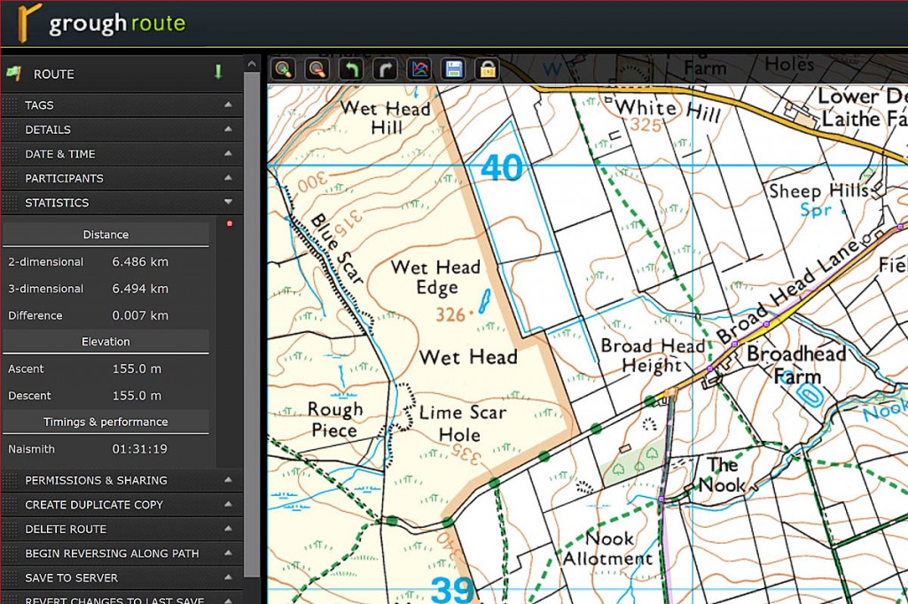
Grough route offers Ordnance Survey mapping at 1:25,000 and 1:50,000 and already has more than 5,500 shared routes available, created by existing subscribers.
New subscribers to the free Covid version can also create their own local routes on their computer, then print out the map marked with the route to take with them. These will, by default, be private routes only available to the person who created them, so as not to encourage too many people to converge on the same paths and bridleways.
You can register for the free version on the grough website.
The grough route system enables users to create routes on the OS mapping by clicking on the online maps. Walking speeds and Naismith’s Rule can be modified to suit the user, and the route and map then printed on an A4 sheet to take with you.
You’ll need a desktop or laptop computer to create the routes. The mapping isn’t downloadable. The normal online support for full subscribers isn’t available for the free version, but there is an online manual.
For those who wish to plan outings farther afield, the standard, paid-for grough route is available. The service costs £5 for a 30-day subscription or £19.50 for a full year’s access to the online system. But remember, travel to Wales and Scotland for exercise is not allowed, so stick to routes in England if you’re planning to drive anywhere other than locally for your walk, run or ride.
The full subscription service is available via our grough route page.
Remember, many facilities in national parks and tourist hotspots in England are still closed, and you’ll have to conform to social distancing regulations when out for your exercise. Mountain rescue teams have also asked walkers and climbers to stay off the high mountains and stay well within their capabilities, as many of them will not be able to respond in the normal way.
We’ll review the provision of the free service if there are any further changes to government regulations and guidance.
Grough route is not suitable for route planning in Northern Ireland as Ordnance Survey mapping only covers Great Britain.

