The first of England’s long-distance paths, now known as national trails, celebrates its 60th birthday next year, and I reached my 66th milestone last year. So what better time to tackle this original, and some would say toughest, of England’s national trails.
Why do humans feel the need to find such challenges? Is it because modern, cossetted life is so removed from our natural atavistic activities? Or is there something in the psyche that demands we push ourselves for no particular reason?
The thought ran through my mind as I pushed myself up yet another steep rocky hillock on Hadrian’s Wall near the end of a long day on the hoof.
It was day ten of my own personal challenge, and my knees were telling me walking more than 40km that day might not have been a great idea. And just why had I set myself this trial of tenacity?
I’m never going to summit Everest; I have neither the money nor the inclination to join a crampon-shod queue in the death zone. Neither, at my age, will I tick off all the munros – I don’t have enough already under my belt and, in any case, I’d rather walk a mountain because of its intrinsic qualities rather than because it appears on a fairly arbitrary list. And I’m not a climber, so the North Face of the Eiger is out of bounds.
But I must have felt a deep inner craving for my own adventure. Or perhaps just a shallow need, as I’m not really that deep. And so I chose the Pennine Way as my challenge. I can walk; navigate reasonably well; and I love the outdoors, so traversing the spine of England in one continuous journey seemed the right thing to do to prove myself in the year I qualified for state pension. And, as I hit 66, my knees were giving hints that, if not now, I might never achieve my little goal.
England’s first official long-distance path opened to walkers when I was eight, and always had a slightly mysterious allure. I grew up and have lived within a few miles of the Pennine Way most of my life, and glancing its finger posts as I crossed its route always evoked a curiosity about who would trudge these miles and why.
Now, the who was me and I think I knew why.
I’d walked the Coast to Coast route in 2007 and managed to complete it in 10 days, averaging about 20 miles a day. I was now 16 years older and my knees had seen a bit more action, but I figured I could walk the 268 (official) miles from Edale to Kirk Yetholm at a similar pace, completing it within two weeks. So that was my challenge, my Everest. Not a stroll, but a sustained yomp north towards the Cheviots and Scotland. And I’d backpack it, camping wherever and whenever possible.
As Alfred Wainwright, and others, have pointed out, the Pennine Way isn’t really a traverse of the range that forms the backbone of England. The Pennines can be properly described as starting further south, in north Staffordshire, and at its northern end beyond the Tyne Gap, you’re firmly into the Cheviots. But the sign in Edale says it’s definitely the start of England’s best known national trail, so I threw myself at the mercy of the shambolic British rail network and bought my ticket to Derbyshire.
Day one, Monday: Edale to Crowden (30.1km, +806m)
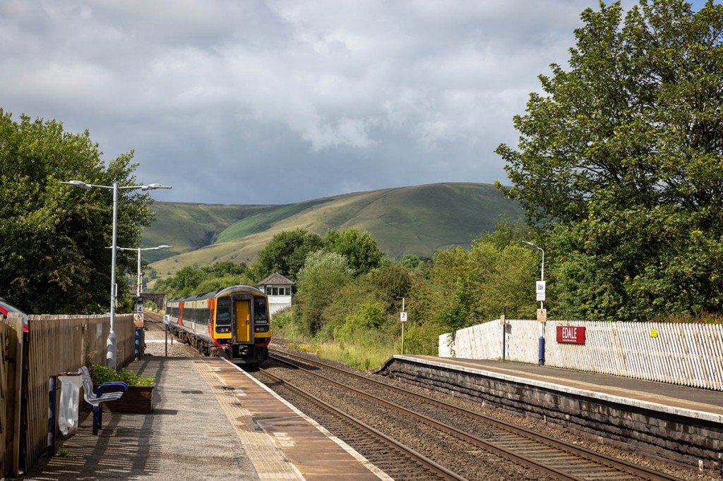
By some miraculous good fortune, all three trains I needed to reach Edale ran pretty much on time and I arrived at the Vale of Edale just before 11am. Stepping off the train onto the platform was to be launched straight into the great outdoors. Like Corrour and Ribblehead, the railway halt is surrounded by proper scenery and dappled sunlight illuminated the Peak District fells. The station nameboard declared: Edale. For Kinder Scout, the Pennine Way and the Moorland Centre. A good start. I’ll take the first two; the last I’d be bypassing on this occasion.
With easy access from the South Yorkshire and Greater Manchester conurbations, Edale felt like the honeypot destination it is. Walkers galore strolled the road skirting the bypassed Moorland Centre, flocking north towards the Peak District’s highest hill. Families, groups of friends, dog-walkers, all heading for a day on the hill. But hang on, I felt like telling them, I’m on a serious mission here. Out of my way, I’m on a challenge. And it actually felt like it. Had I made a mistake? My legs were almost buckling under the weight of my 15kg pack. I walk almost every day, but usually with just a day pack. Carrying all I needed for two weeks on the hoof, along with my camera and lenses, was a different experience and I feared my legs might not be up to completing the route.
Originally, the Pennine Way headed straight on at the Old Nag’s Head, up the narrow lane heading to Grindsbrook Clough, and thereafter over the confusing mass of groughs and hags at the heart of Kinder Scout. Erosion and the difficulty in navigating the peat morass led to the adoption of the ‘bad weather route’ as the main path to Kinder, and the official start of the Pennine Way is now to the left of the pub on the opposite side of the lane.
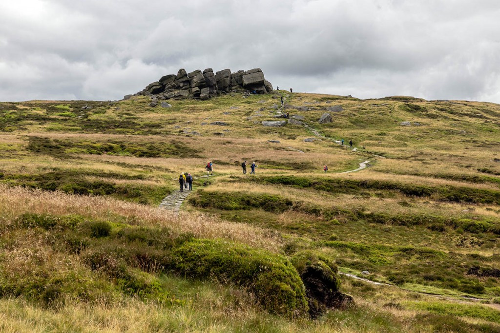
A plaque in the drystone wall declares the official start of the national trail, and a wooden gate has carved into it the snaking shape of the Pennine Way, topped by what would soon become the familiar yellow arrow and black acorn denoting the route. By the time I arrived at the hamlet of Barber Booth, curiously I was 700m south of Grindsbrook Booth. The climb up Jacob’s Ladder was the first dose of concentrated masochism, with an ascent of 250m testing those legs before the outcrops of Edale Rocks were reached. But at least I was heading north.
Beyond that, the white trig pillar sat incongruously atop the gritstone boulders at Kinder Low, 633m above sea level – not quite the highest point of Kinder Scout. That honour(?) is held by a few stones defying the bog 750m or so north-east of the OS pillar, and 3m loftier. I’ve visited the point before and was underwhelmed, so onwards I pressed, to the waterfall at Kinder Downfall, and a stop for lunch.
June 2023 had been quite a scorcher, and the ground on the moors I walked daily had dried out nicely and things were looking promising. Then July arrived. And so did the clouds, the wind and the rain and within a week or so the Pennines had resumed their customary boggy cloak. So there was a fair amount of water in the nascent River Kinder and the crossing of the outflow from the plateau necessitated a little paddling.
Heading towards Sandy Heys I encountered another group of serious walkers. I could tell they were serious because their rucksacks were as big as mine. The girls from Brighton were undertaking their gold Duke of Edinburgh’s Award expedition. They told me it was a long way to come just to get rained on. What would be a good song for them to adopt to help them maintain their walking pace, one asked. Now, I tend to carry an earworm in my head while I’m walking, often playing a single song for a whole day. I know – weird. But I figured none of the music I mentally ran through my synapses would be anything they would remotely know, so I just advised them to find a song with the right cadence for their walking rhythm, which is what I do. And with that I wished them good luck and departed in the opposite direction from the girls.
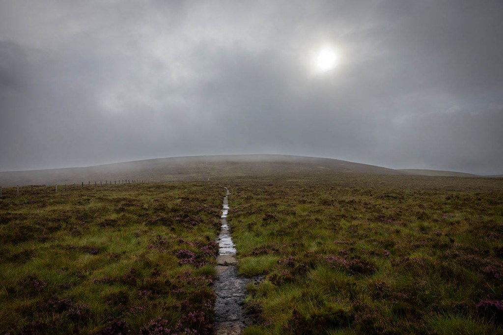
The descent to the footpath junction on Mill Hill and the flagged section over Featherbed Moss saw the crowds thin out and for the first time I felt I was experiencing the Pennine Way environment I expected.
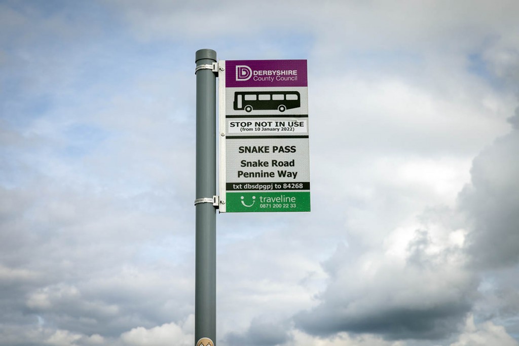
If I’d been hoping to catch a bus for a pit stop at the Snake Inn I’d have been out of luck. The bus stop sign where the trail crosses the A57 declared it wasn’t in use ‘from 10 January 2022’.
Unlike the strenuous climb up Jacob’s Ladder onto Kinder Scout’s plateau, the ascent of the national park’s second-highest hill was a gradual trudge up a very soggy Devil’s Dyke. The previous days’ rains had turned the path into a babbling stream and it was impossible to negotiate a route that kept my feet dry. The route has numerous small signs advising aircraft-wreck hunters heading for the remains of the B29 bomber on Shelf Moor to stay on the main path. As I gained altitude, the vista opened up to the West of Manchester’s high-rise buildings and, in the far distance, the high-rise mountains of north Wales.
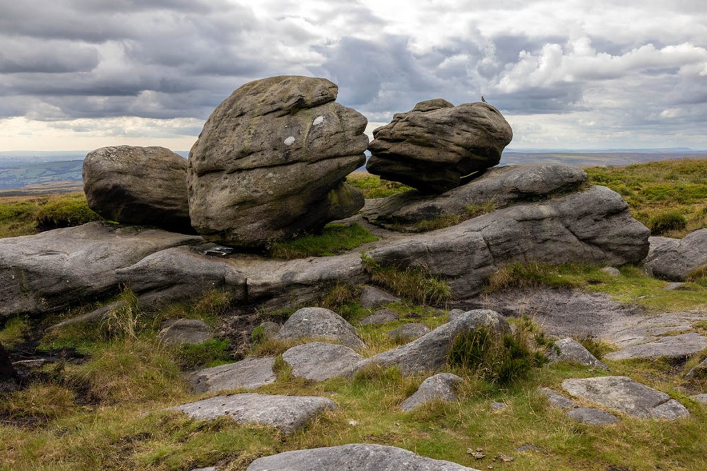
I made the short detour off the Pennine Way at Bleaklow Head to revisit the Wain Stones which, with a little imagination, give the impression of kissing. The national trail route here is marked by a series of low stones with the acorn symbol and a direction arrow carved into them. The high point of Bleaklow, at 633m, is marked by a pile of stones surmounted by a stake at a fair angle from the perpendicular, on a plateau consisting of a mix of boggy pools, peat mounds and rocky islands.
The end of the day’s walk took a good while to come into view, as the route first heads west down Wildboar Grain before picking up the edge of Torside Clough, the deep ravine leading down into Longdendale. Tired legs and a trip over protruding rocks produced my first tumble of the walk and a minor argument with a boulder. Neither of us claimed an outright win; I reckon it was a score draw, but I was glad I’d packed a few sticking plasters.
Longdendale, as well as being home to four reservoirs, also carries one of the many transpennine roads the national trail crosses – the Snake Pass was the first – and the rumble of wagons and other motor vehicles was evident on the descent to the farm buildings at Reaps, while up ahead rose Black Hill, the third of the Peak trio the Pennine Way crosses, but that was for another day and right now my main concern was the major thirst I was feeling and the fact my hydration reservoir was empty, unlike Torside down the valley, which had a good amount of water in it. The route goes down the Torside Reservoir access road and across the dam before passing the curved Rhodeswood Reservoir spillway, but I was unable to use it to replenish my water supply. So there was some urgency in getting to the campsite at Crowden. The Pennine Way passes through a fragrant pinewood adjacent to, and just a few metres below, the A628 Woodhead Pass road, which I crossed to reach a quieter track rising parallel to the main road. The national trail heads off left towards Laddow, but I continued on the track to head for the Camping and Caravanning Club site. I paid my £10.95 pitch fee and dumped my pack and headed for the nearest tap to get the much needed water. There’s usually the chance to replenish supplies at the campsite, but the shop was bereft of provisions. The warden helpfully offered to recharge phones and powerbanks, but I wanted to be off before the reception office opened at 9am the following day.
So the tent went up, the stove went on and I enjoyed my Reindeer Stew from one of the dehydrated meals I’d packed. Crowden was the first locale I encountered a Flemish Belgian man who was walking the length of the Pennine Way as part of his challenge of covering the whole length of Britain from Land’s End to John O’Groats. Definitely trumped my challenge. Our paths would cross regularly during the next few days.
Looking back on my first day, I worked out my pace was fairly slow: 3.5km an hour, so if I was to finish the distance within my target time, I’d need to put in some long days.
Day two, Tuesday: Crowden to Stoodley Pike (37km, +1.070m)
There were four major planning considerations for each day of my walk: finding somewhere to sleep; toilets; resupply food; top up water. From my previous day’s dehydrated finale, the last of these proved probably the most important. I’d also satisfied two others, namely somewhere to sleep, and the campsite had good toilets and showers, once I’d figured out the code to get in. But there was no food to resupply me at the camp shop, though I had packed enough to sustain me for a couple of days.
But it soon dawned that there was another big factor to take into account. Cicerone had kindly provided me with Paddy Dillon’s guide to Walking the Pennine Way and the accompanying map booklet, each of which were tucked into my hipbelt pockets, but I’d actually ended up mostly using my phone to navigate, with the OS Maps app providing quick confirmation of both my position and the route ahead. Which meant it was also vital I kept my phone, and the powerbanks I was carrying to recharge it, topped up. I could have taken up the warden’s offer to recharge them, but I needed to be on the trail before he opened up, so I made a mental note to search out a plug socket wherever I came across one. I switched my smartphone to aeroplane mode most of the day to conserve battery power, engaging full facilities only briefly to inform my wife I was alive and well and to pick up the inevitable important emails (work commissions in particular).
I was packed up and ready to walk at 8am and it wasn’t raining. There was no sign of the Belgian and the campsite was slowly stirring to life as I walked out of the drive. And immediately headed up the wrong track. After fruitlessly attempting to find a shortcut back onto my intended route, thrashing through bracken and bog, I admitted defeat and retraced my steps, finally back on the track I’d followed the previous evening to reach the campsite. Having lost 15 minutes and mentally kicking myself, I turned right after 500m to regain the Pennine Way.
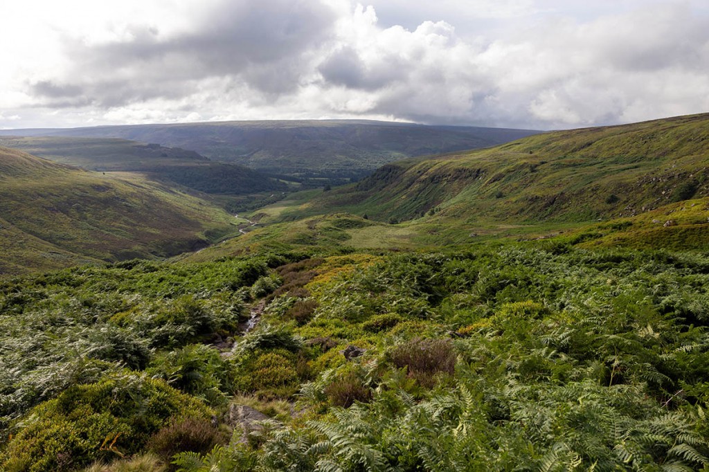
The path climbs gradually and passes a small wood planted in 1980 in memory of ‘staunch walker’ Harry Phillips. Entering the open access land, I was less than enamoured to find myself in a sea of shoulder-high bracken, my least favourite moorland plant. With early morning sunshine releasing the ferns’ unsavoury scent, I thrashed onwards and upwards, the tendrils attempting repeatedly to trip me, while cunningly concealing rocks on the path. All in all, quite arduous progress. In the distance, Laddow Rocks beckoned, the gritstone edge once popular with climbers who could be bothered to hack their way through the Peak District undergrowth, but now deserted.
A steepish trog up Oaken Clough led to the top of Laddow and a good view backwards down the Crowden Valley and beyond to Bleaklow, yesterday’s final hill. Intermittent sunshine was welcome and meant the small group of wild campers back down in the bottom of the valley would be able to strike camp in the dry. The welcome better weather hadn’t had chance to improve conditions underfoot, which remained similar to the First World War trenches in part, though thankfully without the risk of shells exploding around me.
Many years ago I was unfortunate to have to negotiate the summit of Black Hill and its ‘Soldier’s Lump’ during a challenge walk. Back then the trig pillar stood proud on its concrete foundations, the morass of black, soft peat having been eroded away. Now all is changed and the path follows a flagged route across the flat plateau, the tip of the Holme Moss transmitter mast poking above the moorland a kilometre or so to the East.
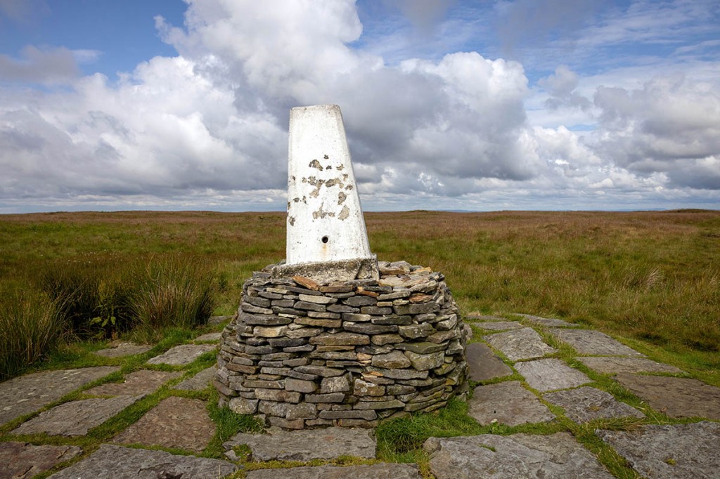
The white-painted trig still stands proud, though not by quite so much and a drystone plinth surrounds it, though the moor is already attempting to reclaim it, with the pillar having taken on a distinct unperpendicular aspect.
On the ascent from Crowden, I’d been leapfrogging the route with a man from Brittany who was also planning to walk the full Pennine Way. I pointed out to him the distant silhouette of Pen-y-ghent, three days’ walk ahead. My explanation that it was a rare example of Cumbric nomenclature in an Anglo-Saxon and Scandinavian dominated landscape, and that it was a distant cousin of the Celtic Breton language was met with blank looks. He didn’t speak Breton. But as we munched on a plentiful supply of bilberries and carefully avoided stepping on numerous caterpillars slowly transiting the stone flags, I was at least able to expand my French vocabulary: myrtilles and chenilles respectively. He too was planning to wild camp somewhere near Blackstone Edge Reservoir, as was I, but my plans would later change.
The summit of Black Hill also allowed good views east to the power stations on the far side of the A1.
As the path begins to drop from Black Hill’s plateau, a warning sign warned that, following heavy rainfall, the ford at Dean Clough could be difficult to negotiate, and in these circumstances recommended using a diversion north-east to join the Kirklees Way to reach Wessenden Head. I pondered my decision briefly – it had poured it down over the past few days even though the rain had now stopped – but decided to risk sticking to the main route. As it happened, the beck at Dean Clough presented no problems and I made the final ascent to the A635 road at Wessenden Head. The layby there overlooks the former site of the Isle of Skye pub, one of the ‘Four Inns’ passed on the challenge walk of that name. All that remains of the former hotel, which closed in October 1956, are the foundations and two slightly ornate stone gateposts, one of which faintly bears the lettering ‘Ladies’. The only signs of life at the inn on this day were two sheep, slumbering in the former snug; or maybe it was the lounge.
In the layby, however, was the very welcome chuck wagon that’s clearly a regular haunt of the two mature motorcyclists chatting to the owner of the burger van, who they were on first-name terms with. As I lunched on a sausage sandwich and a slab of flapjack (£3.50 for both), the host chatted about staying open until four o’clock when the Spine Race runners come through in January.
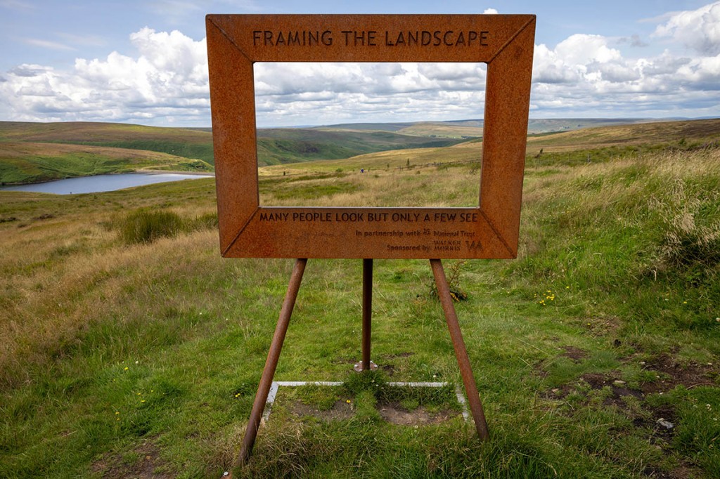
After a short walk along the A635, the Wessenden Head Road forks left and the Pennine Way departs from the asphalt to head into the Wessenden Valley. A rust-coated picture frame greets walkers soon after this: the Framing the Landscape work by painter Ashley Jackson, through which you can view the moorlands beyond and the distinctive profile of Pule Hill. The inscription on the frame reads: ‘Many people look only a few see’.
On a previous visit to the area I’d spotted numerous fallow deer at Wessenden Lodge but on this occasion I couldn’t spot any of the ruminants.
The climb up Blakely Clough is steep, so the chance to pause at the number 11 Marsden Moor Trail viewpoint stone was welcome. Things then flatten out across reservoir land to reach another transpennine road, the A62, then Standedge, at which point the sun deserted me, though the day was still bright and the rain held off, but the westerly winds were whistling up the hillside. Over to the West, the silhouetted tall buildings of Manchester city centre filled the horizon, and north of the conurbation, the high ground of Winter Hill.
Another transpennine road, the A640, is crossed at Haigh Gutter before a soggy incline towards White Hill, passing a stone declaring the most easterly point of the county of Lancashire. White Hill’s trig pillar had unsavoury litter scattered around it. The distant hum of the M62 drifted on the wind as I descended towards the Windy Hill mast, once part of Britain’s communications backbone but now largely shorn of its various dishes and transmitters.
The M62 bridge rises high above the motorway and as I stopped for a photo or two, I got a toot from a passing lorry. The westerlies were fair howling through the deep Windy Hill cutting, so the bridge wasn’t a spot to linger.
Blackstone Edge has, in comparison with Standedge, less black rocks – more dark grey – but I suppose when seen against the sky from the below in Littleborough, they will appear pretty dark. The trig pillar stands proud on a large boulder, among a jumbled terrain of rock and turf. After dropping down northwards from Blackstone Edge, you meet an ancient track and a stumpy upright block of gritstone, the Aiggin Stone. Depending on which expert you believe, it’s either a boundary stone or a waymarker, but most agree it’s 600 years old. The paved track it stands beside is now believed to be a packhorse road likely constructed on top of a Roman road, and both are marked on the OS map. Ahead lay Hollingworth Lake, Littleborough and, to the South-West, the dark shapes of Manchester’s skyscrapers. A kilometre or so further north stands the White House pub, on another transpennine route, the A58. My plan was to eat here, then head out before dark descended to find somewhere to camp in the reservoir country between here and Calderdale. The pub was warm, with friendly staff and, importantly, some power sockets to recharge my phone and powerbank. The food was good and the pint of lemonade welcome after a long day on the edges. I hefted my rucksack onto my back and headed out into the cool Pennine evening.
The reservoir tracks made for good progress and the wind was whipping across the wide-open landscape, so I decided to continue walking rather than pitching the tent near Warland Reservoir. I met a couple of young men from Rochdale out for an evening stroll, who asked if I knew of any good walking routes round these parts. They were incredulous when I told them I was walking to Scotland. “What, without a car?” one of them said, baffled at the idea that someone would want to do that.
From my previous sorties in the area, I figured I might be able to find a bit more shelter in one of the delphs near the Stoodley Pike monument. After a period of examining various hollows and undulations, I found a site that was a little more sheltered and not filled with water, and the tent went up with only a moderate amount of difficulty in the stiff wind. The extra 4km walked meant by time I crawled into my abode for the evening, the daylight was diminishing and I gladly slipped into my sleeping bag.
Day three, Wednesday: Stoodley Pike to Oakworth (33.2km, +890m)
A fairly early start: packed up and walking by 6.40am for the descent to the Calder Valley. I chose the direct, original Pennine Way route rather than the Hebden Bridge loop. It was a pleasant enough day, with some sunshine, as I descended through the woods to meet the main A646 road, which is shoehorned into the narrow valley alongside the Rochdale Canal, the River Calder and the railway that runs between Leeds and Manchester Victoria.
It was warm work slogging up the ancient cobbled ways threading through the hillside settlements above Callis Bridge. There are a lot of green diamonds on the paths marked on the map here. The Pennine Way closely parallels the Pennine Bridleway, and the Calderdale Way isn’t far away, so careful route selection was needed. Part way up the hill, a direction board points to two alternatives: the Wainwright route and the official route. The former heads left to use the bridleway; I chose the official path to the right, past a cascade emerging from a culvert, to appear into open countryside.
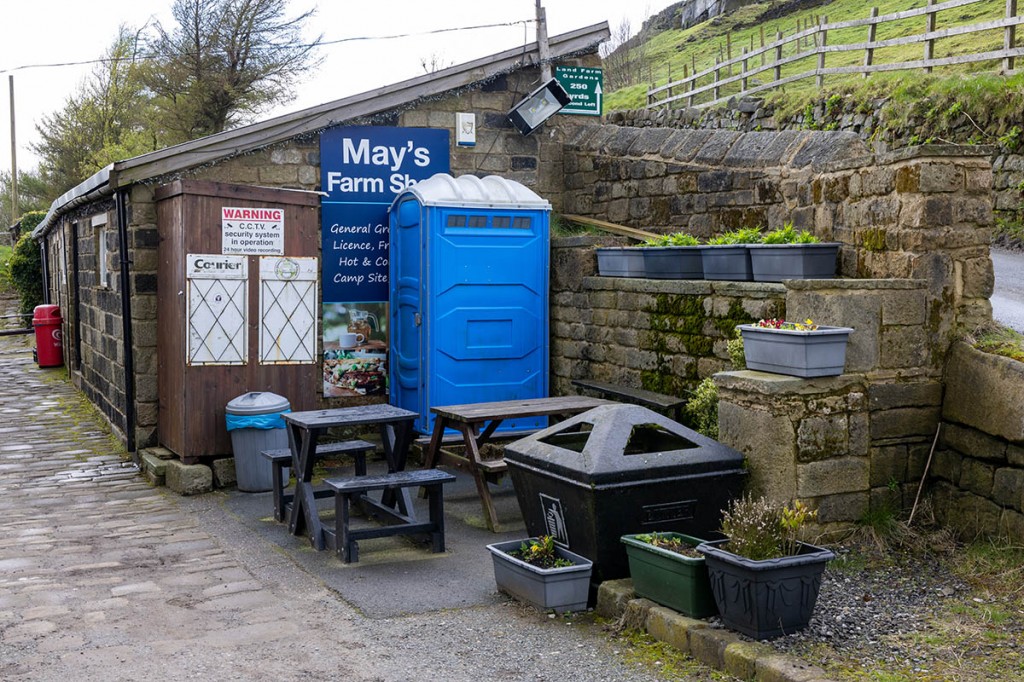
The switchback nature of Calderdale continued, with a sharp drop down to Hebble Hole before another ascent at Colden. A hand-painted sign pointed to May’s Shop to the left, which has acquired a legendary Aladdin’s Cave reputation, providing a welcome pit stop and well-stocked source of resupply for Pennine Way walkers since it opened in 1974.
I didn’t make the short detour, as this evening I planned to luxuriate in an overnight stay at home during which I could restock my provisions.
I met two sets of Pennine Way walkers on Clough Head Hill, then was overtaken by two women undertaking a lightweight four-day traverse of the southern section of the national trail. They planned to walk as far as Ponden that day. I was nearing familiar territory now, with Gorple Lower Reservoir nestled down in the valley. The view along the three Walshaw Dean reservoirs will be radically altered if the plan for a major windfarm, with 65 200m-tall turbines is approved. The path hugs the shore of Walshaw Dean Middle Reservoir before you have to negotiate a fairly precipitous stile consisting of through stones crossing the high boundary wall, then it’s a gentle ascent into Brontë country.
I’ve lost count of the times I’ve visited Top Withins, supposedly the setting for Emily Brontë’s Wuthering Heights, but this was my first halt for lunch at the ruined farmhouse as a Pennine Way traveller. There’s a very basic bothy in the lean-to part of the building. It has only a stone plinth and no other facilities, but as an emergency shelter for the night, it’s useful knowing it’s there. A fellow Pennine Wayfarer I spoke to was heading for Cowling that evening. The ascent after passing Ponden is steep and an encounter at Crag Bottom with a menacing dog and its fey owner who clearly couldn’t control it was unwelcome. The walking poles came in handy for fending off the canine botherer.
At Old Bess Hill on Oakworth Moor, I bade a temporary farewell to the Pennine Way and headed east to Keighley Moor Reservoir and the 6km diversion to my home, where I would spend the night in comfort.
Day Four, Thursday: Oakworth to Malham (43.6km +1,031m)
My son Tom joined me for most of the fourth day’s walk. The sunny intervals of the previous day had gone into hiding and the moors were cloaked in mist and gentle rain meant waterproofs were the order of the day as we summited Maw Stones Moor and headed to Ickornshaw Moor and its curious collection of huts and sheds, some of which sprouted television aerials. Underfoot, things had got very wet, and by the end of the day my feet would begin to feel they would soon be webbed.
A walker we encountered just short of Cowling seemed very concerned about the cows on the path, but all we prompted from the cattle was a little curiosity followed by indifference. By lunch time, taken overlooking the village of Lothersdale, things had dried a little, so the sandwiches didn’t get too soggy as a brief sunny spell warmed things up. It was time to play the ‘guess the accent’ quiz as we exchanged pleasantries with another Pennine Way couple. Dutch or Flemish seemed favourite.
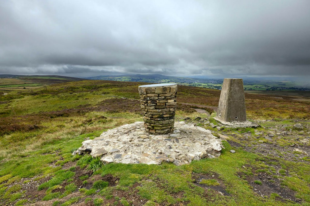
The skies had darkened again and the wind whipped up as we climbed towards Pinhaw’s summit. A family group was gathered round the trig point and the adjacent memorial to people who died in the Covid-19 pandemic of 2020-21. The plaque on it includes a viewpoint indicator as well as a dedication to health service and care staff for their service during the period, with Douglas Goode’s ‘Coronavirus Sonnet’ and an account of Robert Wilson, a Napoleonic War beacon guard whose body was found close-by. We didn’t linger on the windswept beacon, but began the descent into the Aire Gap and more soggy moorland, which I was now realising would be the theme for my Pennine Way walk.
Just short of Thornton a miniature sentry-box-style cupboard offered various refreshments and drinks for payment at its honesty box. A fleeting meeting with the village of Thornton-in-Craven and the busy A56 road passed quickly before heading across unremarkable farmland towards the towpath of the Leeds and Liverpool Canal. The double-arch bridge that carries another transpennine road, the A59, over the cut is a highlight of this brief section beside the water, before a slog across undulating pastureland east of Bank Newton. Finally, the railway bridge signalling the end of Tom’s walk came into view and we approached Gargrave. We’d made good time and there was just a short while for me to stoke up on some chocolate as we waited for my son’s train back to Keighley.
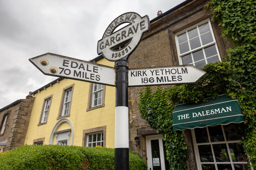
With Tom safely on the train back to West Yorkshire, I headed into the village and its Co-op to resupply. Although there are pubs on the route ahead, there are no shops until Hawes, so this was a good opportunity to make sure I had enough food to last a couple of days. Gargrave also has public loos, if you need them, plus eateries such as the Dalesman Cafe, but I pressed on northwards. A signpost outside the cafe informed me I’d come 70 miles so far from Edale. Someone had added a pair of googly eyes, which somehow seemed appropriate.
The next few miles up Malhamdale are across low-level, undulating fields and progress was good. My original intention was to stay at the Friends’ Meeting House bunkbarn at Airton, but I made the decision to keep walking to Malham. Hanlith Hall, in the hamlet that bears its name, close to Kirkby Malham, looked in a sorry, neglected state. It has the look of a much older building but the present hall was rebuilt in the 19th century. The hall had boarded up windows and a weed-strewn courtyard.
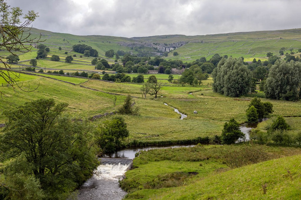
Beyond the hamlet, the route runs parallel to the infant River Aire, with a distant view to the right of the cleft of Gordale Scar before the equally impressive 80m crag of Malham Cove comes into view. The skies had turned leaden by the time I reached the Riverside Campsite at the northern end of the village, my home for the night. The campsite is festooned with notices prohibiting Duke of Edinburgh’s Award candidates from all sorts of activities, from showering to ball games, but the owners are actually very friendly and the restrictions are born of necessity. Malham has always been a honeypot destination in the Dales, but since its brief appearance in one of the Harry Potter films, it is regularly overwhelmed by visitors, and the campsite owners need to ensure both weary DofE-ers and other campers get a fair turn at its facilities.
The campsite was actually pretty quiet as I pitched my tent. I was glad of a shower after a longer day than planned. The £1 token provided seven minutes of hot water, quite adequate for a good clean-up. The campsite is clean and has all the facilities you need. Paddy Dillon in his Walking the Pennine Way guidebook, advises: “As far as possible try to avoid Malham at busy weekends and holidays,” with which I concur.
Day Five, Friday: Malham-Cam High Road (37.7km +1,268m)
Friday dawned as grey as Thursday ended, as I set off towards the geological wonder that is Malham Cove. At one time, a huge waterfall, the stream that once cascaded over the precipice now sinks underground further north. It did briefly flow again in December 2015 following high storm rainfall. Now, it’s home to several climbing routes, a family of peregrine falcons and the outflow of Malham Beck. The River Aire, my companion yesterday, actually emerges from its underground course further south at the superbly named Aire Head.
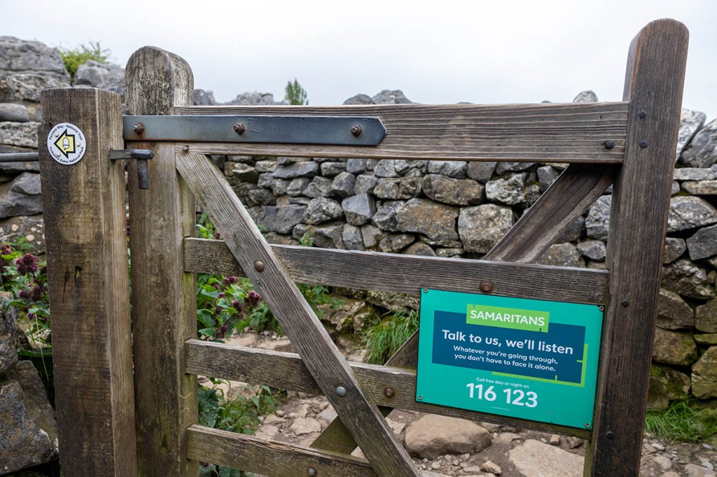
Sadly, the cove is where several people have ended their lives, and as I climbed the steep, stepped path on the western side of the crag, there were repeated reminders on signs that the Samaritans could be contacted by phone day or night. The path proved a good test of my legs and lungs at this early hour, and the limestone pavement, with its wobbly clints and fern-filled grikes were a test of balance with my big pack on. After the climb out of the Watlowes dry valley, the Pennine Way heads for Malham Tarn.
I met the walker I’d spoken to the previous day. He’d wild camped in woodland and planned to walk to Horton in Ribblesdale that day before taking two days’ rest. The grey skies began depositing their precipitation, so it was on with the waterproofs for the next few hours round the head of the tarn and into the dense clag cloaking Fountains Fell. National Trust signs, with a yellow triangle featuring an inverted man falling into a graphical cleft, warn walkers to keep to the footpath as there are mine shafts in the area.
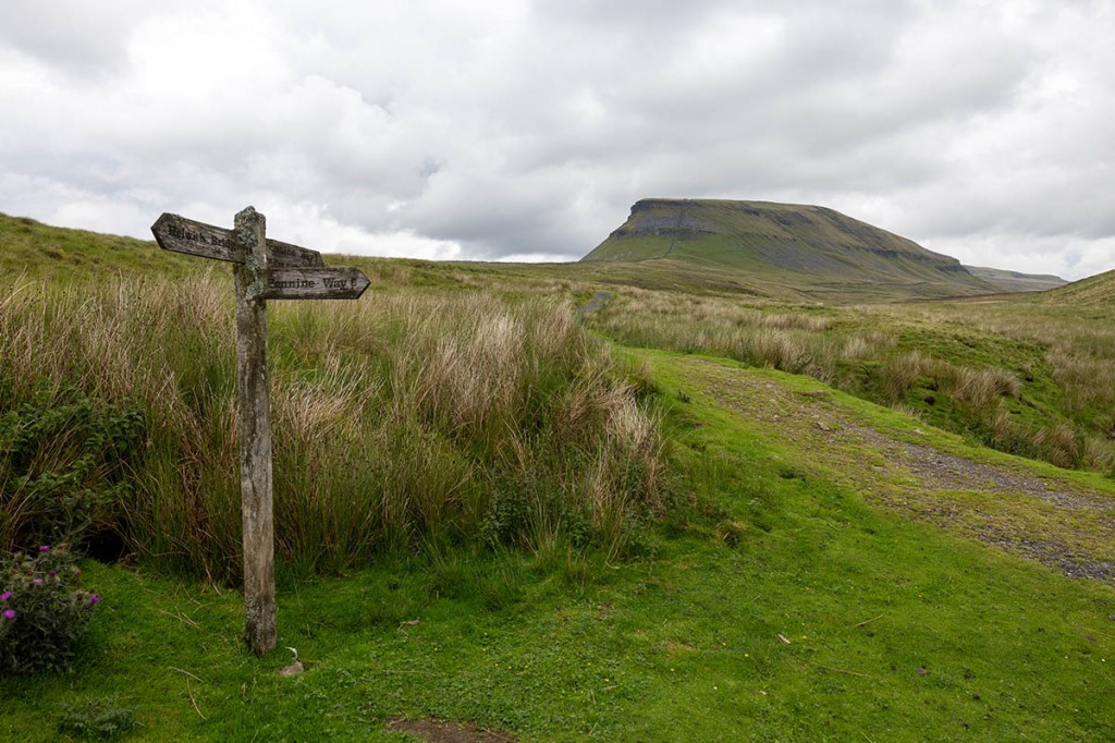
Beyond the foggy summit, descending towards Dale Head, the rain eased and Pen-y-ghent began to uncloak itself slowly. The shapely little peak is well known to me; I regard it as my ‘home’ mountain and have been on its summit at least 100 times. Starting from the quiet Silverdale Road does at least give you a 420m head-start on the ascent, but it’s still a lung-busting 270m trog up the southern nab of the hill. It’s always a bit scrambly over the various escarpments, but with 15kg on my back, I was sure to take a little extra care not to become unbalanced and find myself unexpectedly descending rather than making my way to the summit. A walker from Stuttgart I chatted to professed himself impressed with the Pen-y-ghent scenery.
The leg down to Horton is indicative of the Pennine Way’s origins, which dictated detours to villages where accommodation might be found. It would have been easy to use the newish path created over Whitber Hill for the benefit of Three Peaks walkers, but I was determined not to cheat and followed the full route down into the village. The Crown Inn, still marked as the New Inn on OS maps, was up for sale, I noticed. At one time it would have been possible to resupply at Horton in Ribblesdale, but the village shop and the Pen-y-ghent Cafe are both closed, sadly. The latter used to have a supply of outdoor gear too – useful if you’d had an equipment failure, but the only facilities, apart from the public toilets, are the Golden Lion and Crown pubs.
So I pressed on, passing behind the Crown for the steady ascent up towards Sell Gill. Near Sell Gill Hole, walkers made the grim discovery in 2004 of a woman’s body. A protracted police investigation, including a cold-case reopening of the mysterious death, led to the eventual identification of Lamduan Armitage, née Seekanya, who was originally from Thailand. Her death was deemed suspicious, but no-one has been charged with her murder.
The Pennine Way now shares for a little while the route of the Yorkshire Three Peaks challenge, which involves attempting to summit Pen-y-ghent, Whernside and Ingleborough in less than 12 hours, and I met one family group on their last leg, and possibly last legs, as they made their way to their goal at Ribblehead. My intention had been to find a wild camping site somewhere near Ling Gill, but the clouds had dissipated and sunshine now warmed the fells, so I decided to carry on. After Old Ing, the Pennine Way shares its route with that of the Pennine Bridleway and I was overtaken by a bike rider heading for the end of the route, which oddly concludes in the middle of nowhere in Ravenstonedale, south of Kirkby Stephen. There is a plan to extend the bridleway to Byrness but at present if feels like unfinished business. Anyway, the rider had 20 miles to go and it was well into the evening, so I delayed him no longer and wished him well.
Cam High Road, an old Roman Road and mediaeval packhorse route, has been resurfaced to allow forestry traffic controversially to take timber from the plantations to the South, so progress was rapid. There were great views back to Ingleborough but, as twilight overtook the hillside, it was time to find a suitable place to pitch my tent. I managed to find a fairly well sheltered spot away from the track, and settled in for my evening meal and a good night’s sleep.
Day Six, Saturday: Cam High Road-Keld (31.6km +765m)
It’s never a great start to the day when rain is pounding the tent’s flysheet, but it was onwards and upwards, with my boots on the trail by 8am. The clouds began to break a little and a mini rainbow briefly illuminated Snaizeholme as I traversed the flanks of Dodd Fell. Heavy showers punctuated the brief dry spells on the descent into Wensleydale. The plan was to perhaps treat myself to a little breakfast when I got to Hawes, but after negotiating the pastures and lanes of Gayle, I found the metropolis of Hawes already rammed with tourists and day-trippers, with the cafes full of families and motorists. So it was into the Spar shop to replenish my supplies and obtain a 20p coin for the non-too-clean public conveniences.
I was happy to leave Hawes to the hordes and head down cross the River Ure and eventually find the right footpath to continue along the Pennine Way. There were plenty of dawdlers on the paths in the area, but once through Hardraw and onto the track heading north out of the hamlet, I had the route to myself again.
The ascent of Great Shunner Fell is a slog, a long slog and, as I’ve experienced previously on this 716m hill, it seems prone to perpetual winds, which cast a decidedly cool mood on this section of the national trail. The flagstones that make up the path were sinking into the wet ground in many places, so my damp feet added to the general gloom in my humour. Added to that, for all its bogginess, Great Shunner Fell is bereft of running water and my supply was running low, having last filled up at the Malham campsite.
I had a brief chat with the Belgian Lejogger and a woman at the summit shelter, but it was no place to linger, so it was on with the descent, almost as protracted as the ascent. You might expect the Pennine Way to turn left when it hits the road at Cloggerby Rigg, as that’s the direction in which Keld lies, but it perversely heads to the right and down into the hamlet of Thwaite. Which was a blessing as it gave me the chance to down a welcome pint of lemonade, accompanied by an espresso, at the cafe at Kearton Country Hotel. The sun had now poked out and, in contrast with the cool, windswept ridge of Shunner, the afternoon felt quite benign.
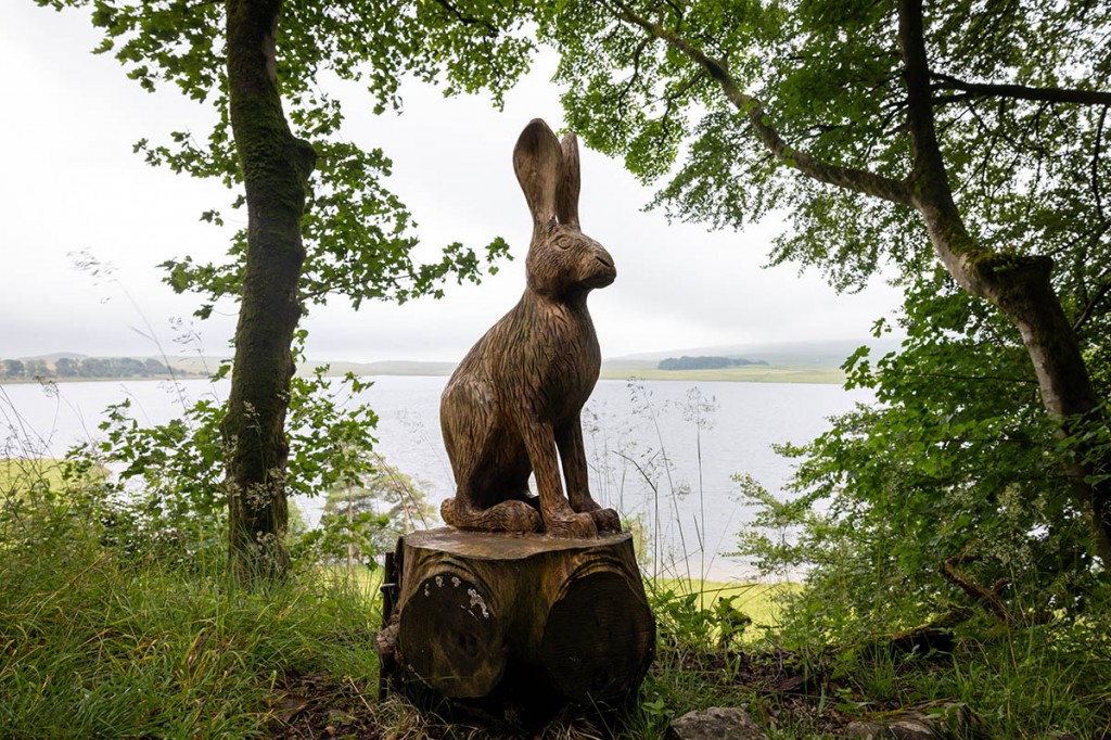
Suitably fuelled by a little caffeine, I hoiked my rucksack back on and headed up on the route round Kisdon. The path was like rabbit hell, with the cadavers of many of them littering the ground. A fellow walker said she had seen one rabbit displaying signs of myxomatosis. Once clear of the leporine graveyard, the path contoured round into the upper reaches of Swaledale, offering impressive views of Swinner Gill, the great ravine scarring the flanks of the high ground north of the River Swale. Sunshine bathed the area, but dark clouds gave a hint the summery weather might not prevail.
Finally the path dropped down towards Keld. Below, youngsters were playing on the banks of the river next to Kisdon Force. Arriving at the campsite run by the Rukin family, I paid my £9 for a tent pitch and bought another soft drink as an immediate thirst quencher. The campsite was busy and felt quite cosmopolitan, with many overseas visitors, including my Belgian friend and a guy from Gouda in the Netherlands. Keld is where the Pennine Way and the Coast to Coast Walk intersect, and a lot of those camping were tackling the latter route. A heavy shower sent most of us scuttling for shelter under the canopy of the shower block. A shower then a meal rounded off the day, with the patter of rain on the tent ending the day six as it began. A shorter day, and still on schedule for a 13-day completion, with the legs and knees still holding up well.
Day seven, Sunday: Keld to Middleton in Teesdale (37.7km +832m)
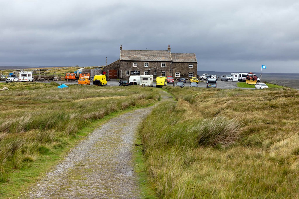
This would be the day when I would pass the point where there was more Pennine Way behind me than ahead of me. Grey skies hung over Keld as I set off up the side of East Gill Force, leaving the shared route of the Coast to Coast Walk for the ascent to Britain’s highest pub at Tan Hill. The path rises steadily, at one point passing a curious section of drystone wall that rises almost to the roof of the adjacent barn. Eventually, the cluster of campervans and other vehicles around the Tan Hill Inn came into view. If you’re after tranquillity, the pub is probably not your ideal destination, and there was lots of activity in and around the place. Rather alarmingly, the inn was the scene of a terrifying gun incident eight days before my visit in which four shots were fired by Richard Bowser after an argument in the pub. He was subsequently jailed for 19 years. No such incidents were evident as I chomped on a couple of chocolate bars, sheltering from the strong westerlies before heading off north.
I was now into unfamiliar territory: Sleightholme Moor. The next six kilometres across the morass that is this moor were some of the worst terrain of the journey so far, with sodden footpaths and deep bogs either side of the narrow route across the featureless plateau. The moor seemed to go on forever, with the distant A66 appearing never to get any closer. It was a relief to reach the dry land of a farm track beyond the peat bogs. At least the sun had appeared for me as I sat beside Frumming Beck to eat my sandwiches. My sometime companion Laurens, the Belgian Lejogger, appeared and we were in complete agreement on how horrible Sleightholme Moor was.
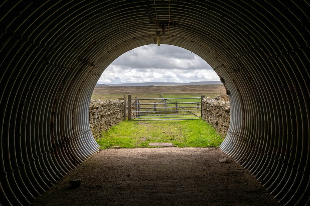
A curious old road sign with just the triangular head was passed on the track towards Sleightholme Farm before the route traverses Wytham Moor and drops down to God’s Bridge, the natural limestone crossing of the River Greta. There was a well preserved limekiln before the track rose to the culvert carrying the Pennine Way under the thundering traffic of the A66 road. There’s a very unofficial scrawled notice on one of the marker arrows that reads: “Congratulations on completing half the Pennine Way. Good luck with the rest.” To which someone has added: ‘suckers’.
The alternative Bowes Loop has by now left the main Pennine Way route, but it was always my intention to stick to the direct path as I saw no reason to divert to Bowes. Beyond Ravock, a shooting hut has its end section left open as a shelter for walkers, complete with a few plastic chairs. On the inner wall there are lots of ink messages from those who have taken temporary refuge. One message implores users to ‘Please keep clean and tidy so all walkers can use the hut and the estate don’t lock it.’ Laurens was using the venue for a cigarette break.
Leaving the hut behind, the route follows a somewhat switchback route over Cotherstone Moor, much of it wet underfoot, before dropping down into Baldersdale, skirting the western reaches of Blackton Reservoir. It then rises to pass Low Birk Hatt Farm, which was home to Hannah Hauxwell, who reluctantly rose to fame after Barry Cockroft produced a documentary, Too Long a Winter, about her spartan life on the isolated Yorkshire farm. The area north of the farm, which is now in County Durham, is designated a site of special scientific interest and are marked on the OS map as Hannah’s Meadow Nature Reserve. More ups and downs followed before the final rise out of Lunedale to the flanks of Harter Fell, from where the day’s final destination, Middleton-in-Teesdale was visible. The hours had advanced and I was glad to see the town nestling in the valley.
Daleview Holiday Park was to be my home for the evening. The reception and clubhouse are in a former station building and there were lots of families enjoying the facilities. A discounted camping rate for walkers of £5 bought me a pitch in a secluded section of the campsite and Laurens and I took advantage of the electricity sockets on the reception’s porch to put some charge back in our powerbanks. Then it was down the road for the short walk to the town itself to resupply at the Co-op. I also took advantage of the local kebab shop for my evening meal, then headed back to my tent. I liked the campsite at Middleton – it had a friendly feel and, had I wanted, I could have enjoyed a pint or two there. Laurens did sample the bar’s brews.
Day eight, Monday: Middleton-in-Teesdale–Dufton (33.8km +624m)
The first section of my second week’s walking would be low-level, following the southern banks of the River Tees, wide and rocky as it makes its early progress eastwards to the former industrial heartland of Teesside. To the south, at a short distance, Holwick, once the most northerly settlement in Yorkshire, is passed and then the distant roar of the river’s cascades comes within earshot. With all the previous rainfall, Low Force had plenty of water foaming over its rocky drops. Wynch Bridge, a historic suspension bridge constructed originally for miners to use, gave a good view of Low Force. The grade II*-listed structure carries a warning sign informing those walking across it that only one person at a time should use it and anyone damaging it by swinging or other means will be liable to prosecution.
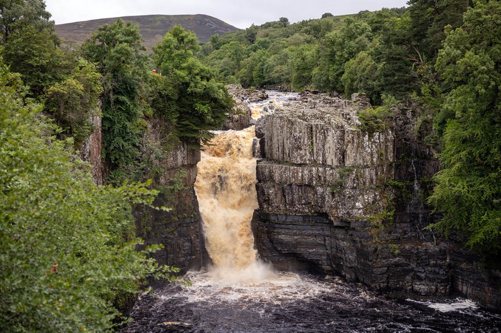
The skies had by now become threatening and the first raindrops began to fall as I passed two stone sculptures of sheep. A torrent of water, brown-tinged with peat, was thundering over the 21m-high rock fault of High Force, filling the dale with its booming cacophony. Signs in the area warned of the continuing outbreak of juniper dieback disease that’s affecting the bushes in the Upper Teesdale national nature reserve. Further signs warned of the possibility of blasting at the quarry on the far bank of the river, but I passed without witnessing any explosions. As I passed the farm at Cronkley, the woman driving into the yard gave me a cheery wave.
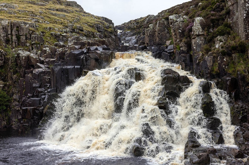
A bridge takes the route briefly onto the eastern bank of the river before it returns, a kilometre or so later, to the west and the beginning of a very remote-feeling part of the Pennine Way. Oddly the national trail heads south as it follows the river’s route, at Holmwath. The only other sign of life in this area came from two runners on the opposite bank, who passed with a wave. The next section of the route was one of my least favourite. Boulder fields running right down to the river made for slow, awkward progress at Falcon Clints. Just when I thought the terrain was easing, another boulder scree beckoned, and it was with a sense of relief that I arrived at the base of Cauldron Snout. It was now raining heavily, and the airy scramble up the rocky side of the waterfall was made more precipitous by the fact that the stone and gravel was decidedly slippery and I really didn’t want to slip into the torrent to my left.
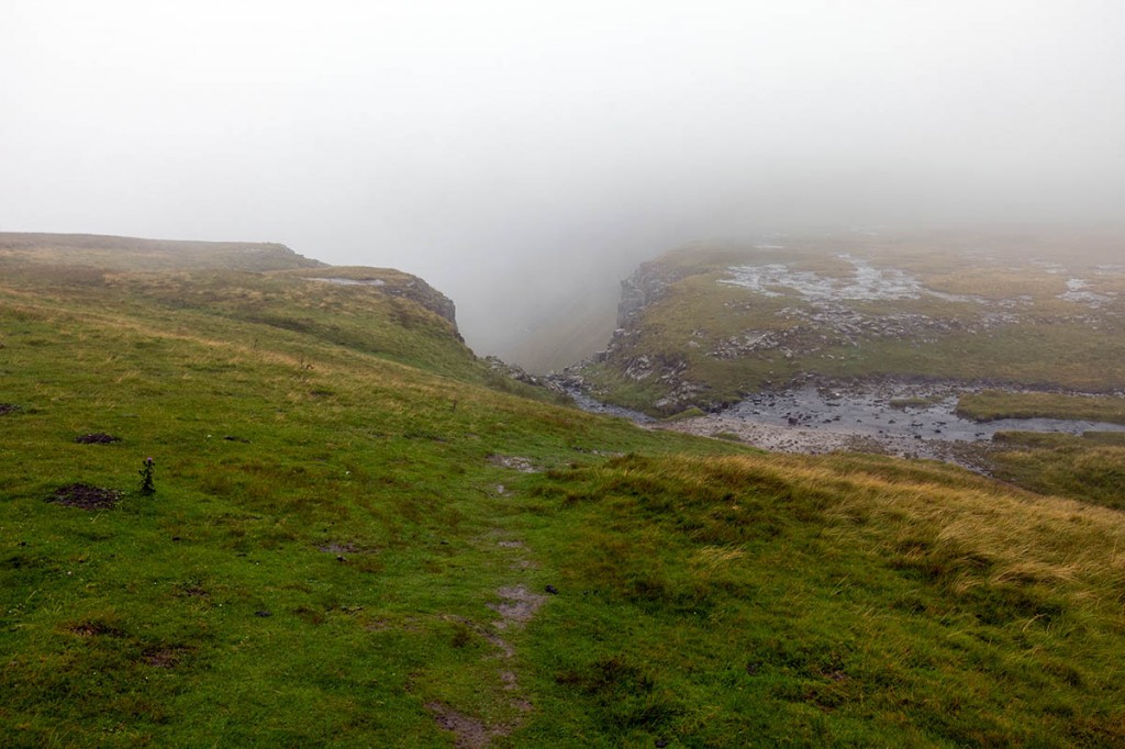
The concrete citadel of Cow Green Dam appeared mistily in the distance as I topped out the scramble , then turned left onto the reservoir access track. The rain lashed the high moorland as I plodded along the gravel, dropping down to meet Maize Beck and finally cross the water over a substantial bridge. My feet were now decidedly moist and my thoughts were almost entirely concentrated on the end of today’s walk. I considered booking a bunk at Dufton youth hostel to dry out, and the idea lifted my spirits a little. Right from the start of the walk I’d anticipated the view from the top of High Cup Nick into England’s own Grand Canyon. Splashing through the sodden ground, arriving at the top of the scar, I was treated to 30m-worth of misty vision. Ah well, I’d seen it a few years previously, so off I went down Narrow Gate, with an occasional backwards look to see if the visibility had improved. It hadn’t.
The descent into the Eden Valley felt long, but eventually I hit Dufton and made my way to the youth hostel, only to learn from the religious group inhabiting it that they had block-booked it. The pub didn’t serve food on Mondays, so it was off to Grandie campsite, where I paid my tenner, put up my tent and fired up the stove. With food inside me and a warm shower I began to feel a little more human, and clambered into my sleeping bag, with the rain pitter-pattering on the flysheet, for a change. I’d seen no sight of Laurens today; his tent was all zipped up when I left Middleton. I never would meet the Belgian again. For all I know, he could be living the life of a hermit still in the North Pennines.
Day nine, Tuesday: Dufton-Alston (33.8km +1,060m)
The forecast for Tuesday promised an improvement in the weather. I’d been fooled again. So my exit from Dufton began in familiar rain. Which was a bit disappointing, as there was going to be a fair old ascent today as I traversed the highest point in the Pennines. At least the wind wasn’t in my face as I headed north, with the shapely form of Dufton Pike a faint shadow on my right in the mist.
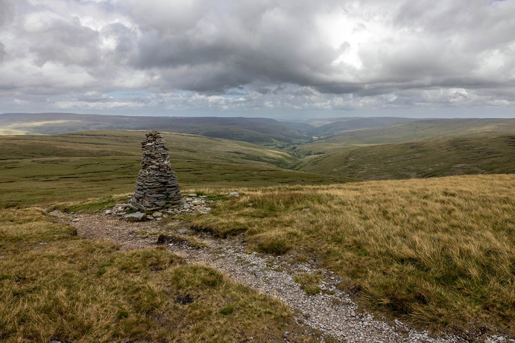
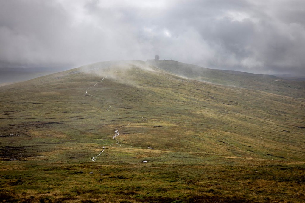
And so the long slog began, with a crossing of Swindale Beck and the trudge up Knock Hush to Knock Old Man, a currick, the name given to cairns in this area. Finding the right direction to follow the broad ridge off The Heights wasn’t easy and I needed about 200m of correction before my feet finally headed in the right direction, towards Great Dun Fell. The Pennine Way briefly joins the asphalt access road to the Nats radar station before finding turf again for the final few hundred metres to the summit. The radomes had an unearthly appearance in the mist. Then, as I headed into the broad col before Little Dun Fell, the cloud began to lift and the southern view back of the Pennines slowly appeared.
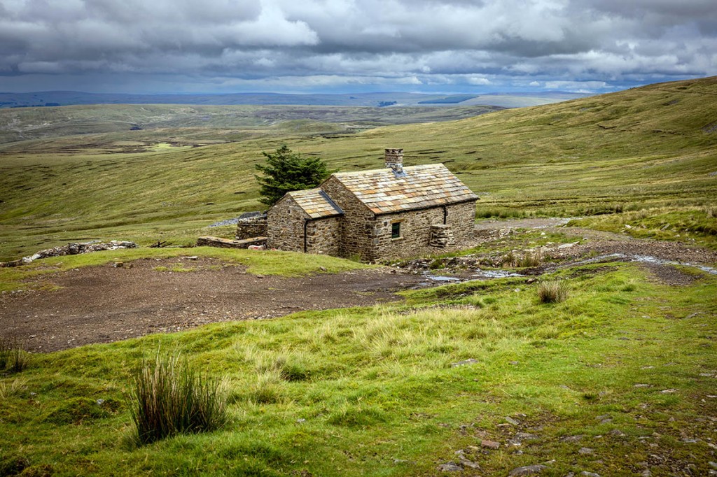
Cow Green Reservoir nestled in the distant flanks and the wide summit ridge of Cross Fell, with its white-painted trig pillar and recently restored shelter revealed themselves. A short-eared owl shot me a glance as he wheeled above the summit. I had a chat with a man from north Wales as the weather slowly improved and a weak sun brightened the fell. As I made the descent towards Greg’s Hut I had my first thigh-deep encounter with a Pennine bog, that necessitated a hands and knees exit to extricate myself from the glutinous mud. A few hundred metres further was the bothy of Greg’s Hut, my lunch stop for the day.
The building has been completely renovated to keep the weather out, but still keeps to the ethos of a rudimentary shelter, with wooden sleeping platforms, a burner stove and a few plastic chairs, along with a guitar missing one of its strings but with a collection of Arctic Monkey stickers. A collection of bottles held the dregs of whisky and rum for anyone bold enough to sample the contents. Stepping outside after finishing my sandwiches, I realised it was actually warmer outside the hut than inside, as the sun had made a bit more effort and was now lifting the temperature a little. However, I contemplated how welcoming the bothy must be on a cold night, with the stove blazing and perhaps even a nip of one of those spirits inside you, while the Helm Wind whistles outside.
The path east from the hut was initially quite rough and a passing cyclist noted the effect it was having on his backside. Further down, estate workers were filling in potholes on the track, no doubt in preparation for the start of the annual hoorays’ grouse massacre. So progress was rapid, halted only briefly by the approach of an eight-wheeled truck who seemed reluctant to slow down. I stood my ground and forced him to stop. We had a robust discussion on the hierarchy of road users.
Arriving in the little village of Garrigill, the route follows the asphalt road through the settlement before diverging onto a section the Pennine Way shares with A Pennine Journey, the South Tyne Trail and the River Tyne Trail. It then heads north with the River South Tyne with a series of minor waterfalls, to the left, before passing Alston youth hostel and descending to the A689. I turned right into the town, which jointly claims the title of England’s highest market town. My intention was to pitch my tent before the dark clouds that had been building over the past hour or so did their worst.
Arriving at the Tyne Willows Caravan Site, I knocked on the door of the caravan signposted ‘warden’. I politely asked the sprightly octogenarian woman who came to the door if I could pitch my tent for the night. “No, bugger off,” she quipped before warmly welcoming me to the site. She offered to recharge my powerbank in her caravan as long as I didn’t interrupt her viewing of Emmerdale. I handed over my £6 and put up my tent. The free showers were in the basement of what appeared to be a former industrial laundry, accessed through a puddle in an old water container. Odd, but nice and warm, which I appreciated after a cool day on the high north Pennines.
I got the impression Alston has seen better days. The fish and chip shop had closed, as had two of the pubs. Jack’s the takeaway was shut so I retired to the Co-op to resupply and get something to eat for the evening. So I sat under the market shelter munching a couple of pies, watching the hubbub of Alston’s night life. The forecast for Wednesday wasn’t at all promising, so I booked a bed at The Sill for the end of what I knew was going to be a long day and, as it turned out, a pretty wet one.
Day ten, Wednesday: Alston-Hadrian’s Wall (The Sill) (42.8km +1,094m)
It hadn’t been the most restful night. As well as the incessant patter of rain on the tent, the Dutch couple’s toddler in the tent next to me had the most terrible cough that kept me (and her) awake for much of the night. I honestly feared for the child’s health. I certainly didn’t envy the family who were bikepacking a coast to coast route, loading up their cycles in the heavy rain that was now battering Alston. I bade my farewell to the comedic warden and the curious shower rooms and headed out through the grey town, leaving it where I entered, near the youth hostel.
The first section of the tenth day ran parallel to the South Tynedale Railway. The route was a little difficult to follow in parts, and it would have been easier to follow the more defined South Tyne Trail, but I was determined to stick to the official Pennine Way. Beyond Slaggyford lay more boggy terrain, with the now familiar wet feet. The Maiden Way over Lambley Moor follows the route of an old Roman road, but it was as wet as the rest of the route. This section involved a lot of moorland ascent and descent. I met one of the now diminishing number of Pennine Wayers, this time a guy walking it north to south – having to cope with the fact that most guidebook instructions assume you’re starting in the South and heading to Scotland. Unless you were Alfred Wainwright, of course, and then you start your book from the back and head forwards to the front. Confused? I was.
Anyway, I didn’t have Wainwright accompanying me, though I did have Paddy Dillon’s Cicerone guidebook, and its companion map book, though for speed of navigation I found the OS Maps app on my phone invaluable. It was proving a day of lots of ascents, invariably in consisting mainly of wet boggy moorland. Beyond lay the historical attractions of Hadrian’s Wall, but first I had to take my life in my hands and cross the A69. It could have all ended there and then, but I managed to dodge the thundering lorries and transpennine travellers to scuttle to the northern side of this main route. A few miles east of this point, the River South Tyne and the River North Tyne combine to become simply the River Tyne. And a kilometre or so’s walking brought me to Hadrian’s Wall, which also completes its journey on Tyneside, at the appropriately named Wallsend.
The village of Greenhead was bypassed by the Pennine Way, and instead my boots trampled the hallowed, manicured fairways of Haltwhistle Golf Club. Less surreal a site was Thirlwall Castle, a ruined 14th century stronghold built using plundered Roman masonry – a common occurrence in these parts when less reverence was lent to ancient monuments and more importance given to constructing farmhouses and dwellings.
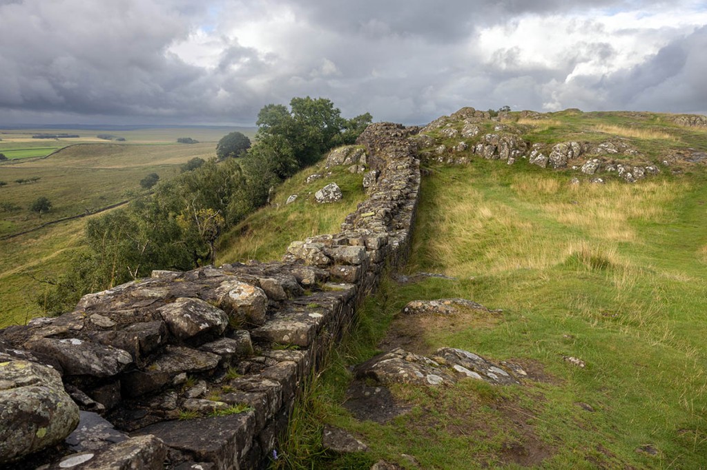
I had to make the youth hostel by 9pm, when the doors closed to new arrivals, and I had a niggly right knee and a switchback route for the next nine kilometres. For the final part of day ten, I’d be sharing my route with another national trail, the Hadrian’s Wall Path. The visitor centre and picnic areas at Walltown were now deserted and my walk along the Roman wall began in earnest. The rock of the Whin Sill forms a national barrier that the Roman structure follows, and this provides a great deal of ascent and descent which, at the end of a long day with now creaking knees, made me appreciative of my walking poles.
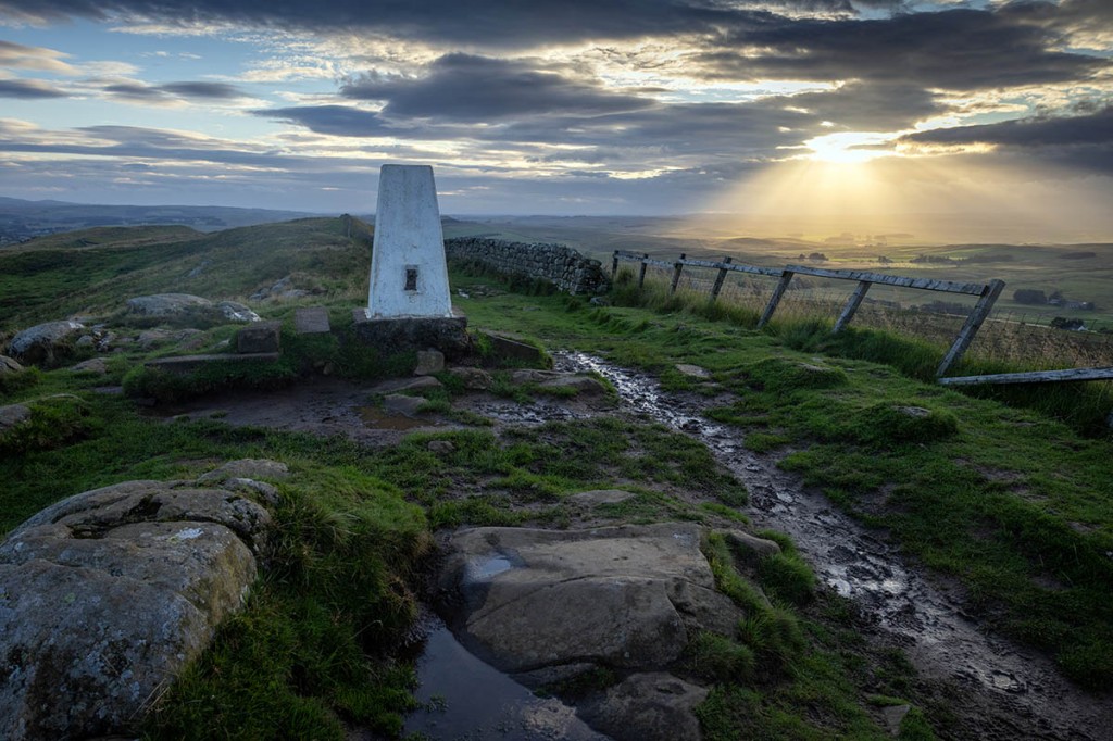
There were intermittent bursts of sunshine brightening the crepuscular light, including a nice fan of rays piercing the clouds as I passed the trig pillar at Winshields. Then it was a short detour off the Pennine Way to the modern hostel at Once Brewed. I arrived there with 20 minutes to spare. The friendly staff told me they’d been trying to ring me to confirm I was still intending to stay there. I explained my phone was on ‘aeroplane mode’ to conserve battery, but there was no problem and I was allocated a bed in a four-person dormitory. Room 007. There was a short time to bond with my room-mates before I headed to the drying room, which was absolutely rammed with walkers’ dripping clothing. A dehumidifier in the centre of the room had given up the ghost and was leaking its water all over the floor. A quick meal, shower and then to bed for a good, warm night’s sleep. Each bunk had two USB sockets and a mains socket so I was able to recharge my phone and power banks. The youth hostel, attached to the national park centre at The Sill, had a very cosmopolitan feel, with lots of different nationalities walking The Wall. I could have ordered a meal there or an alcoholic drink, but my main goal was to get some shut-eye.
Day eleven, Thursday: The Sill-Bellingham (27.5km +671m)
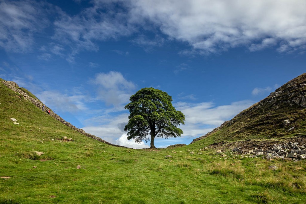
Thursday was to be an easier day and began with a little sunshine as I left The Sill at 8.30am and headed back to the point on the Pennine Way where I had diverted to the hostel. The route was quite busy with walkers tackling the Hadrian’s Wall Path. Crag Lough was passed and then on to Sycamore Gap to take the obligatory pictures of the lone tree. With hindsight, a kind of historic shot that won’t be possible again for many decades.
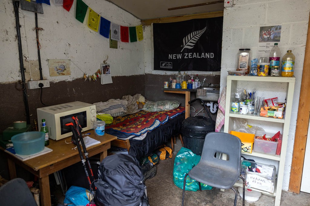
At Cuddy’s Crags, just short of Housesteads fort, the Pennine Way departs north across more bog. It then heads into Wark Forest and through unexceptional pasture before dropping down to cross Warks Burn. I’d made a note in my plans that there was a toilet at Horneystead (these things are important on a multi-day walk). Just beyond the burn, two handwritten signs inform walkers that there’s a ‘Pit Stop up hill open 24 hours’ and ‘Plus, use of picnic tables and chairs, toilet, fridge, shower (even a bed if your feet are saying “no further”).’
Arriving at the farm and venturing into the outbuilding, it was clear that Horneystead offered a whole lot more than just a toilet. It wasn’t the most luxurious of stops, but it had pretty much everything the hungry, thirsty, tired Pennine Wayer needed, including the aforementioned bed. Plus a microwave; various oddments in a ‘hiker’s box’; tins of rice pudding (and tin opener); lots of packets of crisps, chocolate bars; sweets; and a shower. There’s an honesty box but no compulsion to leave a donation. I had a can of cherryade, a bag of crisps and a chocolate bar and left my £3 contribution in the jar, a little closer to sated and much lifted in spirit at this generosity and kindness in the midst of the Northumberland bogs.
A couple of kilometres north lay Shittlington Hall. I had formed a mental image of Lord and Lady Shittlington and countless heirs to the Shittlington fortune gathered in the ornamental gardens. I was to be crestfallen; it’s just a bog-standard farm. Beyond that, a short climb up to the top of Shittlington Crags brought me to the television mast on Ealingham Rigg and the track forming the boundary of the Northumberland national park. A mile or so of road walking brought me into the pleasant town of Bellingham which, in contrast to Alston, seemed to have plenty of life. I managed to catch the bakery just before it closed, and resupplied at the Co-op next door.
The campsite at Demesne Farm was pretty average and a touch on the pricey side at £12. The owner recommended Fountain Cottage as somewhere to eat and she was on the spot with that. It was friendly, and good value for money, with a big plate of food, a coffee, two soft drinks and a dessert for less than £20. Last orders for food there was 7.45pm. I managed to recharge my gadgets and made my way back to the campsite deciding I definitely liked Bellingham.
Day twelve, Friday: Bellingham-Yearning Saddle Hut (39.2km +1,074m)
My penultimate planned day on the trail would be a long one, and I set out early, at 7.20am, in leaden skies on the road out of Bellingham. The guidebook included an optional detour to take in the waterfalls at Hareshaw Linn, but this would have necessitated returning to Bellingham, and I had the scent of the distant border in my nostrils now, so pressed on up the tracks to the moorland above the town.
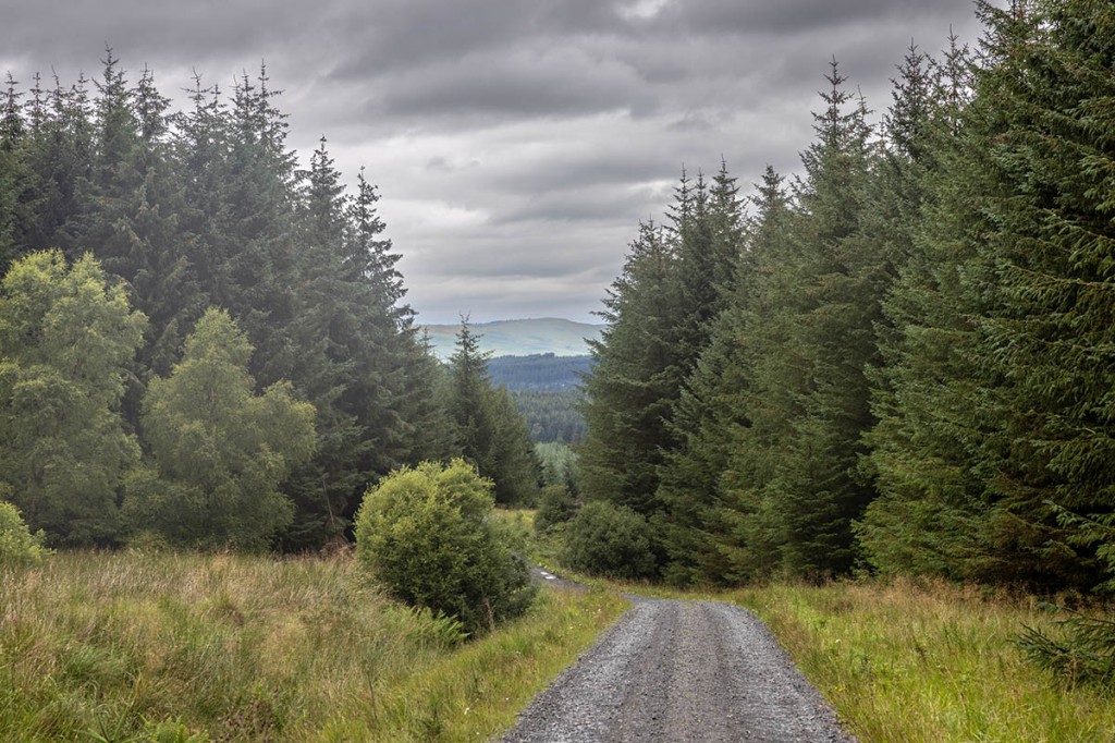
I knew I would have little opportunity to find water once on the Cheviots, so I’d made sure I had as much in my rucksack as possible, though that added more weight than I might have ideally wished. More upland bogs followed, with a couple of minor road crossings, before the Pennine Way approached the dense conifers beyond Blackburn of an easterly finger of the huge Kielder Forest. The path skirts the treeline initially before plunging into what proved to be the most horrendous section of the trail so far. Mud underfoot, with head-high bracken and saplings, wet from earlier rain, blocking the way as I gasped up the incline before finally reaching clear forest tracks, enabling the pace to be picked up.
A stop for lunch and to celebrate escaping the soaking fir trees was accompanied by a brief rain shower. The section through the forest was pleasant enough underfoot if a little monotonous for its views as thousands of near-identical conifers lined the route. There was a toilet at Blakehopeburnhaugh – a last convenience before the wilds of the Cheviot Hills. The path followed the River Rede for a while before heading up to cross the final east-west road, the A68, at Byrness.
The climb out of the settlement – little more than a small church, and the former youth hostel, now the Forest View Inn – is steep, slippery and very foresty and I needed to pause several times to admire the view – of lots of trees. A cairn at the summit of Byrness Hill marked the beginning of the route’s passage over the Cheviots and wide open upland. Catcleugh Reservoir was visible in the distance. Finally I felt in terrain where I could enjoy the trip.
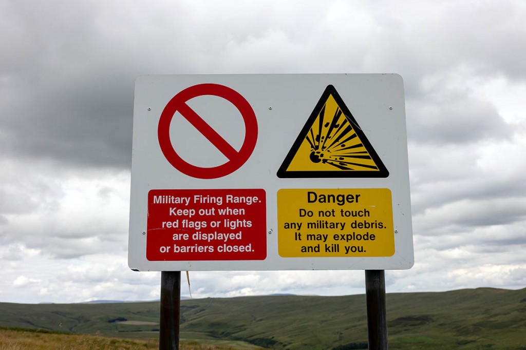
Though the extensive views were at last open, the artillery training ground of the Otterburn Ranges to the east wasn’t. There was no need to worry about the path ahead as a notice informed me the route to Chew Green is open at all times but ‘keep to this side (west) of the warning notices’. Just to add to the adventurous nature of this long section of the Pennine Way, a yellow sign told me: ‘Danger. Do not touch any military debris. It may explode and kill you.’ Keeping a wary eye out for any such debris, I strode out northwards to Ravens Howe.
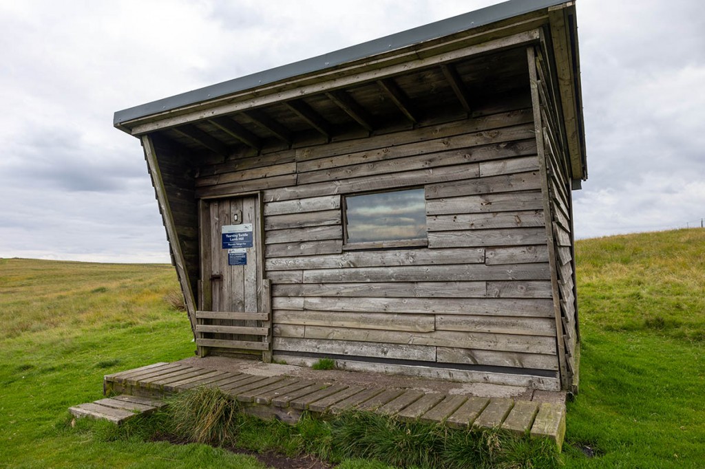
The Cheviots have a great feeling of remoteness. There are few signs of habitation and, for the most part, sheep were my only fellow travellers. No stray shells or explosions punctured the silence and tranquillity of the hills. My water was now depleting. Having studied the map, I figured I might be able to refill from the River Coquet near Chew Green but it was too far off the route, so I continued on up the old Roman road of Dere Street past the grassy mounds of the former fortlet. Soon afterwards, I found a little running water at Chew Sike and filtered 2½ litres into my hydration reservoir – my last chance before the hut that would be my home for the night. I was joined by a small group of feral goats before the welcome sight of the mountain refuge appeared in the distance. I arrived at the Yearning Saddle hut at 8.45pm, more than 13 hours after setting off from Bellingham. I had the place to myself. There was the customary collection of walker-friendly items on its shelf: a couple of toilet rolls, three gas canisters, a packet of tampons, a mug and some hand sanitiser. Plenty of names scrawled on the wooden walls, along with an odd A4 sheet with a picture of a large rodent and a message: ‘Rodney says have a great hike. See Ya latta’.
Evening meal cooked on the stove, then into the sleeping bag and off to the land of nod, ready for the final push.
Day thirteen, Saturday: Yearning Saddle-Kirk Yetholm (30.9km +939m)
My final planned day of the Pennine Way jaunt. I was up early and walking by 7.15am, heading into previously unwalked territory for me. I’d managed to make contact with my son Luke, who had kindly offered to pick me up at Kirk Yetholm as I would arrive too late for the last bus and there wasn’t any service on a Sunday.
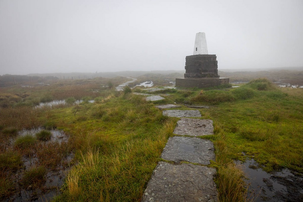
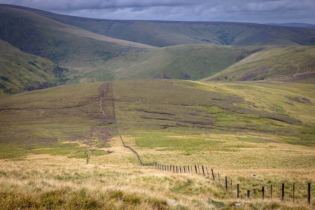
The weather was initially bright but misty, but soon began to deteriorate, with dark clouds beginning to shroud the summits of the hills ahead of me. I was following two borders: the northern edge of the Northumberland national park and, more significantly, the national border with Scotland. Lamb Hill and Beefstand Hill were summited and then the heavy rain began, accompanied by strong winds. This trail had no intention of gifting me a sunny ending. From time to time the mist cleared, and in the distance Windy Gyle loomed. The walking was fairly pleasant, with only occasional boggy sections and there was a real sense of isolation up there on the Cheviots. Just me and the border fence as a constant companion. Beyond King’s Seat lay the out-and-back deviation to take in The Cheviot. I’d already determined to stick to the Pennine Way route proper, and since I viewed summiting that particular hill an integral part of completing the challenge, I headed along the flags over Cairn Hill to the trig point on a stone pedestal that marked the highest point of the Cheviots. The view was remarkable – almost 30m in the claggy mist that enveloped the extinct volcano. I was glad I’d made the walk to the summit; there was very little ascent and it meant only a couple of kilometres each way to add to the overall total.
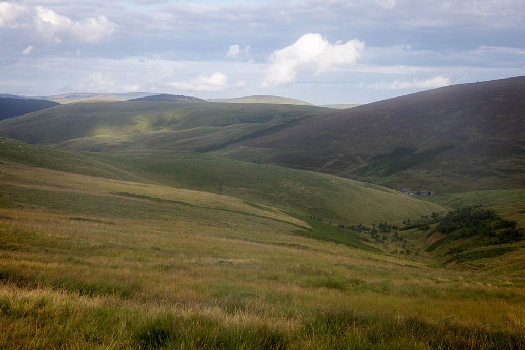
Auchope Cairn was soon passed, and I could now see in the distance the second of the two mountain refuge huts, which I’d earmarked for my lunch stop. The cloud had lifted clear of the summits now and I could sense the end was, if not nigh, then not too far away. There was a grand vista of the Cheviot range ahead, with the deep ravine of Hen Hole on the right. A welcome descent down the broad slopes brought me down from the 700m-plus height of the cairn to the wooden refuge, at a spot height of 498m. The next major obstacle, The Schil, stood proud on the northern skyline.
The Auchope mountain refuge hut has a similar wooden construction to the one I slept in the previous night, with wooden benches, a window, a few odds and ends and a visitor’s book. My name added and lunch consumed, it was out into the cool Cheviots air for the ascent of the 601m Schil. By now my energy was clearly a bit depleted and there were a few internal cursing monologues as I trudged up to the rocky summit. Between The Schil and Black Hag, a decision had to be made: take the now official ‘high-level’ route to the finish, or use the low-level alternative, formerly the main route. A three-way finger post informed me I’d travelled 8¼ miles since summiting Windy Gyle and that the low-level route would save me half a mile of walking. But since I’d determined to stick to the official Pennine Way route for the whole distance and it seemed pointless, within scent of Kirk Yetholm, not to continue this decision.
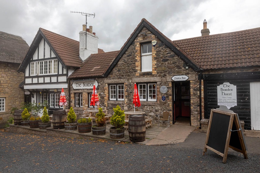
Which, in hindsight, was a bit masochistic. Yes, there’s an extra half mile to walk, but there’s also White Law to traverse. At least I was now on the Scottish side of the fence, as I gazed down on the last summit. I made slow progress up the Law, over a col, then finally the path began heading downhill to meet the road at Halter Burn. I was passed by a few backpackers heading in the opposite direction, even though it was past five o’clock. The last obstacle is a steep road climb before the minor dropped into Kirk Yetholm. I was greeted by Luke who took the obligatory picture of me outside the Border Hotel.
Stepping into the hotel was a trip back to a world of 40 years ago. We were told there would be a delay in serving food because they were so busy. To be fair, there were nearly half a dozen people in the bar, but what’s half an hour’s wait when you’ve spent 13 days getting there. Once it was clear to the bar tender that I’d just completed the Pennine Way, the visitor’s book was proffered for me to sign and a welcome half pint of beer thrust into my hand. So all that effort was worth it.
Looking back, I enjoyed discovering the previously unvisited parts of the Pennines and I really liked my two days in the Cheviots. Less welcome was the persistent wet feet from numerous bogs and some pretty rainy days. Walking a long-distance trail in Britain’s summer months is no guarantee of good weather. I don’t know how popular the full traverse of the Pennine Way is these days. Certainly I encountered very few walkers in the section north of Hadrian’s Wall, and there was plenty of solitude, once away from the honeypots of Kinder Scout, Malham and the Three Peaks area.
It was good to see plenty of people crossing my route to tackle the Coast to Coast Walk and Hadrian’s Wall Path, which both seemed a lot more popular than England’s first national trail. It celebrates its 60th birthday next year. I celebrated my 66th last year, so for me, it will now be my Route 66. And the knees held up well. I do occasionally wonder where my sometime Belgian companion Laurens got to. Perhaps he’s still wandering the Cheviots and has made a new life in the refuges. Or, more likely, he did complete his grand Land’s End to John O’Groats walk. Puts mine in the shade a bit, really, but a challenge is a personal thing, and I’m glad I completed mine.
My totals: 460.3km (286 miles); 11,328.6m (37,165ft) of ascent.


John Traynor
05 August 2024Epic! Thanks, Bob
David Gordon
03 October 2024Thank you for a. very enjoyable read. Don’t know if I’ll ever tackle the route but it seems like a great little adventure. David
Paul
01 January 2025Really enjoyed reading your article, I take my hat off to you for achieving the challenge. The remorseless bogs sound desperate.
Paul
19 February 2025Thoroughly enjoyable read and so much of it reminded me of my walk in July 1981. I always say I didn't walk the section from Edale to Hawes - I swam it! Just like your story - it poured with rain. Would I do it again - in a heartbeat. Most memorable view - High Cup Nick...Wow. Great experience.
suzannah hill
28 February 2025Thank you so much for making this account available. I live in the dales and was wondering how challenging the Pennine Way is. I now have an idea!
Mike Hooper
24 May 2025Many thanks. It took me back to 1985! Back then though there were more hostels and such and it was possible to avoid a tent and a heavy pack.
I'm 66 next year, you've given me an idea of how to spend the Summer... but properly backpacking this time, of course.
Paul
29 January 2026Great post. Took me back to 1981 when I completed it from South to North with the obligatory Wainwright in hand. I thought we had bad weather - Edale to Hawes was torrential - we swam it! but Hawes northwards was gorgeous. (note - i opted out of the Cheviot so technically I haven't done the whole route! Our last day - Byreness to Kirk Y at 30 miles was enough!)