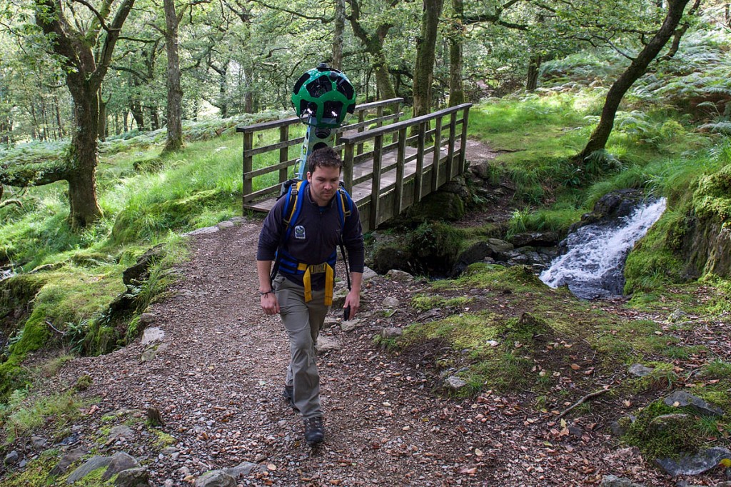
Armchair mountaineers can now make the journey to the top of Wales’s highest peak from the comfort and warmth of their homes.
Snowdon’s main paths are among those that can now be seen on Google’s Street View service.
The technology giant announced the addition of routes in Snowdonia fittingly on International Mountain Day.
The views are available thanks to the efforts of staff and volunteer wardens from Snowdonia National Park Authority who have made the ascents with the 22kg (49lb) Google Trekker strapped to their backs.
Snowdon’s Pyg Track, Miners Track, Watkin Path, Llanberis Path, Rhyd Ddu Path and the Snowdon Ranger Path can now be seen on Google Street View, along with the Pony Path, Minffordd Path, Mynydd Moel and the Llanfihangel y Pennant path on Cadair Idris.
Liz Jenkins, the authority’s geography information services officer, said: “We are very pleased to be collaborating with Google to ensure that the special qualities of Snowdonia can be viewed by everyone in the world.
“Once the images have been processed, we’ll use them on our website so that everyone can enjoy them, in the hope that eventually they will inspire them to visit Snowdonia and see this wonderful area for themselves.”
The inclusion of Snowdon’s paths completes Google Street View’s coverage of Britain’s national three peaks: Scafell Pike and Ben Nevis are already on view on the service.
The Street View images of Ben Nevis, Snowdon and Scafell Pike will be useful to walkers planning an ascent of the mountains to view the types of terrain they are likely to encounter.
Laurian Clemence of Google UK said: “We are delighted to bring Britain’s highest peaks to the world through Street View. These areas of outstanding natural beauty in Wales, England and Scotland can be viewed by anyone who is planning a specific visit, or for those who are simply interested in learning more about each peak, from the terrain and landscape, to the vegetation and views.”
International Mountain Day began in 2003 to raise awareness of the importance of mountains to life, to highlight the opportunities and obstacles in the development of mountains and to foster alliances which bring positive changes to people and mountain environments around the world.
Mountains cover about 22 per cent of the earth’s land surface, providing support and welfare to 615 million people around the world, and also provide clean water, energy and food resources which are likely to become scarce during the coming decades.
