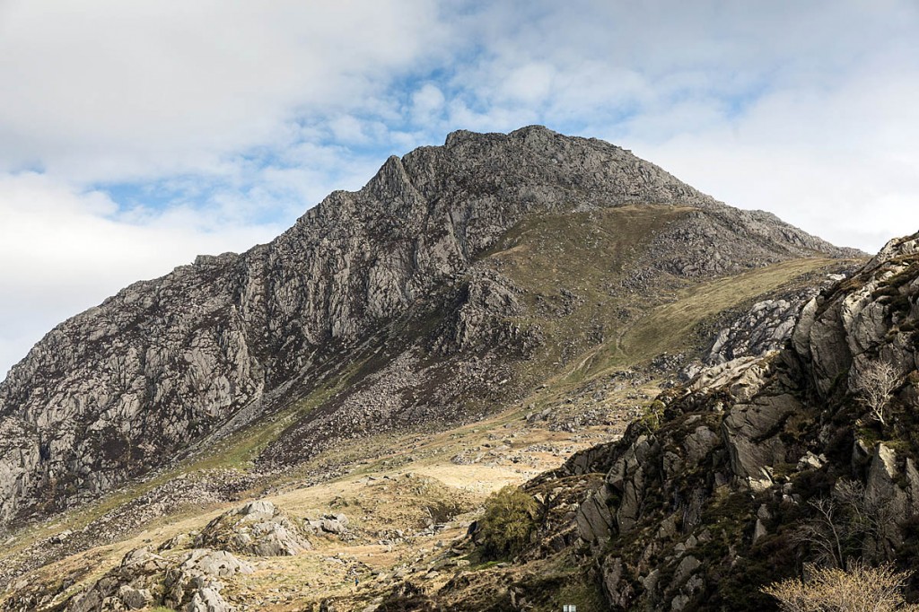
Tryfan’s shapely profile beckons the visitor from its commanding position right next to Thomas Telford’s Holyhead Road as it sweeps through the western reaches of Snowdonia.
Its ease of access from the A5 and its rocky slopes make it a target for many hillwalkers and, on a fine day, the views from its 917m (3,010ft) summit are extensive.
But, search for Tryfan on grough’s pages and the results tell a tale of misfortune and tragedy. The mountain is no easy stroll. It’s reckoned by some to be the first true mountain you’ll encounter south of Scotland because it’s impossible to summit without putting hand to rock.
Whichever route you choose to ascend Tryfan, you will need to scramble.
Ogwen Valley Mountain Rescue Organisation’s base lies close to the foot of Tryfan, which is fortunate because almost a third of callouts for its 50-or-so volunteers are on this hill.
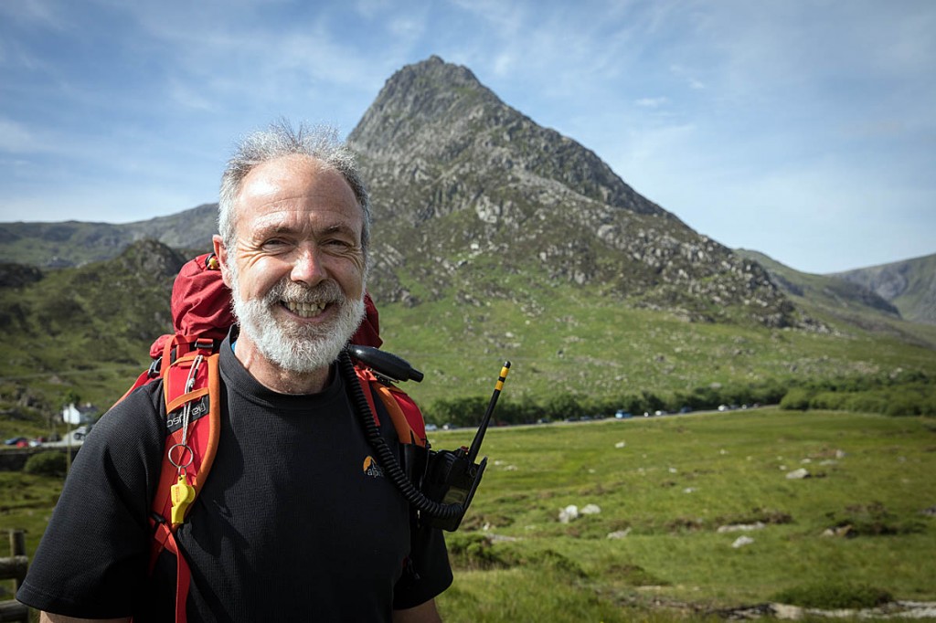
I joined Chris Lloyd of the team to find out where people come to grief and how you can avoid becoming a mountain rescue statistic if you decide to tackle this popular peak.
Chris has extensive experience both with the team and personally as a climber, and his local knowledge of the mountains around the Ogwen Valley make him an ideal guide for the ascent.
“It is a serious lump of rock and it does bite back,” he said. “But it’s very rewarding when you’ve been up there and done it.
“I never like to put people off coming here and enjoying themselves. It’s not about preventing people going on the mountains; we just want them to come back safe.”
As well as adventurous walkers making the ascent of the North Ridge, climbers can attempt serious routes on Tryfan’s towering cliffs, principally on the East Face. All can become ‘customers’ for the Ogwen Valley team.
Chris said Tryfan is responsible for about 30 per cent of OVMRO’s callouts each year, which currently total about 130.
“The types of callout vary – mainly people getting stuck due to navigation errors. It’s quite a complicated mountain in that you require good local knowledge or good mountaineering skills.
“As well as navigation and scrambling skills, this is mountaineering awareness to realise that this is going into a dangerous part – I need to turn around and go and find another way, whereas people get very tempted to continue on their way, especially in descent.
“Going down, they’re sure it will improve, and it gets worse, and then they take possibly a fatal step, which is very unfortunate.
“So it’s generally people with navigational errors, but of course, we’ve got some large crags on the East Face which are rock-climbing areas.
“Again, some of those lead to navigational errors by rock climbers; they come off the route and get stuck, so we go out and rescue them. But also between the rock-climbs there are gullies which people come down. Again, it’s the same navigational problems, not having the local knowledge or the skill to say ‘I’ve gone wrong’ and again, sometimes that has fatal consequences unfortunately.
“It’s very easy to park the car at the bottom and scramble up. We do get loads of people who are totally ill equipped for going up on to the mountain and most of them come down successfully but a few don’t because of the lack of knowledge and experience.
“We do get large numbers of overseas visitors going up there. Again, the attraction is: let’s go up there and then we have to spend some time rounding them up and bringing them down safely.”
Tryfan is oriented roughly north-to-south, with the long North Ridge leading directly to the summit, which lies about two-thirds along its length, which is about 1.3km in total.
At the north-western corner of the mountain, next to the A5, is Milestone Buttress, and its southern extremity is marked by the col at Bwlch Tryfan.
The Heather Terrace path follows a geological feature on the mountain’s East Face and is one of the easier ascent routes. It leads underneath the major climbing routes and will bring you to the bwlch, from where the South Ridge can be used to reach the main summit, though even this involves some scrambling.
But most people heading for the twin monoliths of Adam and Eve on the mountain’s top use the North Ridge. Chris said: “It’s a good, classic scramble. All routes lead to the summit but if you try to come back down it, you’ll find routes lead everywhere and it does have some hazards, especially on the descent, some stings in the tail.”
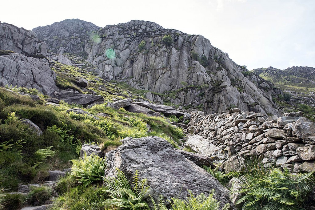
We headed up on the path at the foot of Milestone Buttress (SH 663 602). The path rose immediately, with a low wall to the right, and soon turns left, under the base of the buttress.
Soon, Chris was pointing out the first problem point. On the right as the path climbs is the bottom of what the rescue team calls Waterfall Gully.
The black pecked path shown on Ordnance Survey maps, which runs down the North Ridge, shows the route continuing down into this gully, which has steep rock drops at its end and there have been fatalities here.
It’s usually wet and slimy, hence the name.
When descending, a safer route near the bottom of the path marked on the map is to turn right and traverse to meet the main path to the East.
The ascent route passes Piccadilly Circus, so named because it’s the meeting point of ascent routes, including the North Ridge and Heather Terrace paths and can get quite busy.
From here, if you’re ascending the North Ridge, it’s time to put your scrambling brain into gear. The path makes its way through a mixture of heather and boulders.
The ridge is broad, and there are numerous little possible variations to make progress uphill. To the East, the ground fairly obviously drops away steeply. To the West, the drop-away in gentler but below this the ground is steep.
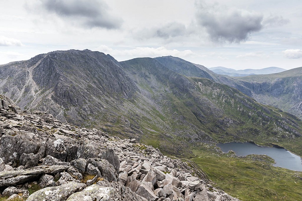
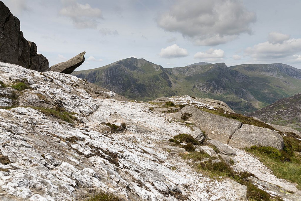
A large sloping area of quartz is soon encountered with the easily recognised Cannon Rock jutting out on the western side. A good excuse to pause for a photo and admire the view, in the right conditions, over to Y Garn and down the Ogwen Valley to Bangor and Anglesey.
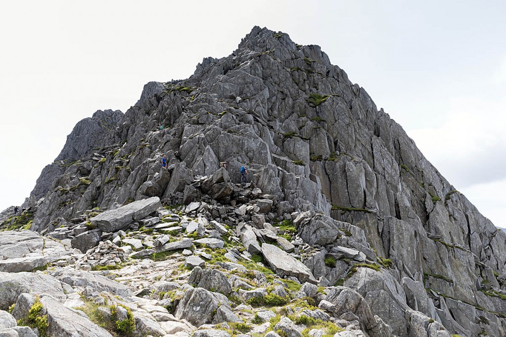
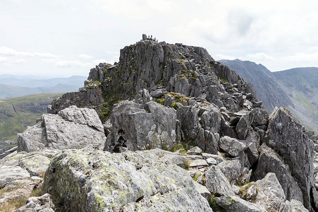
Up ahead can be seen, at least in good visibility, the North Tower or North Buttress, with the North Summit beyond it.
In descent, the safest line at this point is to keep to the central area of the ridge. Veering to the left will lead you to the gullies above Milestone Buttress and a probable call for rescue.
The North Tower can seem a little daunting to anyone who’s not an accomplished scrambler and it’s the point some people turn back and head down the ridge. This in turn has led them to venture into the dangerous ground on the West Face and becoming cragfast or worse.
We took a line just left of the centre line of the tower and there are one or two slightly demanding moves and, OK, I confess, I used my knee at one point.
Our ascent was made on a fine, warm, dry day, but some of the rock on the popular routes is polished and can become slippery when wet.
Directly below the North Tower, to the East, is Bastow Gully, a problem area for rescues and definite scrambling terrain.
An easier alternative for those who don’t fancy tackling the North Tower is to take the Eastern Traverse to the left of the tower, but take care not to venture down Bastow Gully.
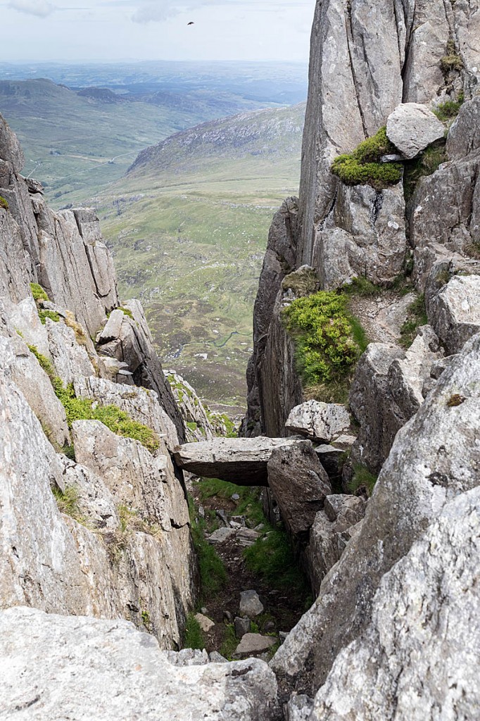
After the North Tower, you’re faced with a descent into The Notch, a pronounced cleft across the route, before reaching the North Summit.
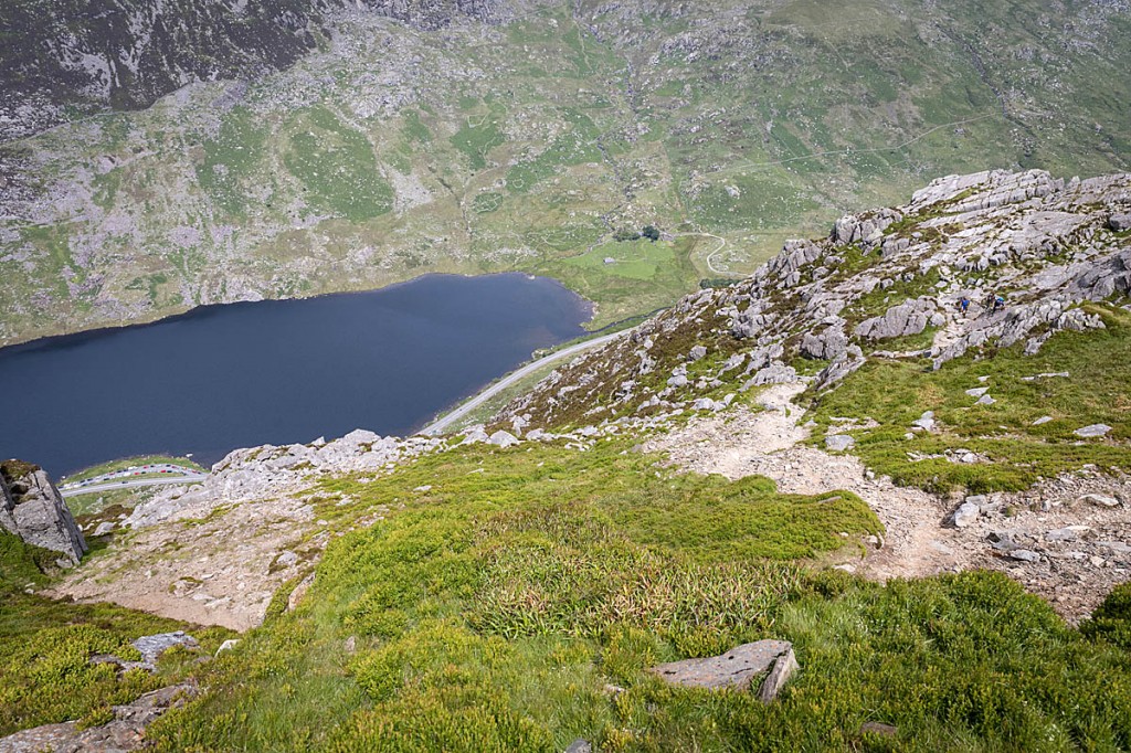
Looking down the North Ridge with the path leading to the right. It's easy to veer left and on to dangerous ground. Photo: Bob Smith/grough
At this point, Nor Nor Gully leads down eastwards to the left, and Y Gully on the opposite side to the West. Neither of these are walkers’ scrambling routes, so don’t be tempted to try to use these to circumvent the climb to the North Summit.
Negotiating The Notch involves a short traverse using high handholds to shuffle to the East, before lowering down into The Notch itself.
The North Summit can be bypassed safely on its western side, but Chris led us up with another scramble to reach this subsidiary buttress. Because it’s there.
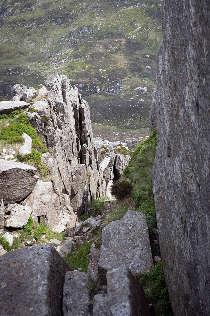
Dropping down slightly before the final ascent, we viewed the North Gully, leading down to the East, with a large chockstone a short distance below its start. This would be our descent after summiting, but it’s important to remember not to follow the North Gully right to its lowest point, because this leads to rock-climbing territory and a 30ft drop.
On the right, the Western Gully leads down to the only decent footpath on that side of the mountain. It heads up from the Bochlwyd area up to the small col immediately north of the final scramble on to the main summit. During our visit, a group of runners were testing their shoes’ friction on the slabby section at the top before descending to continue their attempt on the Welsh 3,000s.
There has been a reported rockfall near the bottom of the Western Gully, with a large four-ton boulder having come lose, so care will be needed in this area. In fact, during the whole ascent and descent there was evidence of recent rockfalls, with some sizable rocks having broken away at several points.
A final scramble leads up to the main summit of Tryfan, with its twin vertical rocks Adam and Eve. The brave can attempt the leap from one to the other but, as Chris said, it’s not the jump that’s difficult, but stopping once you’ve made the leap.
Despite the fact that the ascent of Tryfan is no stroll, there were plenty of walkers on its summit – testament to the popularity of this Welsh 3,000-footer.
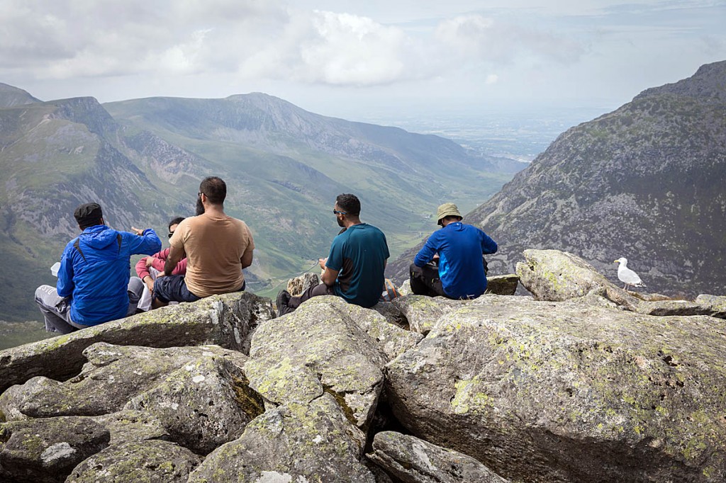
After lunch on a summit bathed in June sunshine, with views beyond Anglesey, down to Cadair Idris and to the Berwyn in the East, it was time for the descent.
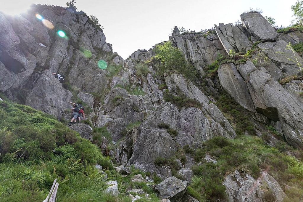
There are a few awkward moves to reach North Gully and under the chockstone. Chris said this route is appropriate for people who are happy scrambling, but local knowledge is useful to take the required route to the right near the bottom section, into Little Gully (not to be confused with one of the same name on the West Face).
The gully is a mixture of loose path and rocky steps down, which are mainly tackled facing in, with Chris guiding me to hand- and footholds.
Above us, a group of climbers were on a route on the North Buttress.
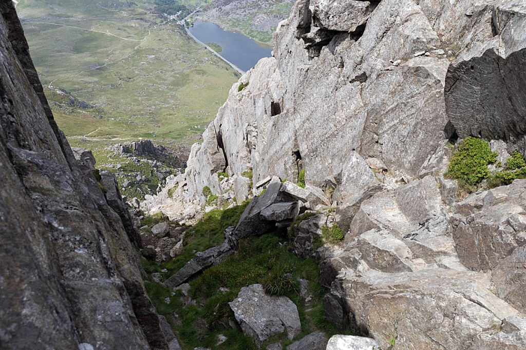
The diversion on to Little Gully on the right is important to avoid an awkward step at the bottom of North Gully, which has been the scene of fatal falls. Little Gully is again a mixture of scree path and rock steps. Eventually the path of Heather Terrace came into view. Behind us, the clanking of two climbers’ gear racks could be heard as they used the gullies as a descent route.
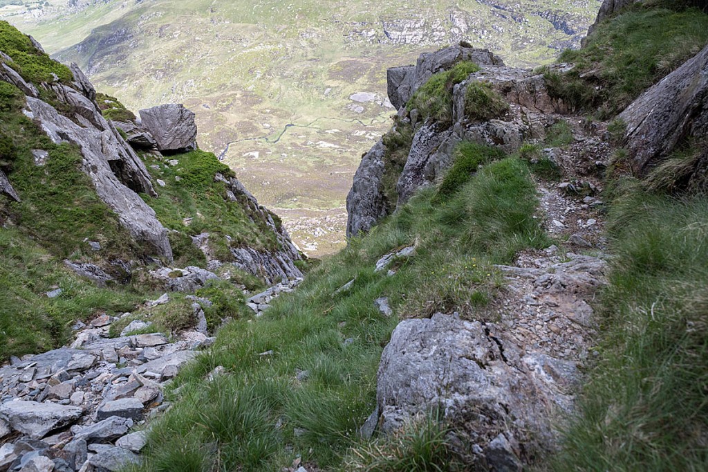
The point at which the path to Little Gully, on the right, leaves North Gully. Photo: Bob Smith/grough
The descent of Heather Terrace gave Chris an opportunity to point out where the various rescues, many of them resulting in fatalities, have taken place. The lowest section of North Gully has a large chockstone which necessitates a difficult diversion round it, often with a bad outcome.
Nor Nor Gully which, despite its name is not the most northerly of the gullies on the East Face, is ‘do-able’ to a competent scrambler, Chris said, but does necessitate a little rock-climbing section.
Just below Heather Terrace at the bottom of Nor Nor Gully is the Tryfan Cross, a bas-relief carving in a boulder with the initials POW and the date 1901 chiselled out of the rock. Three team members who were on the hill with a prospective recruit discovered the carving and research revealed it was a memorial to Percy Octavius Weightman, a well-to-do director of the Bootle Jute Works who fell to his death at that location while climbing with friends.
Further down, Bastow Gully is the actual most northerly gully and is reckoned by Chris to be a safe scrambling route.
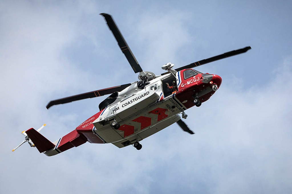
We got a wave from the Coastguard helicopter winchman. Photo: Bob Smith/grough
As we discussed a few horror stories of hillgoers who have come to grief on the East Face, we heard the sound of the approaching Caernarfon Coastguard S-92 helicopter. Chris checked with the crew via his radio that the team’s attention was not required and was assured there is no incident on the mountain – the crew was returning to base from another mission. A wave from the winchman and the aircraft headed off westwards.
Chris said the team doesn’t always call for help from the Coastguard crew for uninjured casualties, who are usually walked off the mountain accompanied by the team members. The large Sikorksy helicopter’s rotors produce a strong downwash, so injured people are usually carried away from the popular paths before being winched into the aircraft .
“It’s certainly not the case that a casualty will be airlifted off the mountain,” he said. “We are very fortunate having the Caernarfon Coastguard close by and we also had a very good relationship with RAF 22 Squadron here and we continue that relationship with the Bristow crews and the Coastguard helicopter at Caernarfon.
“We’ve made a point with this team with our annual reports that we don’t put a helicopter on the front page, because mountain rescue is not about helicopters. It’s about a lot of hard slog going up on the mountains to get people off the mountains.
“In the event of serious injury, or certainly if there are children involved, we will request the assistance of the helicopter, but generally we don’t need them.”
There was a recent case of a couple on a Snowdonia hill who insisted the woman needed helicopter evacuation because she could no longer walk because of an ankle injury. When the aircraft landed at the team’s base, she seemed to have made an unexpected recovery and walked from the helicopter to the OVMRO headquarters.
He said: “They are not to be abused. And that’s our worry. People have free access to the mountains and we have a free rescue service. If we abuse those privileges, someone’s going to put a big stop on it which none of us want.
“People say, surely people should be insured, but a lot of people here aren’t even fit to walk across Tesco’s car park; they’re not going to be insured. But some time, they’ll put a fence round the mountains and say, right – have you got your Mountain Leader card? Have you got this ticket to go up the mountain?”
The team will often send up an advanced group to render immediate help to a casualty. “To a degree, a hasty party is first come, first to serve. We’re here in the mountains; we’re not a town-based team, so it takes time for team members to get here before they’re deployed on the mountain and we’re all trained in casualty care to varying degrees.
“The hasty party will usually be a team of three with casualty-care kit, and going up to locate the casualty and stabilise the casualty until more team members arrive but at least they can get information back to the base to see whether it will require a helicopter to assist evacuation. It might be a rope-rescue job to get the casualty out of the area.
“But initially, they’ll go up there; one person will be responsible for the first-aid and casualty care and there will be another person possibly taking rope to access in or access out but it usually goes as a team of three.”
At the bottom of Heather Terrace we diverted briefly round to Piccadilly Circus to view the area before heading back to No-Name Gully, an easy descent with a stepped rock path leading to the Tryfan Bach – Little Tryfan – with its slabby climbing area, and then back through the campsite at Gwern Gof Uchaf.
Back at the Ogwen Valley team base over a cup of coffee, we discussed Tryfan’s routes.
Chris said: “It’s the descent generally where people come to grief. Most of the paths lead to the top so most of the paths go up there. We showed you the marked path which has got this dangerous start to it or dangerous finish if people are coming down it – the Waterfall Gully as we know it and how it’s best to go further along and scramble up from there.
“It’s impossible to climb the mountain without using your hands. You’ve got to be able to scramble, have a bit of a head for heights because there are some steep, rocky bits. You have to be able to place your feet competently, to find good handholds, and to be able to move comfortably over rough terrain.
“Good footwear is important, and also to know that, when you come to something you think is beyond you, to stop; turn around, and go back.
“And that also means, if you’re coming down and you come to something that’s very steep ground you need to think: this is not the way down. Go back up and find the right way down or find the last path you were on.
“The least technical routes are No-Name Gully then Heather Terrace, Bwlch Tryfan and the South Ridge, or the Western Gully which is a quicker ascent. It is more loose rock going up the Western Gully, but it’s reasonably safe apart from this one recent rockfall.
“But there’s still the final climb to the summit but that’s very similar to some of the stuff on the South Ridge too.”
So to anyone thinking of ascending Tryfan, remember that Edward Whymper’s advice in Scrambles Amongst the Alps is every bit as pertinent to this little Snowdonia rock as any Alpine peak: “Climb if you will, but remember that courage and strength are nought without prudence, and that a momentary negligence may destroy the happiness of a lifetime.
“Do nothing in haste; look well to each step; and from the beginning think what may be the end.”
Paul
28 June 2018A quality article of which has been sadly missing from the outdoor magazines. Is anyone keeping count of people who have read Trail magazine then gone and fallen off a scramble to their death?
Heather Wheatley
29 June 2018I did Tryfan on 17th May this year, I am a keen walker, and was told there was a bit of scrambling, well it was all scrambling, and I feared for my life in places, you have to pull yourself up, I did hit my head at one stage, as I pulled myself up into a pointed stone! And fell back, luckily not off the edge. But I was lucky, my head hurt for a few weeks after! There were a couple of men jumping across Adam and Eve which looked really scary and I hoped they didn’t fall off! On the way down was quite bad too as I was scared of slipping, you have to watch where you trod! It’s not a place to go if there has been rainfall or a cold frost! Glad I managed to conquer it but wish I had read up on it first, as I am a rambler not a scrambler!
Matt
29 June 2018You're all doomed! a fine mountain, but a challenge to walk up with your hands in your pockets - but it can be done.
SW
03 July 2018Tryfan is not for expert walkers, it's for novice climbers. You can't walk up it. It and Jack's Rake should be struck from lists of 'adventurous walks'. Avoiding the difficult step on both those mountains leads walkers to accident blackspots, along paths inches from death. One tragedy is too many, but there have already been many.
Bernard Mitchinson
14 July 2018I was eighty when I did this walk. Take it easy, enjoy the views and wild goats on the Heather Terrace. Modest scrambling and latch on to a school group for a safe descent. A great walk. Cheers, Bernard
Russell
13 July 2020Climbed heather Terrace last week July 2020. Wasnt easy for a fat lad! Really enjoyed it! Cane down off tryfan to llyn bochlwyd for a bivy in the dark. Was exhilarating.
Laura
08 August 2020Did extensive research of this mountain prior to going up a freind and I scrambled the north ridge and around 20ft from the summit the weather changed gusts of wind and cloud, a few people on the mountain had turned back but these had knowledge of the mountain and routes to descend. We ourselves also decided to bail we began descending via the North ridge but we knew we had no chance getting down the nor nor gully we ascended and found paths just led everywhere Another women attached her company to us she said she had climbing experience and she led us down the west side of nor nor gully till we could get no further then moved along the side to y gully the gullys appeared promising we continued to descend y gully but came to 3 large rocks and a shear drop at this point I realised we was screwed and felt i was going to die if we went any further. We called mountain rescue whom came and airlifted us off. Ive climbed 100s of mountains but this is the 1st time I was absolutely terrified. Chris was part of the team that rescued us and I can't be anymore thankful for my life... 1 of the mountain rescue team told us we'd made a good call because their normally collecting bodys from the bottom. As we was winched away I could then see there was nothing but a pure drop below us...
The gullys are so lurying as the scree makes them look like a path but the further in you get so does the steepness...
I felt so bad for dragging mountain rescue out but this was a call I'm glad I made. As I know I wouldn't be here today..
Thank you so much to Chris and the team you was magnificent and to the young lad that winched us down he was so amazing... You are all amazing hero's
This isn't no easy climb this is serious with a lot of dangers yes all mountains are dangerous but this is the hardest I've ever met the ascent is what you make it but the descent is a whole different ball game...
Beverly Taff
16 September 2020A quite fascinating article.
I scaled this mountain once only when I was taking a sabbatical month walking and climbing alone in Snowdonia during 1967. I tackled I think most of the main peaks in Snowdonia during my sojurn which was a theraputic mental excercise more than anything else.
I was coming to terms with my gender dysphoria and that month alone was one of the most difficult and yet reparative instances of my life.
To say I went up a man and came down a woman would not be entirely true; more correctly, I went up confused and came down resolved. I had determined that I was definitely transgendered (not a woman, but a transgender!)
Up amongst the peaks I took some incredible and seriously stupid risks but I was mildly suicidal as I struggled with my transgederism. Killing myself did not seem that bad an option.
I knew absolutely nothing about rock-climbing, mountaineering or any sort of mountaincraft and truthfully I was criminally negilgent of my own safety.
Mountains are truly theraputic. Tryfan was my happiest day.
I did not jump between Adam and Eve because truly, I knew nothing about the tradition. It was raining and windy and it never crossed my mind.
I hardly spoke to anybody during that whole month. I did not even know the names of the routes I took because I had no guidebooks or maps during the whole month.
Looking back these 53 years, I was lucky.
Steve Howarth
16 April 2021Great article, hopefully it will give some people pause before heading up Tryfan, especially the North Ridge.
I've climbed/scrambled up this "small gothic cathedral of a mountain" (Jim Perrin) maybe 40 times since the early 70's. Mainly via the North Ridge, and usually continuing to the Glyders via the Bristly Ridge. I was always aware that it killed people, however.
Having completed the route today (16/4/21) but descended Y Gribin rather than continuing to Glyder Fawr, I do have some reflections, relating to age and fitness, basically:
In the 80's/90's I could jaunt up this hill and complete the full Ogwen circuit in 5 hrs or less. Today (age 65) the same route is an all day deal...ie, 8 hrs+. It's to do with having failing shock absorbers, as in knees/lower back/ankles. Cardio endurance, for me, is no issue at all, but age related wear and tear certainly is. I met a guy with his son, and he expressed similar thoughts relating to the diminishing ability we have with repeated impact to joints, etc as we get older in these challenging hill environments.
I felt my safety was compromised due to my inability to move swiftly and competently across fairly simple rock, either going up or down. This leads to impaired judgement and possible bad decision making, particularly if stress is also a factor.
I suppose my point is to observe to those who have been blessed with fitness, agility and endurance and found Tryfan to be a minor gymnastic exercise in their heyday may have a completely different proposition ahead of them as age exerts its malign influence!
Another strange outcome...having said "never again" to this challenging route, a few hours later after a hot shower and (several) drinks I'm thinking it wasn't so bad after all, and looking forwards to the next time.
Go Figure!
Derek Ryan
19 June 2021Beverly's and Steve's comments speak of the spiritual nature of wild places and why we must protect them.
I climbed the face from Heather Terrace with a teaching colleague in May 2000 at the age of 53. I was foolish enough to jump Adam and Eve in a loose parka without incident but coming down the North ridge a small brief case sized slab of rock slipped from under my feet and landed me on my bum only six to eight feet below.
The result was a compression fracture of T12 and airlift by Sea King to Conway hospital. No long term consequences other than minor back problems but the experience has made me much more conscious of the hidden traps in anything we do.
Steve is spot on with the limits ageing places on us. I no longer ski because of knee trouble and overnight bush walks with a heavy pack are beyond me, but cycling is a wonderful sport for ageing bodies and here in Australia we are blessed with some of the best mountain biking through pristine forests and hundreds of kilometers of sedate rail trails.
Sadly, Covid has prevented us from discovering other wild places on the planet so we must treasure our own back yard.