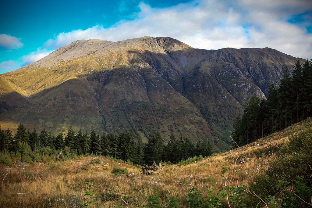
Mountain experts are warning walkers could be led into dangerous steep terrain if they attempt to ascend Ben Nevis using a route on Google Maps.
Mountaineering Scotland said the John Muir Trust, which looks after the upper reaches of Ben Nevis, has become concerned at an increasing number of visitors using the app to direct them to a route up the UK’s highest mountain.
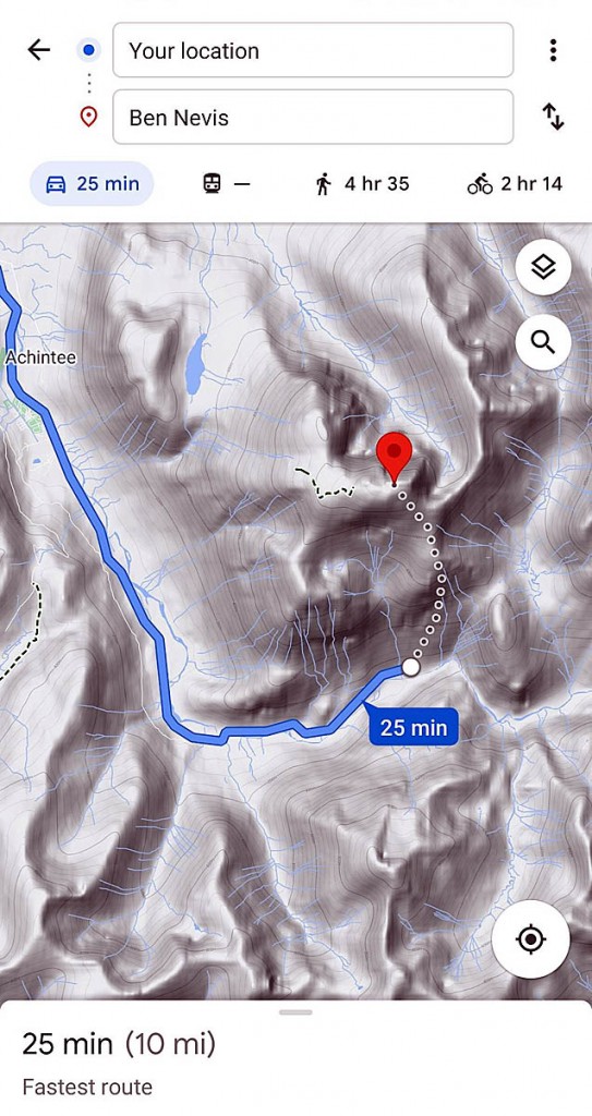
Depending on how someone searches for the route, Google Maps may direct them to the car park nearest the summit as the crow flies, indicating a route described by experts as ‘highly dangerous, even for experienced climbers’.
A dotted line traces a route from the Upper Falls car park in Glen Nevis to the mountain’s 1,344m (4,410ft) summit via steep, rocky ground and gullies with crags and large exposed drops in the Sloc nan Uan area.
The John Muir Trust’s Nevis conservation officer Nathan Berrie said: “The problem is that Google Maps directs some visitors to the Upper Falls car park, presumably because it is the closest car park to the summit.
“But this is not the correct route and we often come across groups of inexperienced walkers heading towards Steall Falls or up the south slopes of Ben Nevis believing it is the route to the summit.”
Heather Morning, Mountaineering Scotland’s mountain safety adviser, said: “For those new to hillwalking, it would seem perfectly logical to check out Google Maps for information on how to get to your chosen mountain.
“But when you input Ben Nevis and click on the car icon, up pops a map of your route, taking you to the car park at the head of Glen Nevis, followed by a dotted line appearing to show a route to the summit.
“Even the most experienced mountaineer would have difficulty following this route. The line goes through very steep, rocky, and pathless terrain where even in good visibility it would be challenging to find a safe line.
“Add in low cloud and rain and the suggested Google line is potentially fatal.”
The problem is not confine to Ben Nevis. Mountaineering Scotland said many other popular munros show a line that would lure the unwary into life-threatening terrain.
For An Teallach, a challenging mountain in the north-west Highlands, a ‘walking’ route was input into the search engine and the line offered would take people over a cliff.
Ms Morning said: “It’s all too easy these days to assume that information on the internet is all good stuff, correct, up to date and safe.
“Sadly, experience shows this is not the case and there have been a number of incidents recently where following routes downloaded off the internet have resulted in injury or worse.
“Modern navigation technology brings some amazing advantages for hillwalkers, but this example is clearly not one of them.
“Walkers and climbers with even a little experience will know to read information from a map, whether digital or paper, and if they are looking for downloadable routes know to use reputable sources and check several sources to ensure the information they are accessing is the right route for their level of experience and ability.
“But especially on Ben Nevis, many people are not aware of where to get reliable information and may quite naturally assume that Google Maps, which got them from their home to the foot of the mountain, can carry on and do the job right to the top. This is not the case.”
Mountaineering Scotland and John Muir Trust are appealing to Google to consult with them so the life-threating information is removed from their system. The trust added that appeals so far have been met with silence.
In the meantime, they would like to advise anyone thinking of walking Ben Nevis, or any other mountain or hill, to cross check information on a map, or consult a local guide.
- Grough’s own mapping and route-planning system, grough route, shows a good number of Ben Nevis ascent routes created by users, most from the visitor centre car park in Glen Nevis, or via the path from the glen a kilometre to the South. These lead by the ‘tourist track’ to Lochan Meall an t-Suidhe, then via the zig-zags to the summit plateau, which has dangerous cliffs to the North and hazardous gullies to the South.
There are also routes via the exposed grade-one scramble to the summit via the Càrn Mòr Dearg Arête, which is only suitable for experienced hillwalkers with a head for heights. None of the routes use the terrain shown on the Google Maps route.
Grough route offers OS mapping at 1:25,000 and 1:50,000 plus the chance to create, share or use routes and print them out onto an A4 sheet to take with you on your journey into the hills. Subscriptions start at £5 for 30 days’ use. A year’s subscription to the service costs £19.50.


Andy
16 July 2021No doubt that getting google to address this is a good thing.
We need to do much more though.
PE at schools needs to become Outdoor Education which includes both conventional PE and sport, but also education in the outdoors which starts from a young age.
Without this, the uninitiated will continue to travel to mountainous areas with no clue how to avoid getting into bother.
Urban areas may not have the mountains but children can still be taught so much regarding access rights, planning and safety.
Sheepy
16 July 2021@Andy, and how to behave when they get there.
Joe Bell
16 July 2021It's all OK. The OS say 70% of people 'rate their own map reading skills', and these are the 'maps' they are reading. What can possibly go wrong.
Andy
16 July 2021@Sheepy, yes and that too!
Graham
16 July 2021To be fair to Google maps, if you select "walking" and start point as Fort William it correctly identifies the tourist route.
Margaret
17 July 2021Andy,
back in the day, 1960s/1970s and into the 80s, we had just what you are describing, before it all fell apart.
Richard Warren
23 July 2021There is another serious situation for Scafell Pike as the route shown on Google maps takes the OS ‘mapless’ novice Walker around the back of Lingmell Craggs and across our notorious Straight Gill which is one of our accident Blackspots for those who venture into this area. We are trying to keep lost walkers away from here as we have had a number of fatalities. Richard Warren Wasdale MRT