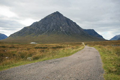
 The walker setting forth on the West Highland Way is embarking on a trip through history. Not only will his or her route pass through scenes of bloody massacre, betrayal, lawlessness and military campaigns, but the way itself is the result of the historic movement towards forging routes to enable the masses to enjoy the open countryside and escape the dark urban confines of Britain’s towns and cities.
The West Highland Way approaches Buachaille Etive Mòr in Glencoe
From the skirmishes between northern English ramblers and gamekeepers on the moors and fells of the Peak District came the notion of a long-distance path running from Derbyshire to the Scottish Borders. Tom Stephenson’s Pennine Way would be a long time coming, being opened finally in 1965, 30 years after the journalist first mooted the concept.
Allied with this, north of the border, a tradition had grown of young men and women escaping Glasgow’s industrial horrors to enjoy the mountains of the Highlands. Each weekend climbers and walkers would pour from the city and take to the hills in the wilds of the West. Sections of the present West Highland Way (WHW) have their origins in the routes established in the 1930s by the various walking and climbing clubs based in the city. The area has a long tradition of outdoor activity: the first ever federation of rambling groups was formed in Glasgow in 1892 when the West of Scotland Ramblers’ Alliance was set up.
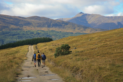 Much of the WHW follows another historic set of tracks: the old military roads constructed under the instruction of Field Marshall George Wade and his successor Major William Caulfeild to, in the words of the fortunately seldom sung sixth verse of the British national anthem: ‘Sedition hush; and like a torrent rush, rebellious Scots to crush’.
The old military road in Glen Orchy
The WHW, which was originally to be called simply The Highland Way, was planned initially to run from Glasgow to Glen Falloch. Much of the surveying of the possible route was done by Tom Hunter and members of the various rambling clubs in the area. The way was subsequently extended north to Fort William and was officially opened in October, 1980 by the Earl of Mansfield, Minister of State at the Scottish Office.
The route is now tramped by thousands of walkers every year. What can you expect as you pound the paths from Milngavie to Nevis Bridge? I pulled on my boots – more on that later – and joined five companions of varying degrees of experience in long-distance walking and hit the trail. To spare blushes and possible libel suits, I’ve used only first names.
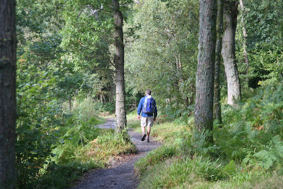 The first point to make about the WHW is that it is impressively maintained.
The maintained path through woodland alongside Loch Lomond
Navigation is easy with, in all but a few places, the route being obvious and well waymarked. Having undertaken Wainwright’s Coast to Coast walk, I found routefinding here a breeze and much easier than many other national trails, so top marks to the authorities who look after the way. The second point is that it is essentially a low-level route through Highland terrain, rather than over it. You can, of course, add on high-level excursions such as ascents of Ben Lomond, Beinn Dorain or even the challenging Buachaille Etive Mòr. Many strong completers of the WHW add a journey up Ben Nevis to their itinerary on arrival at the way’s end.
Normal duration for the whole walk is seven or eight days. For those feeling strong and whose feet can bear the pace, this can often be cut to six days. Any additional ascents will, of course, add to the time (and energy!) necessary.
There are dire warnings in some guide books about the difficulty of the route, the roughness of its paths, the exposure of its cols and passes. Now, in bad weather and certainly in winter, the way will present a major challenge and good equipment and clothing are essential. Certainly between December and April, true winter conditions may be encountered and the use of ice-axe and possibly crampons will have to be considered.
However, the WHW’s highest point is the summit of the Devil’s Staircase, at 555m, and the roughest of the path sections are certainly no worse than many Lake District routes and a lot easier to follow than most Highland summit paths. So although sensible preparation is advisable, I don’t think anyone should be afraid of tackling the way – with one important proviso.
The WHW under foot is hard for much of its length. It follows maintained paths, old military tracks and forest roads. There’s not too much asphalt, but the 152km will give your feet, knees and joints a pounding: there’s not much in the way of soft grassy sections, so prepare yourself by putting in a bit of mileage before hand and hardening up those feet and limbs.
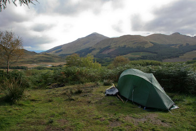 The Land Reform (Scotland) Act means there is now a legal right to walk on open land and wild camp in open countryside.
Wild camping in Glen Fillan
Camping has always been tolerated at certain points on the way and there are commercial campsites too, but the Scottish right-to-roam legislation, superior to that in England and Wales, opens up new opportunities to walkers who are prepared to carry their tent and stove. Camping gives the flexibility and freedom to go at the pace you want, rather than being tied to accommodation. The only drawback is that long sections of the route are bereft of shops to stock up on, so careful planning of provisions purchase is needed. Otherwise, of course, you can still stop off at the pubs, hotels and cafés en route that offer meals.
There are also bag-carrying companies that will transport your heavy gear from point to point, leaving you with a much lighter daysack to carry. The Sherpa Van Project is probably the best known and was the one we booked our bags on. However, when we got to Milngavie, it turned out the service had been subcontracted to Travel-Lite, run by Marion and Gilbert McVean out of Milngavie. They run the service from the end of March to the first week in October, but there are other companies offering a limited service for other parts of the year. We found the Travel-Lite operation worked well and our bags were in place when we got to each night-stop. The only glitch seemed to be for a pair of fellow walkers who had to wait a while at Nevis Bridge for their gear to turn up. By the end of the route, the van doesn’t get there until late afternoon, having to call at all the intermediate stops north, so if you finish earlier than about 4pm, you may have to wait for your bags in Fort William.
Our party of footsloggers chose the comfort of a roof over the head each night which, in theory at least, would guarantee a good night’s sleep and the chance to shower.
This is not meant to be a pace-by-pace guide to the WHW. There are plenty of guidebooks to help you follow and appreciate the route. Rather, this is our experience of actually walking the way: the highs the lows, the joys and the pain of walking what is, in my view, one of the best long-distance walks in the country.
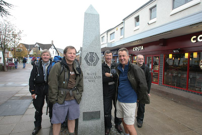 Milngavie, the starting point, holds no horrors. It will, of course trip up the unwary traveller who foolishly asks for a ticket to the station without realising that the pronunciation of their destination is ‘Mul-guy.’ Still, it probably provides amusement in the otherwise staid lives of the First ScotRail staff.
The route starts implausibly from the pedestrian precinct in Milngavie
It is possible to use buses to reach this northernmost suburb of Glasgow or even to walk there using the Clyde, Kelvin and Allander walkways, but the station is only yards from the start of the WHW, a granite obelisk slap bang in the middle of a pedestrian precinct, sandwiched between Costa Coffee and Marks and Spencer: a surreal start to the great adventure into the wilds of the Highlands.
We’d spent the night in the town’s Premier Travel Inn, with a tour of the town’s highspots. By the time we left the Talbot Arms about 10 o’clock, there was one customer left in the pub. You get the impression most of the burghers of Milngavie go elsewhere for their enjoyment.
The town must be overjoyed to have been picked as the start place of the WHW. There’s not much else to mark it out: a couple of Chinese restaurants, an Italian eaterie and the usual bored kids messing about on skateboards and bikes. Oh, and a fish shop so, had Alfred Wainwright lived long enough to undertake the WHW, he would no doubt have been pleased to stoke up his fat levels at the chippie.
Breakfast on the Sunday meant a trip to Tesco for what was to become the common start to the day: bacon, sausage (sometimes the square, Lorn variety), eggs, potato cake or scone, beans (for later wind assistance); then a rendezvous with Travel-Lite at the car park just below the obelisk. The driver kindly informed us we needn’t have lugged the big bags to the start point; he would have picked them up from the Travel Inn.
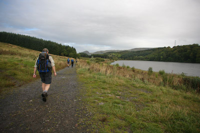 The WHW starts inauspiciously from the obelisk, across the aforementioned car park, past the Allander Water burn containing various urban detritus before entering scrubby woodland. It soon becomes evident how popular the way is: within minutes we’re encountering fellow walkers on the route.
Soon out of Milngavie, we were into pleasant country – not spectacular, that was still to come – as we headed towards Mugdock Wood and Craigallian Loch.
Craigallian Loch, 5km from the start of the way
The feeling that we were heading for some quality Scottish landscape was confirmed by the first sighting of the Campsie Fells and their sudden western termination at the pyramid-like, 427m Dumgoyne.
By now the waterproofs were off and warm September sunshine was warming the back. Strathblane has a Highland feel, even though we were less than three miles from the way’s start. It’s long been a bolt-hole for Glaswegians, as attested by the incongruous collection of odd little beach huts near Craigallian Loch.
At Carbeth, the West Highland Whinge began. A mere 7km into the walk, one of our party – we’ll call him Pete, for that is his name – declared that he needed to get out the Compeed. With 145km still to tackle, Pete’s feet were giving him grief and the plasters were applied to soothe his pain. The West Highland Whinge was to be our constant companion as, one by one, various bits of our middle-aged bodies succumbed to the pounding and the rigours of six days on the hoof. Not one of our party would end the walk without some complaint or other. Pain would be our constant companion. As would alcohol.
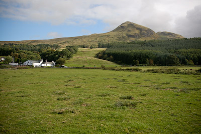 In fact, it could be argued that our trip along the WHW was actually an elongated pub crawl. First stop Dumgoyne. Having successfully resisted the temptation of a quarter-mile detour to the Glengoyne distillery, nestled under the fells, we arrived at the former Dumgoyne station after following the bed of the old Blane Valley Railway for a couple of miles.
The Glengoyne distillery, under the volcanic pyramid of Dumgoyne
The station building is now the Beech Tree, a pub with a beer garden in which we sat to soothe the first ravages of the Whinge but, to the horror of Chris, our party’s finest alcohol aficionado, it was too early – Sunday licensing laws and all that – to get a pint.
The beer garden is a gathering ground for walkers: a German couple consulting the guide book; two women accompanied by their dog; six middle aged men resigned to drinking J2O and coffee due to the vagaries of the influence of the Wee Free Church on Scottish alcohol sales.
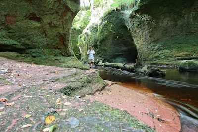 Paul, who probably has more experience walking in Scotland than any other member of the party, suggested we take a detour from the WHW to Finnich Glen.
Finnich Glen: off the way, but worth the detour
The five-mile excursion away from the route drew Whinge protests but was ultimately worth the trip for the three who braved the treacherously slippery steps to the bottom of the steep gorge, which seems another world entirely. The gorge is only accessed by clambering over a wall and along overgrown paths which are close to some large drops down into the gorge, so care is needed.
In 1998, the glen was the scene of an artistic endeavour by NVA, a group best known for its recent illuminated show at The Storr on Skye. In The Secret Sign, the audience was taken by bus, with blacked-out windows, to the glen, where they were equipped with hard hats and waders. They were led up the glen where a sort of son-et-lumière show was put on. There’s a video of the event on YouTube.
The gorge is quite an eerie place at the best of times. It must have been absolutely petrifying during the performance.
Back on the way, the track continued on the old railway bed until Gartness was reached. There followed one of the few sections on metalled road, towards Drymen, our first overnight stop.
The hedgerows around Drumquhassle provided an unexpected feast of ripe blackberries, which slowed my progress a little, but was worth the frequent stops. I had imagined joining a group of walkers would mean keeping together as a tight group, but it was not turning out to be so. Bob was always out ahead of the group, walking poles flailing as he set his own blistering pace. The rest of us were strung out along a kilometre or so, in pockets of two or three as we took a more leisurely approach.
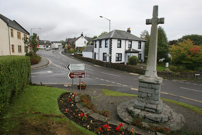 Drymen is just off the WHW, half a kilometre to the West and a favourite stopover for the first night of the route. Our destination was The Hawthorns, a tidy bed-and-breakfast establishment run by friendly host Jim.
Drymen, and The Hawthorns, our first night's stop
For those with a fear of the dreaded Highland midge, Jim sells bottles of the squaddies’ favourite deterrent, Avon’s Skin So Soft.
The weather forecast for Sunday, our first day, had been dire, but the day turned out beautiful, with sunshine all the way after about 10.30am. Undoubtedly, walking the WHW is much more pleasant when it’s not raining torrents and the first day, a shortish one at 20km (12 miles) had been easy if a little hard on the feet.
The scenes in the various bedrooms did at times resemble a casualty ward, with blisters being pierced, various liniments and plasters applied and a general fatigue that could only be cured by ingestation of copious doses of liquid anaesthetic. Happily, Drymen has four licensed establishments able to supply the needs of a footsore walker. Unfortunately, my first choice, the Winnock, was not to prove a happy option. From the outside, the Winnock has a very traditional appearance, on the village green, the epitome of an old coaching inn.
Inside, however, the pub has been sanitised and corporatised to remove all originality. The young man desperately trying to serve the liquid needs of a roomful of thirsty customers was not helped by both handpumps going off at the same time and it was clear he was overwhelmed. A wait of 20 minutes for the first drink was not welcome and we left in search of a more accommodating hostelry.
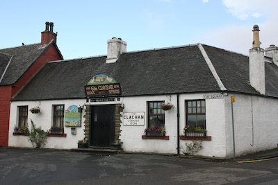 The Clachan claims to be Scotland’s oldest pub, and had a good mix of local drinkers and WHWers. Whether we arrived in Drymen the day before the drays, I don’t know, but within five minutes of walking through the doors of the Clachan, it too had run out of cask beer. Still, the atmosphere was good, without the raucous rugby songs and howling of youths at televised sport we’d had to endure in the Winnock.
There was a wait of an hour and a half before we could get a table to eat, but once it did arrive, the food was good. Plainly, it pays to be patient in Drymen.
Stocked up with food from the village’s two stores (there’s also an outdoors shop if you’ve forgotten or broken anything) we headed back on to the trail. Coachloads of Yorkshire grannies had invaded the village during the night, attracted no doubt by the 2am caterwauling of our rugby fans outside our bedroom window. It was time to get out of Drymen.
It was on the outskirts of the town we first encountered the man we would come to know as Kevin, who possessed the accent of someone from a far-off land: Kevin was a Californian. In fact, it rapidly became clear how cosmopolitan the WHW is. Through the forest north of Drymen we encountered Germans, Swiss, English and even Scots! There was a steady procession of nationalities heading for the first real climb of the route, Conic Hill. Some of the old guidebooks will tell you that dogs are not allowed on Conic Hill and that walkers are not even allowed on it during lambing season. The new access laws mean these warnings can safely be ignored though, obviously, when lambing is happening, consideration needs to be given.
Kevin’s usual wildlife concerns were bears and mountain lions. Garadhban provided its own exotic fauna which seemed to fascinate him: giant slugs.
Scotland then decided to give us a little lesson in meteorological uncertainty as the skies grew greyer and the few spots of precipitation became a steady blanket of drizzly rain that cloaked the top of the hill and meant the waterproofs had to go back on.
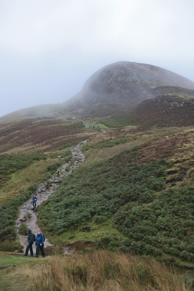 With all thoughts of a panoramic view obscured in Scotch mist, it was head down and slog up the hill. I’d opted to put on a pair of thicker, woollier socks that cushioned the feet a little better midway through Sunday. However, today, in the cold, dry light of dawn, I’d chosen to swap to fellrunning shoes.
Conic Hill, the first workout for legs and lungs
So now I had wet feet. But I also had less painful feet and on balance, I was glad I’d chosen the softness of the shoes. My heavy leather boots were stuffed ignominiously on top of my rucksack, their usefulness over. I kept them in case I encountered difficult terrain. I never did: I kept the fellrunning shoes on for the rest of the walk.
The distant glimpses of Ben Lomond’s summit seen yesterday had now disappeared, but as we descended from Conic below the grey blanket of cloud, a panorama of Lomond did finally materialise, the islands across the water marking the continuation of the Highland Boundary Fault on which Conic Hill lies, and the distant Arrochar Alps faintly visible through the gloom.
Balmaha provided the chance for a drink and food for some of our weary footsloggers, though, unlike Bob and Chris, I baulked at spending nearly a fiver on a bowl of soup.
Drymen to Rowardennan, on the shore of Loch Lomond, is 24km (15 miles). Not too arduous a distance, but we had been warned the footpath along the eastern shore of the loch was heavy going in places. Again, I think people overdramatise parts of the way. The route presents no great difficulties though Paul and Phil were mightily peeved at the seemingly pointless little tour of Craigie Fort, a promontory just north of Balmaha, which takes you steeply up to the top of the rock, where a cairn helpfully suggests you may want to get out your binoculars, before just as abruptly depositing you back down a the lochside, begging the question: why?
 The answer, of course, as anyone with a knowledge of mountaineering history will know, is because it’s there. The WHW is certainly not about striking the shortest route between A and B, but the best quality route. Anyway, the official opening plaque used to be on top of Craigie Fort, so it would be rude not to pay a visit.
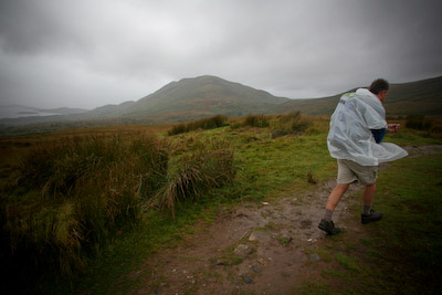
Proof that you don't need to spend £200 on a waterproof: Chris models a giveaway plastic poncho as the heavens open
The way follows Loch Lomond’s shore for 31km (19 miles) and the track provided an ever-changing prospect as the weather faltered, the rain dried up and the scenery gave the feeling that at last we were entering true Highland territory. The path makes frequent visits to the lochside, and takes to the asphalt road briefly. Although many view this section as a bit of a long drag, I have to disagree. The delights of Lomond are too big a distraction to make the walk anything but exciting as the boldness of the Highlands starts to unfold as you make your way north.
It was only day two of the walk, but already there was a sense of camaraderie building with the other walkers we saw along the way. Kevin had started the walk with his partner Mary who had had to drop out of the walk with a back injury, so I suppose he was glad of someone to tag along with. As you stop for breaks and meals, other groups overtake and are themselves overtaken so, throughout the length of the walk, we met many of the others tackling the WHW and picked up their stories.
Rowardennan marks the end of the motor road along the loch and is as well known as the starting point for the climb to Scotland’s southernmost Munro, Ben Lomond. It was to be our home for tonight. I had built up my own mental picture of the Rowardennan Hotel: stags’ heads piercing the walls; Jimmy Shand music just audible above the sound of creaking floorboards; Basil McFawlty abusing guests as general chaos ruled. I was half right.
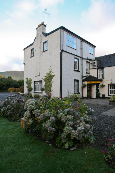 The generally dilapidated air of the Rowardennan Hotel belies the high prices it charges. It was the most expensive of our nightstops on the whole route and certainly didn’t earn its premium. There was nothing wrong as such; just a feeling that not much money had been spent because there’s effectively a captive audience and it doesn’t warrant it. Compared with the obvious desire to please displayed by our host in Drymen, it was a big disappointment.
The Rowardennan Hotel: nothing to merit its high prices
However, the Clansman bar in an annexe of the hotel served good food and proper ale. For the second night running, we were able to sample a dram of Glengoyne, though it came at a price (£3.40). That said, the staff were very friendly, obliging and if only subtitles had been available, quite amusing, I’m sure. A blazing log fire was kept well stoked and Bob did the rounds of every available female WHW walker in the room, his stand up comedy routine bringing furrowed looks to the faces of everyone he spoke to. Whether through amusement or fear wasn’t immediately obvious, but his perseverance was commendable.
We needed a good night’s sleep: tomorrow would be a long day, 21 miles (33km) to Crianlarich.
More dire warnings were issued by two seasoned Scottish WHW veterans of the rough nature of the terrain on this section of the shore. The weather forecast from the weekend had also promised horrendous rain and possibly thunderstorms on the Tuesday. In fact, neither turned out to be true and, although the path does meander up and down and some stretches are rocky, it’s no big deal. As for the weather, the high-pressure system due to arrive the day after had taken the express route and got to us early. Tuesday dawned cool, sunny and crisp, a harbinger of the weather for the whole of the rest of the walk.
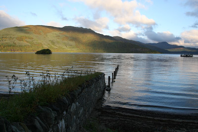 Most recommendations say walk the WHW from South to North, with which I would concur.
Loch Lomond at Rowardennan
One of the best aspects of the way is its crescendo, building day by day as the landscapes and views provide more drama hour by hour. Rowardennan was, for me, when the walk picked up. Though the scenery through the low country of Strathblane is pleasant, there’s no beating the high drama of Scotland’s rugged Highlands. Ben Vorlich, Ben Lomond, Ben Arthur (The Cobbler) and the other peaks hold the attention as much as the ever changing shades on the loch, Britain’s greatest expanse of fresh water.
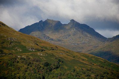 We, in turn, were the object of close attention from the trippers on the Loch Lomond Cruise, which came in close to the eastern shore to observe at close quarters the strange, gaily coloured bipeds ambling through the woods, before the boat turned for Tarbet.
The route along the eastern shore of Loch Lomond affords views of The Cobbler
Inversnaid is an odd interjection into the remote shores of the loch. For miles, there is no road link to Lomond. But at Inversnaid, the asphalt comes over from Aberfoyle, bringing coachloads of older visitors who amble around the hotel, gaze at the water and disappear inside for haggis and chips. They must wonder where the hell the hordes of walkers come from too, so far from other enclaves of civilisation.
Inversnaid’s steps alongside the Snaid Burn were to be Phil’s downfall – literally – as he took a tumble which was to lend him a distinctive gait for the rest of the walk.
We were deep in Rob Roy territory here, and everywhere his presence is evident, be it at Rob Roy’s Prison, Rob Roy’s Cave, Rob Roy’s bar, Rob Roy’s holistic healing tepee. Well, not quite, but there’s a certain amount of hokum about the MacGregor outlaw, much of which can be lain at the feet of Sir Walter Scott, whose fictional account of the feared reiver turned him into a sort of Highland Robin Hood, though it’s doubtful the settlers whose stock he plundered viewed him in such rosy light. Rob Roy’s Cave, signed further north, can be visited, but don’t expect to be enthralled.
Beyond Inversnaid, we met three brothers from Freiburg, near the Black Forest, who had clubbed together to bring their 60-year-old father on the WHW as a treat. A testimony to the way’s attraction is that the lads had also considered the Alps and Sweden, but the Scottish Highlands beat the competition.
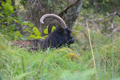 Black, feral goats can be glimpsed in the undergrowth on this section. They seemed utterly unperturbed by the passing walkers and barely glanced at the humans.
The way has a roller-coaster character here, with steep slopes up and down but, with care, presents no difficulties to the seasoned walker. Across the water, the pipes of the Loch Sloy hydro plant can be seen plunging down the hillside to Inveruglas.
One of the buildings at Doune Farm has been converted to a bothy which, on our visit boasted a garden seat outside and a radio inside (bring your own batteries) as well as the more conventional sleeping platform and hearth.
South of Ardleish, lies a pebbly beach which is ideal for a lunch stop, so that’s what we did. Warm sunshine, a great retrospective view of the loch and mountains on either side. It doesn’t get much better.
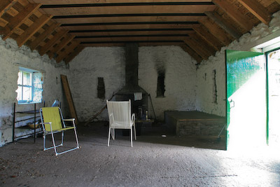 At Ardleish, we passed the ferry point for Ardlui. The boat is summoned by raising a ball on a signal post. I couldn’t help wondering how long it would take the ferryman to spot the passenger’s signal, had we wanted to cross.
The inside of the bothy at Doune
It was at this point that we left the loch which had been our companion for almost two days. The route climbs gently away to the low col marking the start of Glen Falloch. It felt strange not to have water on one side, but Falloch is high mountain country, with its own particular beauties. Sadly, as with many highland glens and straths, electricity power lines accompany the walker for much of the route and there were warnings of possible path closures and diversions which, fortunately did not materialise. It would have made for interesting debate between WHWers and power workers.
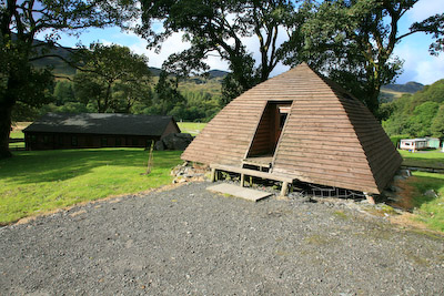 Beinglas Farm is a stop for some following the way. As well as camping facilities, it has a collection of wooden wigwams offering an alternative to canvas. Paul, Chris and Nick, a hotel manager from Hampshire who had joined our merry, if hobbling band, were taking advantage of the farm’s café as I pressed on.
This was real Highland scenery and despite the length of the day’s walk, I felt it the best so far. Glen Falloch pitches the walker from lochside to mountain, with stunning views all around. The Falls of Falloch are just a bonus, surveyed in the company of three women taking the ultralightweight approach to the WHW: tiny daysacks and no changes of clothing. Best to keep upwind, I thought.
A very low sheep creep under the railway made me glad I wasn’t lugging a huge pack; I’d have been on my knees. The route then pitched us up on to the opposite side of the glen, with views east to Ben More and Cruach Ardrain. I was solo by this point. Bob was probably on his third pint in the Rod and Reel in Crianlarich, I pondered, while the other members of our Highland Whingers were somewhere not far behind me.
Above the ancient farmstead of Keilator, there was a sign boasting of the efforts in rebuilding this particular stretch of the WHW. Far be it from me to decry anyone’s endeavours, but it was the worst section of the whole 95 miles. Was the notice a cruel joke, to taunt weary walkers just a mile short of their goal? Or was it perhaps an experimental surface, designed to test the flex and strength of ankle and sinew. If the latter, it certainly worked and I was glad to reach the relative smoothness of the forest track.
The WHW forks left here, heading up Strath Fillan, but our destination for the night was Crianlarich, and the Ben More Lodge motel. A steep descent through the woods brought the village in sight (and brought to mind the fact that the steep path would have to be reclimbed in the morning) and a short deviation round the railway station’s underpass landed me at the village’s Londis store.
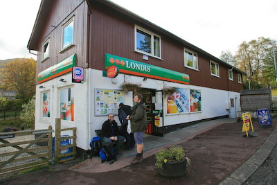 Mindful of the fact that there was no shop at tomorrow night’s stopover, I decided it was time to restock the provisions. Bread, meat and cereal bars were in abundance; conversation wasn’t. I don’t know how difficult an existence it is being a shopkeeper in such glorious surroundings, but good cheer was in very short supply.
The Crianlarich village store: well stocked, but short on good cheer
As if to match our latter-day Arkwright’s demeanour, the first spots of unexpected rain accompanied my final few hundred metres to the Ben More Lodge. The big bags had arrived and the man in the bar pointed out our accommodation. I thought I’d misunderstood his Highland brogue. He was indicating what I was sure was the toilet block. There were luxurious-looking log cabins and at the end of the neat row was The Hut.
I gingerly pushed open the door, half expecting to have to apologise to some unfortunate for barging in on them with their pants round their ankles.
“What a dump! The kettle doesn’t even work!”
Bob had managed to half flood the cramped confines of The Hut by foolishly having a shower. He’d already formed a one-man escape committee and announced he was going to look for alternative lodgings. Phil’s name was mud. He’d proudly found the cheapest gaffe on the route and it showed. The shower floor was also mud, as was most of the rest of the building.
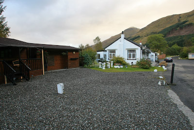 With the arrival of the rest of the party, moving around The Hut became a sort of three-dimensional Twister game, with floor space the prize for a successful move. All Paul could utter was: “Breakfast must be included! You don’t pay 16 quid for a place like this if it doesn’t include food.” (it turned out it was included). Serious alcohol intake was going to be necessary to get anything approaching a good night’s sleep. The Rod and Reel beckoned, but not before Bob had managed to get a replacement kettle.
A visitor to Crianlarich’s main public house may be forgiven for feeling tipsy on a less than average intake of liquid refreshment. Halfway across the room, the floor takes an alarming dive and ends up somehow two feet lower than the rest of the bar. On subsequent examination in the morning daylight, it was clear why: the whole building sags on one side!
However, the food was good; Kevin and Mary joined us, along with Nick. Supper was rounded off with more single malts as we vainly clung to the warmth and succour of the pub. Eventually, the barmaid, a refugee from Erskine who had found Shangri-la in Crianlarich, had both this job and a daytime job at Tyndrum’s Green Welly Stop, and told us how to pronounce the name of the village properly (Cree-an-laarich), made it clear the pub was closing and we stumbled back to Stalag 66.
The Hut had developed its own micro-climate by morning and cumulonimbus hung heavily over the six bunk beds. Comedy was provided by our breakfast waitress who threw various food items to the floor while constantly and embarrassedly apologising, to the accompaniment of what sounded like a pipe band on Es and Whizz.
Wednesday’s destination was Bridge of Orchy, a mere 13 miles (21km) up Glen Fillan. With half the WHW’s distance under our boots, the sun shone weakly and the conversation in the Londis flowed like frozen sewage. Then it was back up the forest track to rejoin the route, where we encountered a pair of Scots who had nighted at Beinglas and obviously made a much earlier start to the day than we had. They had as their staple that great Scottish energy source, Irn-Bru, and at times it was difficult to distinguish the results from the bellowing of rutting stags.
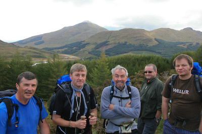 The route continued through the trees, with a fine viewpoint at which to take your pictures with Ben More and Stob Binnein in the background, before finally descending and crossing the main road.
The Whingers pause for a pose, with Ben More in the distance
There was another enthralling viewpoint at the bridge over the River Fillan, leading to Kirton Farm, which has a helpful interpretation board to help you put names to the peaks if in doubt. The farmland and buildings are run by the Scottish Agricultural College and are well tended, with a plethora of boards informing walkers of the history of St Fillan and the buildings in the area. Auchtertyre is also run by the college and boasted more wooden wigwams and a somewhat out-of-character ‘Wild West’ staging post where we found Nick stocking up on buns.
Ben Lui, its tw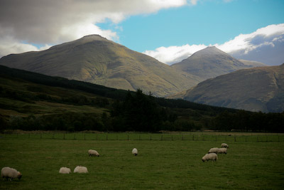 in peaks sprinkled with snow, filled the skyline westwards as the way meandered around the waters of the River Cononish. Tyndrum soon came into sight, as did a pair of people standing in the middle of the Crom Allt. It soon dawned that they were prospectors: panning for gold. There’s a disused gold mine at Cononish, so it’s plain there is some of the shiny stuff in them thar hills. The gentleman had had a small success that morning: a tiny nugget. Perhaps that Wild West staging post wasn’t so out-of-place after all.
The view down Strath Fillan, dominated by Ben More and Stob Binnein
Tyndrum’s Green Welly Stop provided a coffee break among bikers, coach parties and other WHWers. The birds here have realised which side their bread’s buttered and the tamest pied wagtail in Scotland was taking food from visitor’s hands. Oddly, it turned up its beak at Paul’s bridie pasty and promptly stamped on the offering. A bird with taste!
Wednesday was undoubtedly the best day so far. True mountain territory with, for the rest of the day, the towering pyramid of Beinn Dorain our companion. As the track climbed out of Tyndrum, the broad valley of Glen Orchy came into view; road, railway track and WHW squeezed into the col at its southern end. In the distance, the mountains at the head of Glen Etive. For those of us who have driven the main route north towards Rannoch Moor, the journey on foot provided a chance to take in the full joy of this massive scenery usually only glanced for fear of running into a passing coach or steering into a ditch while gazing up at Dorain’s broad flanks.
Glen Orchy really is an impressive place and the walk along its length a treat, especially with September sunshine on the back.
We caught up with Bob raiding the contents of his flask just before Auch. My comments to him were muffled by the drone of some of his Sounds of the Sixties blasting from the iPod, so I bellowed my usual amusing obscenity to him. The echoes of the foul language reverberated through the glen just as five ladies rounded the corner. They were genteel enough not to mention the incident but I thought it best to let them get some way into the distance before setting off again.
Auch provided a challenge to Paul. He had had a nasty encounter near the sheep creep in Glen Falloch, when a large cow had come in close proximity. It turned out that Paul had a psychological aversion to bovines, and up ahead stood a dozen or so hefty Highland cattle, right on the track. Thankfully, my efforts pointing my camera up the snouts of these most placid of farm animals distracted them long enough for Paul and Chris to sneak past.
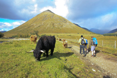 Paul, Chris and Nick sneak past the Highland cattle at Auch
The long, straight stretches of the old military road which run alongside the West Highland Railway line gave a chance to observe and compare the injured gaits of our band. Bob, of course, his blisters pricked and iPod on some 120 beats-per-minute Sixties thrash, was hundreds of metres out in front, his poles rhythmically pounding the Highland stone, like a Nordic skier practising for the Vasaloppsled race. Phil’s tortured movements were instantly recognisable after his tumble down the steps and matched Quasimodo’s for grace. Pete’s tenderfoot gait meant every step seemed excruciating pain.
 Chris had managed to crock one of his knees on the shores of Lomond and now had the aid of one walking pole. Paul’s progress was instantly recognisable by the plume of roll-up smoke. I, meanwhile, had a nagging ankle that had started to swell and made downhill sections uncomfortable. Oh, for a good steep ascent.
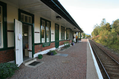
Bridge of Orchy station, home for the night
Nick, who regaled us with blood-curdling details of childhood limb breakages, always looked like he was about to fall over. He had intended to stop at Tyndrum Youth Hostel that night but, bolstered by the fine fellowship he had found, he decided he would walk to Bridge of Orchy, get a train back to Tyndrum, then get the first train north in the morning. It sort of made sense.
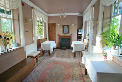 Bridge of Orchy station hove into view and with it our digs for Wednesday. The platform buildings have been imaginatively converted into the Railway Sleeper bunkbarn, with three-high beds in dorms and the waiting room made into a common room and kitchen. It’s a great use for the station which no longer sees that many passengers and the bunks are nicely furnished.
The old waiting room at the station has been transformed into a common room for the bunkhouse
The common room is done out simply but in a sort of Brief Encounter style. I loved the place. Be warned, however, that the dormitories are mixed, so if you are particular about who you share with, you may have to compromise. All the bunks have curtains, though.
Our single-outfit ladies had to share the same room as an odd character, an itinerant spit of the Gary Holton character from Auf Wiedersehen Pet who, literally, never stopped talking.
Breakfast, for which extra payment has to be made, is left cold in the fridge and consists of bread to toast, cereal, coffee and fruit juice. Bob and Pete had lugged our big bags up the hill to the station from the hotel where they had been left.
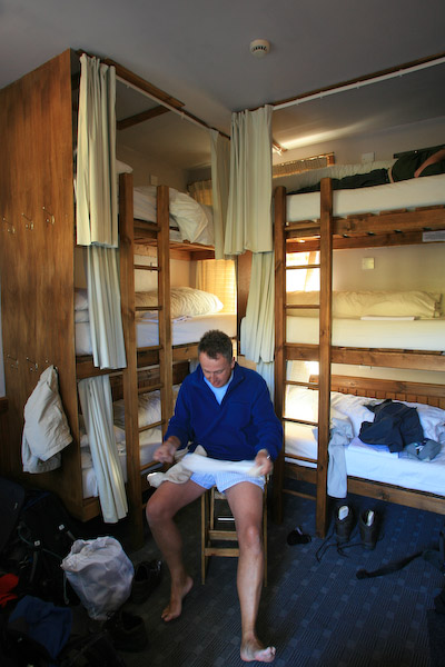 It has to be said that the atmosphere in the bunkhouse was akin to the wind from hell. By now, the boots were beyond ripe, and a succession of full Scottish breakfasts had done its worst to the digestive tracts of our team. My camera viewfinder steamed up and it would not clear fully until I’d left Scotland!
The Bridge of Orchy Hotel provided our evening sustenance. The bar was doing a roaring trade and the restaurant was busy, not least because we changed our table requirements at least five times during the evening. The five women who had witnessed my obscenities were there; they were using the hotel’s bunkhouse. This, of course prompted Bob into his Lothario mode. There were also the Irn-Bru Two and assorted WHWers, along with a few non-walkers.
Paul had adopted haggis as his staple diet – he’d managed to eat it every night so far – and I joined him tonight. I was glad I did. It was superb. The hotel obviously prides itself in its food. No chips: the chef doesn’t have fryers in his kitchen. Just good, well cooked food and no more expensive than anywhere else along the way (Milngavie chippie excepted). Recommended.
Back on the station, we gathered like excited schoolchildren to watch the night sleeper train pull in. ‘Wayne’ was still jabbering but the fragrant ladies were fast asleep.
Thursday dawned cool and bright. The realisation dawned, too, that the walk was not far from its end and with the realisation, a sense of sadness mixed with the excitement of the day to come. This would also be our longest day, 22 miles (35km), with nearly a thousand metres of ascent.
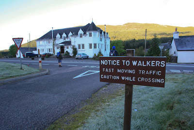 The section from Bridge of Orchy is often described as going over Rannoch Moor and all the potential horrors that entails.
The route crosses the main road north at the Bridge of Orchy Hotel
Frankly, the WHW skirts the moor, giving great views down on to its vast expanse, but not really venturing into the blanket bog. The way rose gently from the bridge, through the plantation before a panorama of Loch Tulla appeared from the shoulder of Mam Carraigh. The route ahead could be plainly seen, from Inveroran across the opposite hillside in the shadow of the towering ridges of Stob Ghabhar and the slopes of its neighbour Stob a’Choire Odhair.
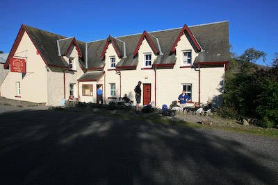 At the old drovers’ inn at Inveroran, our intrepid team decided it was time for a coffee break, having walked for almost an hour unaided by artificial stimulation.
The inn at Inveroran
At this point it occurred to me that the day had grown warm enough to finally change into shorts. With perfect timing, I was assailed on the one side by the coterie of five gentlewomen, wolf whistling at the sight of a middle-aged man in his underwear, hopping on one leg while struggling not to get flattened by the Land Rover on the other side, approaching down the road which I had assumed would not see any motor traffic that day.
The guide books to the WHW detail ‘mountain mileposts’ which define significant points on the walk. Ben Lomond is the first, with Ben Vorlich and Ben More figuring large, then Beinn Dorain even larger. Mentally, I had been looking forward to our next milepost more than any. Buachaille Etive 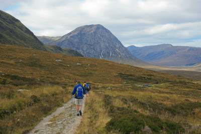 for me, as for many others with a love of the mountains and fells of Britain, epitomises the Highlands and I know many mountaineers who will stop their vehicles and, figuratively at least, doff their woolly hat at the great Glencoe shepherd.
The West Highland Way approaches Buachaille Etive Mòr
The next few miles would be spent in anticipation of meeting my old friend at the head of that historic glen.
Glencoe has been described many times as a scene of high drama. Even in the most benign weather, it has the capacity to raise the hairs on the back of the neck as mountains tower either side. Serious mountains: from the Buachaille and the Three Sisters on one side to the perilous scramble of Aonach Eagach on the northern edge, Glencoe demands to be taken seriously.
Add to this the history of the Campbell slaughter of their MacDonald hosts and you have, I think, one of the most atmospheric arenas in the Highlands. And it was just over the shoulder of the next hill.
Kingshouse Hotel came into view first, backed by the Mamores, then finally the full glory of Glencoe revealed itself, the skies darkening appropriately and the morning’s sun disappearing. High above Meall a’Bhuiridh, five hanglider pilots were defying gravity as they wheeled on the currents coming up the mountain. Down below, traffic heading northwards on the busy main road rumbled noisily into the glen. A perfect spot for lunch, with a 270-degree panorama stretching from Buachaille Etive Mor, eastwards across the boggy expanse of Rannoch and south to the mountains we’d passed earlier in the week.
The chairlifts of the White Corries hung redundant above the grassy slopes above Blackrock Cottage. A photographer was setting up his tripod to capture the image which must be snapped thousands of times a year, the white climbing hut dwarfed by the pyramid of Stob Dearg. I too pointed my lens at the scene.
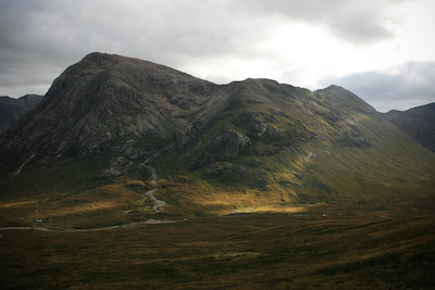 Needless to say, Kingshouse Hotel necessitated a visit from the thirstier of our members, preparing for the fearsome-sounding Devil’s Staircase.
The track from the inn ran more or less parallel to the main road, heading into Glencoe and providing a changing perspective on the Buachaille, which reveals itself to be not an isolated pyramid, but a much more complex mountain, cradling the Coire na Tulaich and displaying its massive gullies as the way passed under its great bulk.
Altnafeadh, the point at which the Devil’s Staircase departs northwards from Glencoe, seemed a long time coming, but finally the fateful moment arrived. It has been said many times that the path’s bark is worse than its bite and, in truth, its worrying soubriquet was most likely applied by the poor soldiers charged with building it rather than those who subsequently used it to pass into Kinlochleven.
The Staircase starts steeply, but its zigzags ease the route and before long the summit was reached. The backward view was filled with Glen Etive and its mountains and, finally, Scotland’s king of mountains could be seen: Ben Nevis.
The peaks of the Mamore Forest held the distant horizon with, to the North-East, the reservoir of Blackwater sitting murkily on the high plateau. Paul, Chris and I stopped for a break and were passed by another Irn-Bru athlete, solo en route for Kinlochleven. Stob Ban stood sentinel as the Big Ben dropped out of sight
Among our party, the list of woes mounted: Phil felt he had flu coming on; Chris’s twisted ankle was still troubling him; Pete’s feet continued to pain him even though he bought a pair of poles en route; Paul had been applying Deep Heat to various bits of his limbs and my shin splints are getting worse. No-one really knew what Bob was suffering because he was too far out in front for us to make contact.
Some of our fellow walkers had chosen to break their journey for the night at Kingshouse, but reaching the former aluminium smelting town would mean a fairly short final day for us.
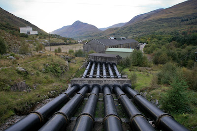 The settlement of Kinlochleven was soon to be seen, nestled at the head of the loch, steep slopes enclosing its factory-built homes. Some sort of mountain pixie must be at work up on the tops, for the town never seemed to get closer.
The massive pipes which fed the old aluminium works in Kinlochleven
The track, built for the smelting works’ maintenance vehicles to reach the system of pipes feeding from Blackwater, is hard on the feet and progressed through a series of hairpins that seemed to stretch to eternity. Never has so short a distance seemed so long. Perhaps it was the pain from the swollen ankle that rankled, or maybe just the fatigue of the longest, hardest day.
At last, the ramshackle remains of the old aluminium works drew close and with it the promise of food, drink and rest.
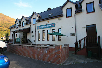 The Tailrace Inn is right on the WHW and the smell of food wafting from it was most welcome. Chris’s priority was to replace three or four pints of the fluid lost on the journey’s endeavours.
While both Chris and the staff spoke roughly the same language, comprehension seemed difficult – a problem I was later to encounter myself when attempting the difficult task of ordering a pint of beer – but eventually it dawned that we had booked rooms there and we were able to shower and eat. The food was mediocre but the best news of the night was that karaoke was off. Sleep was assured.
We now had only 15 miles (23km) to go, with a couple of thousand feet of climbing, until we reached Nirvana, or Nevis Bridge roundabout as it’s known to the locals.
A trip to the Co-op in Kinlochleven started Friday, stocking up on bread and meat for the final leg on our last legs up the steep climb out of the town and up towards the Lairig Mor. Kinlochleven has the feel of a council estate plonked in the middle a beauty spot. Its uniform houses indicate the planned nature of the settlement, created for the workforce for the now silent smelting works, which has been converted to an indoor ice-climbing centre.
As promised by the Met Office, the morning was fresh, bright and sunny, bringing a warm glow to the party winding its way through the forest rising above the loch. Views of the water were restricted as the path moved away towards the grand pass of the lairig, the bulk of Beinn na’Caillich intervening soon afterwards.
There was a spring in the step of most of our group, even if it was a lopsided spring. Phil, suffering perhaps more than anyone, had set off early to try and make some headway. LA Kevin appeared like a genie as we stood outside the Tailrace and joined our party for the final push, and Nick hobbled up the hill with us, his itinerary certainly quicker than he had originally intended.
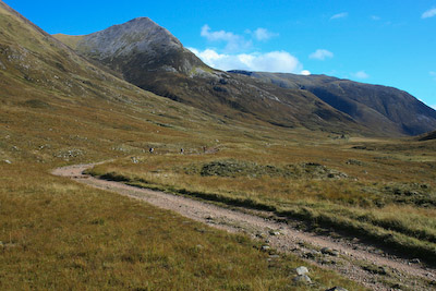 The Lairig Mòr is another hugely significant part of the Highlands. Its long, broad pass was the route taken by leaders of the MacDonald clan who had escaped the murderous night of the Campbells’ treachery. Even in the glorious autumn sunshine, it was possible to imagine the horror and despair these Highlanders must have felt as they headed, wounded and shocked, back to their Glencoe base.
The Lairig Mòr, between Kinlochleven and Glen Nevis
At the far end of the lairig is a great cairn. Tradition says that a passing MacDonald should add a stone; a Campbell should remove one. As a Smith, I felt unqualified to take sides. I ate my lunch while gazing at the cairn and its interpretation board.
Feeling ever more confident as the journey’s end approached, I delved into my schoolboy German vocabulary to strike up a conversation with the Freiburg quartet. “Morgen; wie geht’s?” I tried. Father came back: “Schuh ist kaput!” And indeed it was. One of his son’s boots had given up the struggle and its sole was flapping wildly, unable to make the distance. Ever resourceful, the gaffer tape was out and the party continued on its way.
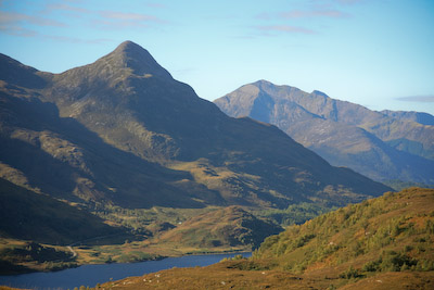 The rounded top of the Pap of Glencoe and a distant view of Aonach Eagach’s northern face provided the mountain background along the route.
Beyond the two ruined crofts of Tigh-na-Sleubhaich and Lairigmòr, the map shows the track entering forest again as it turns north towards Glen Nevis. A great deal of logging was going on and vast clearings have been made. Machinery was at work on the lower slopes of Meall a’Chaorainn, snipping tree trunks as a pair of scissors would snip a drinking straw.
The climax of the walk was approaching, and finally Ben Nevis’s massive bulk started to fill the view ahead. The WHW diverges from its former route at Blar a’Chaorainn, where the metalled road forges north towards the west end of Fort William. You can still follow this more direct way, past Lochan Lùnn Dà-Bhrà, if you fancy the prospect of six kilometres of hard asphalt. However, we followed the main route which swings north-east into the Nevis Forest.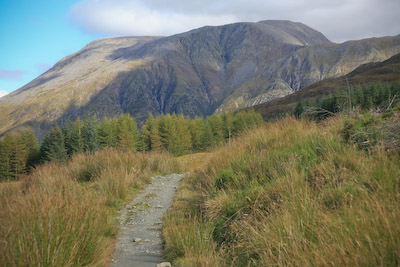
The West Highland Way, heading towards Ben Nevis
In parts, the day turned to night as the heavy conifer canopy blocked the light on the track. Ben Nevis’s south-western peak Carn Dearg dominated and Five Finger Gully’s steep rockiness displayed its fearsome charms. The tourist zig-zags looked fairly quiet, despite the good weather and clear summit.
Chris took a detour off the path to visit the vitrified fort at Dùn Deardail. It comes highly recommended for its views.
Now, it has to be said that the end of the WHW is a bit of an anticlimax. Unlike the descent into Kinlochleven, the track seems to drop quickly enough, the view of Ben Nevis receding as you make your way northwards and before long, I found myself on the roadside in Glen Nevis. The plan had been for everyone to meet up and finish together. Like the best laid plans, it didn’t work. I hung on at the Clach Comhairle, the great boulder at the side of the road. Bob was ahead, as usual, and eventually I was joined by Paul, Pete and Phil. Chris had made his diversion to the Dùn.
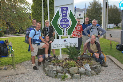 So it was a somewhat fractured group that ended up at the roundabout, the official end of the route, for the customary photographs, handshakes and backslaps.
Journey's end: the team, plus friends, at Nevis Bridge. From left, Pete, Chris, Paul, Bob, Phil, Kevin, Bob Smith and Nick
The feet and legs felt every mile of the 95 we’d covered, but the way provided some fabulous memories.
We did eventually manage to corral the troops for a full group picture.
Would I recommend the West Highland Way? Without hesitation. The guys who had completed the route ten times asked me if it was better than the Coast to Coast. That’s a difficult question. I’d had a very different experience on the Coast to Coast: solo, big pack, double the distance. I’d say the Wainwright route has a bit more variety, but the West Highland Way has grandeur in abundance. There’s no capping the views of the mountains of the Highlands and it’s a splendid walk. And, it’s easier. There’s considerably less climbing and the route is very well maintained, with none of the navigational difficulties of the Coast to Coast.
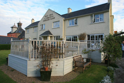 So, do them both, and see what you think. As for us, it was off to our home for the night, just a few yards away at the Distillery Guest House.
The Distillery House B&B, our final stop
Celebrations were had at the Grog and Gruel, the only pub I can truly recommend in Fort William, where Kevin and Mary joined us, along with Nick. Kevin had brought his odd miniature guitar with him all the way, so it was only fair he got the chance to belt out a couple of songs, to the puzzlement of some of the locals.
A curry at the Indian Garden rounded off our evening, before a hobble back up the road to bed and the prospect of a nine-hour train journey home the following day.
Over the pricey parathas, I asked Kevin why he chose, of all the walks in all the world, the West Highland Way.
“I’d been researching the long walks in Scotland and northern England for some time for a walk I was planning with my father when he was alive,” he told me. “He and I had looked at the West Highland Way, which then was still pretty new.
“We had talked about it and also about walking Hadrian’s Wall. When Mary and I talked about doing something for my 50th birthday after my father had passed away, the idea came back to me.
“After talking to people who had done the walk, we agreed that Hadrian’s Wall and the West Highland Way were good, historical walks. Although Hadrian’s Wall has Scottish history, it’s not actually in Scotland. I’d also worked in Glasgow 20 years ago and the idea of starting a walk where I’d been before and going some place new was good.”
And his view of the way: “It was better than I’d ever expected. The company was fantastic. It was great to see the Highlands in the fall. It’s magical to see the landscapes at your own pace.
“I like the history of the trail and the narrative: the books you’ve read, the movies you’ve seen. Everything from Rob Roy to Burns poetry and music. A band called Silly Wizard had lots of the place names on the trail in their songs.”
“I’ve done four or five 60-mile sections of the Pacific Crest Trail, but it’s the first time I’ve done anything where you hiked from inn to inn. A hundred mile pub crawl. Parts of the trail are quite challenging. The scenery is as spectacular as any other and it’s comfortable at the end of the day. You get to sleep in an inn. Your girlfriend can take the bus!
“On the John Muir Trail, you don’t even cross a road for 210 miles.”
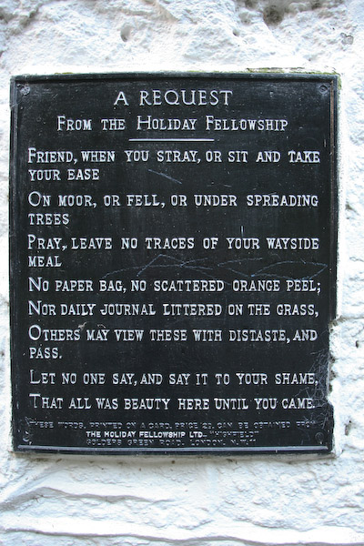 So there you are: a Californian’s recommendation of a great Scottish pub crawl. What do you need to complete it? Perseverance; a few blister plasters; a map, even though some say you can do it without ever referring to the map; plenty of money for the bars, and that‘s about it.
Protection against the elements is essential. We were very lucky with the weather but there are prolonged sections of the WHW where, when the weather is bad, it will be very bad, so heed the advice. Camping is possible virtually anywhere along the route, and there are carriers who will take the heavy loads and leave you free to enjoy the glorious scenery.
By Saturday, the view from our train had changed: the top of The Ben was shrouded in cloud and a light drizzle hung over the expanse of Rannoch Moor. We’d managed to time it just right.
I now had a camera full of pictures and a head full of memories. They’ll last; the ankle pain has already subsided.
Eduardo
25 February 2011It's a pleasure to read your account of the journey and I'm sure I'll do it again a couple of times.
I'm going there next September(2011) with my wife and was trying to decide wether or not I should include one more day in the middle section (we were going to skip something like 30 km, budget & time issues). One day more it is! :)
Thanks
Yvonne
22 March 2011Love the details you include about WHW. I will be doing ti in September and for sure I will hold the information you provided us.
Thanks
Bob
23 March 2011Thanks Yvonne. Just remember you've now an extra mile to walk at the end, as the route has been extended into Fort William, right past the pasty shop!
There's a great camaraderie on the way, I'm sure you'll have a great time.
Hope the weather stays good for you.
Bob Smith
Editor
mike
22 April 2011good website m8. iam planning on starting whw Monday on my own camping all the way. kinda bricking it a bit. :-o
Campbell
26 April 2011I enjoyed reading all about your walk, we are walking the way in September myself my partner and son,(first timers) we will be camping along the way so now we know is pain and pleasure all the way but worth doing going by your description. of the WHW
thanks Bob :)
Tracey
11 December 2011loved this account, loved the pics..........spectacular views. Will be rambling it in April, looking forward to it
Lynn Mackay
14 February 2012have really enjoyed your account of your walk. I'm walking it in May with three friends (all walking virgins) doing it over 5 days. think we've set ourselves a bit of a challenge, but no turning back now. How much training would you suggest before the walk. We're doing 12 miles on sundays at monent and starting to hillwalk this weekend with a gentle stroll up Ben Aan.
Bob
15 February 2012I don't think a huge amount of training is necessary if you're a regular walker.
The route is not arduous and even though you're aiming at some long distances each day, it's achievable as long as you're used to more than just a stroll.
You're going to be pushing close to an average of 20 miles a day which is a fair amount, but if you start early-ish and don't pick up any injuries, it should be relatively straightforward.
Weather, of course, is something you have no control over, so don't fret over it. Just go with what the heavens throw at you and enjoy the experience.
It's a great route.
Bob Smith
Editor
Gary mcghee
05 June 2012Hi , we have just done the whw (June 1st -5th) over 4 days . I can fully agree with this write up , absolutely beautiful, great time , weather was the best luckily, but ooooo did my feet , ankles, hips and knees hurt lol , thoroughly recommend doing the walk, but not over 4 days unless your a top walker, which we weren't, take care and enjoy it
Gary
Tim Little
28 June 2012Lovely account... myself and 3 others excited chaps are off to walk this baby next Thursday. Sleeping under the umbrella of the Gods by night whilst marvelling at the Munroes, moors and heath by day!
Stuart S
20 April 2013Brilliant account! Thanks for sharing your experience. I've walked the WHW four times and don't think I will ever tire of it.
When I first completed it in 2004, I kept a daily notebook, and it reads very much like yours! A pleasure to read and pretty accurate as well.
Charlotte
19 May 2013I'm looking forward to walking the WHW this summer, but I'm a bit worried about getting enough clean water...Was getting water a problem for you? We will mostly be camping on the way ..
Bob
19 May 2013Getting water wasn't a huge problem. The WHW passes through enough settlements to top up and most of the mountain burns can probably be trusted as long as there isn't anything dead upstream.
Bob Smith
Editor
Peter Hall
27 July 2015Am going tomorrow. A really well written , humorous piece Bob. Thank you for taking the trouble. Will be listening to the Ashes as I go along. Am worried about the possibility of encountering the huge cattle as I have been chased twice before. Peter
Erik
08 September 2015Gotta take into account the 'machismo' of doing this. It's all pain and you all know that "No PAIN is no GAIN!" ;)
I've been walking the WHW since I was a 19 year old student in 1986.
Back then it was mostly young athletics in their late teens and early twenties. Nowadays you see kids, I took my nephew when he was ten, and pensioners doing it a leg at a time just because now that can can be done.
No side trips for me, but mostly its been a five day trip, though last time was seven due to a failing in the backpack that I have used ever since I was 19. My fault really, I should have had it repaired.
Why people walk the WHW baffles me in a sense. There are so many reasons and just as many people from all over the world who come to Scotland just to walk the WHW.
I walk it for health and because the people are awesome! So many of us from all over the world who have never met before but seem somehow to have always been friends.
Just so you know, and this is the only real advice anyone can give, the WHW is as easy or as hard as you want it to be,
The shortest day, if you don't camp, is an unbroken stretch of about 11 miles (about 16km) and, both, those longer stretches are fairly arduous, so take health, fitness and potential medical issues into account on that basis.
The rest of it is really a walk in the park, if you want it to be, or a serious self-gruelling, if you want to do it that way.
No matter how you decide to do it, leave yourself some slack and a spare £20 or so in case you need Travel Lite to grab your bags for a day or two, or you need to get the bus/train back because of some unexpected situation.
Whatever your case, even experienced walkers find every walk has its pros and cons for them personally, so don't take anything for granted.
Really enjoyed reading the story above and I suspect I may actually have met you at the Beech Tree that year.
Anis
04 December 2015I'm so glad I found your website. What a great read this was! I loved the details about the route, and now I'm more than convinced that I *need* to do the WHW. I'm planning to do this next year but I haven't decided whether to do it alone or with friends (solo female). Thanks for sharing!
Rochelle
09 December 2015wholesale authdntic sports jerseys nfl shop cyber monday sale wholesale authentic sports jerseys
Veronique
02 April 2016Coach factory outlet store in milpitas black friday nhl shop Clearance coach shoes
Dyan
25 July 2016The cheapest mlb hats authentic online sale,
recommend best quality jerseys of star, world brand soprts jerseys.
Amanda
12 November 2016What route did you take from WHW to Finnich Glen?
Bob
13 November 2016Amanda, where the WHW crosses the B834 just west of Killearn, we turned left on to the road, across the roundabout on the A81, then up the B834 to its junction with the A809, then turned left down to Finnich Bridge, where the footpath into the glen leaves the road. The steps into the glen are very steep and quite slippery - Bob
Mariana
25 January 2018What is size of where to buy cheap jerseys online may
have? Know more about here - all day wholesale jerseys
Jim Gillies
01 June 2023Thank you , I am glad you had a good stay at the hawthorns, I really enjoyed my time running the B&B and have great memories I also got to meet some lovely people , to this day Avon skin so soft is still the no.1 repellent, I have now sold up and moved on but will always have my memories
Thanks
Jim