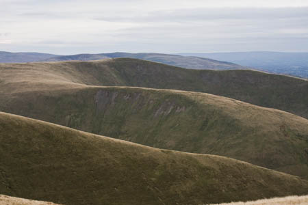
The Howgills: smooth and velvety
Quite unlike their near cousins the Yorkshire Dales and the Cumbrian Fells, the velvety bumps of the Howgill Fells have a character all of their own.
Older than their carboniferous upstarts to the South-East, the smooth, uniformly sloping hills of this remarkably compact group of fells feel like neither of their neighbouring upland areas. Their names share an affinity with the Lakeland hills and valleys yet they lack the preponderance of rocky outcrops and soaring crags.
Neither can they boast the gleaming limestone of the Dales, with its attendant caves and clints and grikes.
Distance: 12.1km (7½ miles)
Ascent: 920m (3,018ft)
Time: allow 4½ hours
Map: Ordnance Survey Explorer EX 019, Howgill Fells and Upper Eden Valley
Note: grough routes should be used in conjunction with maps, a compass and other navigational aids. Routes often use access land and involve finding your route off footpaths. Knowledge of and competence in using a map and compass is essential when using the routes. Carry the correct equipment for the conditions and be aware of hazards in the outdoor and upland environment.
However, what the Howgills have is solitude in abundance, great views and navigational challenges galore.
The rocks which form the 100 sq km (40 sq miles) of this upland plateau are more than 400 million years old: Silurian sandstones and mudstones which have weathered evenly and resisted glaciations at the same rate. Because of this, the whole group has a samey look and peak spotters would be hard pushed to put a name to many of the fells without seeing them in their context.
Not a single village encroaches into the massif, bounded by the Dent Fault to the South-East and the River Lune to the West and North.
Walls are a rarity and many paths are indistinct and follow trails not of much use to the walker wanting to summit the fells. The Howgills are, in short, hard to navigate.
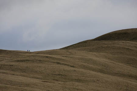
The rewards are there for walkers
But the rewards for the determined hillwalker are many. On a good day, the views are fantastic. The fells of the western Yorkshire Dales seem close enough to reach out and touch; the whole of the eastern aspect of the Lake District’s peaks are on show, and the northern Pennines fill the remaining vista.
Add to that the expanse of Morecambe Bay and, for the transport enthusiast, the chance to spot the latest Eddie Stobart lorry or the Virgin express trundling down the West Coast Main Line and virtually every taste is catered for. These are hills for the connoisseur.
The Howgills themselves have many attractions. Within half an hour of walking into the fells, it can feel like you are a hundred miles from the nearest civilisation. The deep gills and occasional waterfalls are mightily impressive. And although a few of the tops are gaining in popularity, it is quite possible to complete a day’s walk with the only other living things encountered being the fell ponies, an odd deer, the circling ravens and buzzards and a few sheep.
The Howgills’ highest peak is The Calf, and that is our goal on this walk. But rather than approach the 676m (2,215ft) summit from its usual, southerly direction, we’ll start from the old Roman road to the West of the fells.
There is a small parking area (SD 629 979) on the unfenced Fairmile Road, 200m north of the bridge at Fairmile Gate. The single-track road can be accessed from the centre of Sedbergh along Howgill Lane and from the North at Low Borrowbridge, where the road ducks under the M6 after leaving the A685 Tebay road.
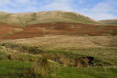
Linghaw from the parking area at Fairmile Gate
From the parking area, it’s a hill-climb straight away – a taste of things to come – with an unrelenting climb up the slopes of Linghaw, between Dry Gill to the North and Fairmile Beck to the South. There are faint paths, but you can make up your own route through the bracken and to the first peak of the day, a barely discernable tiny 500m ring contour on the OS map.
The background hum of the M6 traffic is a constant companion on the climb, with an occasional rumble along the parallel train track. Backward glances gradually reveal the southern Lakeland fells, with Scafell and Scafell Pike easily picked out, the Old Man of Coniston to their South and the eastern fells of the Kentmere horseshoe also prominent. Blencathra looks distant to the North.
As the contour lines are ticked off, Morecambe Bay starts to reveal itself, with the dark, twin cuboids of Heysham power station silhouetted against the Irish Sea.
Cross Fell and Mickle Fell come into view to the North-East, and there’s a good retrospective of the lower Lune Valley.
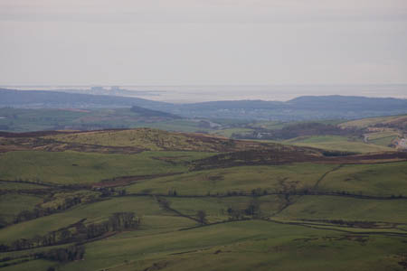
Morecambe Bay, with Heysham power station, left
Fell Head, the next objective, is only 123m higher, but there’s a Howgills catch: the col separating the two means a drop of 30m, so the legs and lungs get a workout on the way to the peak, marked by a small cairn. This is a typical ridge walk, with frequent drops as the route passes along cols. But there is no sense of exposure. The Howgill’s rounded ridge tops are wide, with easy walking along springy short turf.
The deep gills of these fells are a distinct feature and as we progress to the next small cairn at 649 981, 300m along the ridge, there is an impressive view down into Long Rigg Gill.
We continue along the ridge with just the gentlest of rises to Breaks Head, 653 985, enjoying a great view north-west of the angry gash of Black Force and The Spout.
In the opposite direction, and 400m below, the waters of Long Rigg Beck snake towards their eventual goal, the River Lune.
The desolate valley of Bowderdale can be seen to the East as the next peak is sought, Bush Howe. A steep drop down 80m to the col at Windscarth Wyke is inevitably followed by another trog up to the 623m (2.044ft) summit.
From Bush Howe, an easy and pleasant stroll follows to White Fell Head, from where, on a clear day, the distant triangulation pillar of The Calf should just be visible.
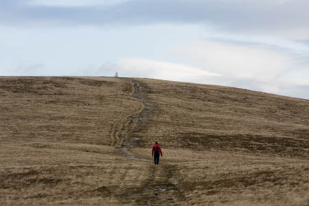
The rise to the trig point on The Calf
Three small water pools grace the broad summit of White Fell Head, from where a moderate rise up to the white trig point on The Calf brings us to our goal.
Unusually, when we visited, the trig pillar was surrounded by people, including a large party of walkers from Wigan, who had come up the southerly route from Sedbergh. The Howgills’ highest peak has little of interest topographically apart from a small tarn just to the East of the Ordnance Survey pillar, and is a disappointingly dull shape compared to many of its immediate neighbours.
So savour the views, then turn on your heels and walk back the way you came for 300m until a path diverges left towards White Fell, eventually becoming a distinct footpath (actually it’s a bridleway) as it starts the steep descent of the spur.
Here, you have choices. If you want to bag a couple more minor summits, continue down the bridleway, crossing Long Rigg Beck at 645 963, from where you can make a steep ascent to the top of Castley Knotts, continuing north-east to the 412m (1,352ft) summit of Brown Moor. Exhausted travellers can continue
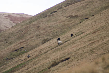
Fell ponies graze on the slopes above Long Rigg Beck
along the bridleway for another 1½km to meet the road at Four Lane Ends. The problem with this option is that you are then faced with 2km-worth of road walking north. You could always stick out your thumb and take your chances with one of the three or so vehicles that use the road each day.
A third way, which we used, was to diverge from the bridleway midway down the long tongue of White Fell, aiming for the confluence of Long Rigg Beck and Long Rigg Gill, at 648 969. The fellside is steep, but without difficulties. Crossing the shallow beck may entail wet boots but is easily accomplished unless the stream is in spate.
Then, follow the west bank of Long Rigg Gill, slowly rising up and aiming for the col between Castley Knotts and Brown Moor (643 964) and picking up the path which contours round the gill and rises gently up to Whin’s End – the final climb of the day.
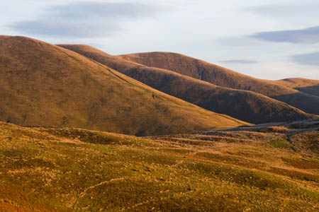
Late winter sunshine illuminates the slopes of the Howgills
From there, head towards the right-hand end of the intake wall (633 978) and pick up the rough path above the gill of Fairmile Beck. The path leads to the bridge at Fairmile Gate and the short road section back to the parking area.
In this relatively short walk, you will have summited between eight and ten tops and, if the weather’s good, seen some fantastic views. And you will have had chance to experience the Howgills’ best feature: its solitude. Don’t tell everyone; they’ll all want some.