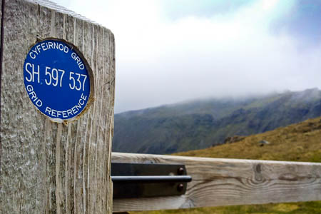
The plaques are fixed to gates and stiles and bear the location's grid reference. Photo: Snowdonia NPA
A scheme that placed markers bearing grid references at points in a national park is credited with aiding the rescue of three lost walkers.
Aberdyfi Search and Rescue Team said the location marker plaque had been a massive help in finding the three, who rescuers said were poorly equipped.
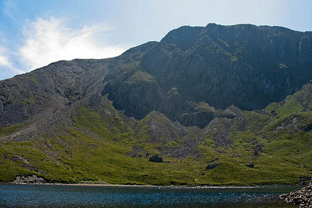
The trio of walkers got lost yesterday on Cadair Idris, the 893m (2,930ft) peak in the South-West of the Snowdonia national park.
Aberdyfi SRT was alerted at 4.50pm.
A spokesperson said: “The group was poorly equipped and did not have a map although luckily for them they had located one of the new Snowdonia national park grid reference markers on a stile which is part of the park’s mountain safety initiative.
“The team quickly deployed in poor weather conditions and located the party who were very cold. They provided warm clothing and walked the three down before dropping them back to their car.
“This was the first time the grid reference markers had been used in a rescue on Cadair Idris and something which massively aided in the rescue.
“Yet again the team would urge all venturing out into the mountains to ensure they are properly equipped and have the skills to navigate in the terrain.”
The plaques are part of a plan by the Mountainsafe Partnership to increase safety on the hills of the Snowdonia national park.
They were first installed on and around Snowdon and are attached to gates and stiles, giving walkers and other outdoor enthusiasts a six-figure grid reference and two initial letters to aid navigation.
Snowdonia national park warden Gruff Owen said when the scheme was launched: “The idea for placing grid references on footpath furniture originally came from local mountain rescue teams.
“By working closely with recreation groups through the Mountainsafe Partnership we’ve developed the idea so that it’s as unobtrusive as possible.
“The markers are being placed on pre-existing stiles and gates so that temporarily disoriented walkers who’ve brought a map and remember their geography lessons, will easily be able to pinpoint their position.”
The Mountainsafe Partnership consists of Snowdonia National Park Authority, North Wales Police, Llanberis Mountain Rescue Team, the British Mountaineering Council, Mountain Training Wales, North Wales Mountain Rescue Association, RAF 22 Squadron and Snowdonia Active.

Gerald Davison
17 September 2012Glad to see these markers are paying off. Such a simple, cheap and unobtrusive way of helping people who are lost or even a "bit mislaid".
Simon
17 September 2012I agree Gerald - never understood the opposition to them. Real shame that SO many people are venturing out without proper skills/equipment.
Philip Clayden
18 September 2012brilliant idea it should be rolled out across all the national parks
siggy
18 September 2012Another stupid dumbing down of the mountains...along with the idiots who build cairns every 20 ' up Scafell Pike...of course they are 'useful' ... but so would be sign posts and street lamps if we want to make it so. Anybody able to use a map and navigate will not be in need of these especially given they are are on 'line' navigation features ...anybody that comes across them that needs them will most likley not be able to usefully use them, just as likley to have GPS/smartphone and will still need to call for assistance and will be as clueless and at risk of further incident. I can find no justification for these. I am also an MRT member and do not agree with this type of initiative in the hills no more than signs on Jacks rake, ropes on broadstand, bolted crags in trad. areas.
Charles Britten
18 September 2012I think I'd be lost if I was in the Cadair Idris area and found myself 3,225 ft up. It's 2,930 ft.
Bob
18 September 2012Apologies for our wonky conversion of Cadair Idris's metric height to feet.
This has now been corrected.
Bob Smith
Editor
Margaret
18 September 2012I wonder what Dr Jim Bell, Bill Murray, Don Whillans or Walter Bonatti would have thought about this.
But now we are not talking about mountaineering (...whether we are dealing with the little 1000 foot hill near our home or taking part in an assault on a 20,000 foot giant...J H B Bell) we seem to be dealing with tourism.
Siggy, maybe street (path) lights will soon be needed, though no self respecting mountaineer would need a little sign with a grid reference.
Tim
24 September 2012I agree with Siggy and Margeret. This world is dumbed down too much. There are times when you want to escape the regimented and prescribed, health and safety obsessed life we lead and venture out with a few calculated risks. The reason more people are getting into trouble is because we are losing the ability to judge risk, it is a vicious circle.
The money would be better spent on signage at the bottom of popular tops with a kit list, warnings of dangers, and places where training can be gained to improve skills.
Cadair is a beautiful place, one of my favourites and does not need this Legoland sign-age. The next step will be sign-age at every path junction like in popular Alpine areas. It is a shame.
I do agree that it helped the Aberdyfi SRT so for that we should be grateful. I also recognise that popular tops attract unprepared walkers and present particular problems for SRT, but on balance, and in my opinion, this a bad idea and I hope it is not extended. This is a Welsh mountain not a tourist trail.
Tim (ML)